Current condition
In use
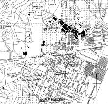
The road layout around here changed when the Kai Tak airport was expanded during the Japanese occupation. Originally, Prince Edward Rd continued east in a straight line, but after the airport was expanded north, Prince Edward Rd was realigned, so the road now bends north at this point.
Photos that show this Place
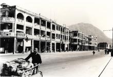
1938
1930s
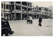
1930s