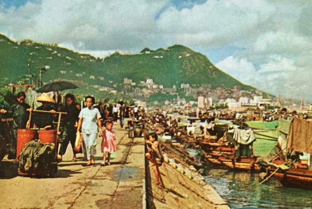
This image of a seawall, which appears in the Hong Kong Government booklet titled: Hong Kong, Hong Kong Government Information Services, Central Government Offices, Ice House Street 1960, is captioned: Today, the waterfront throbs with life; a modern city lies below the Peak.
I’m guessing that this scene maybe in the Causeway Bay area; perhaps a portion of the seawall making up the Causeway Bay Typhoon Shelter. But I am not at all confident in offering up this suggestion; I feel confident, though, that a better informed Gwulo colleague will be able to provide an accurate caption to accompany this colourful c.1959 image.
Date picture taken
1958 (year is approximate)
Shows place(s)
Comments
Seawakk
It looks like Causeway Typhoon Shelter
Re: Causeway Bay Typhoon Shelter
Hi There,
I have a photo pointing towards Central at the approximate location. The waterfront there had been rebuilt to accommodate seating areas by the water. Not exactly of the same viewing angle, but it was close. Sorry for the distortion as I only have a 9mm fisheye lens with me at the time.
T
1958 Seawall of Causeway Bay Typhoon Shelter
Upon completion of Victoria Park in Causeway Bay, the seawall was extended. I guess the location of the photographer was on the vertical strip of pathway adjacent to the typhoon shelter seen below.
I think I can just make out the RHKYC on the right in the main photo.
Thank you Gwulo Colleagues
Thanks to the helpful and informed contributions submitted by “s.w.ho”, “tngan”, “moddsey”, and “admin”, I can now re-label that seawall image with confidence.