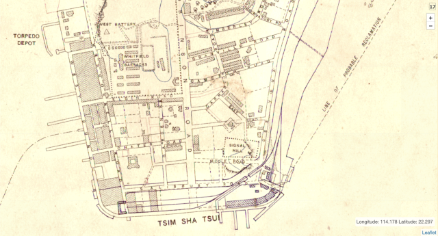
Clipped from a larger map of Kowloon and the NT, surveyed under the superintendence of Major H.S. King R.E., viewable here: https://hkmaps.hk/map.html?1904
Date picture taken
1903
Shows place(s)
Clipped from a larger map of Kowloon and the NT, surveyed under the superintendence of Major H.S. King R.E., viewable here: https://hkmaps.hk/map.html?1904
Comments
Re: Map
Although 1902/03 is given, the map appears to have been updated in subsequent years with other features added in. Holt's Wharf (completed in 1910) can be seen at bottom right. The permanent KCR terminus (1916) at TST and indication of the railway line commencing from the waterfront are also noticeable.