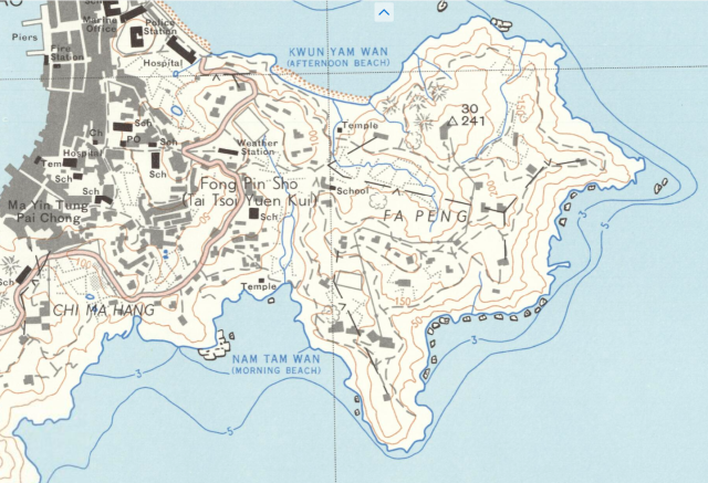
This is a snapshot from a 1:10000 map of Cheung Chau, for illustration only. With the Weather Station marked, over that roughly triangular piece of land above 'Fong Pin Sho'.
Note the (Government) School, Police Station and Weather Station buildings in nearly isosceles triangle configuration (cf Hinton's description, 1929).
source : TROVE, National Library of Australia
Date picture taken
1967
Shows place(s)
Comments
Re: present day Marine Police District JPC club house
Hi there,
It would seem the former weather station is likely where the JPC club house is located, behind Kwan Kung Pavilion.
T