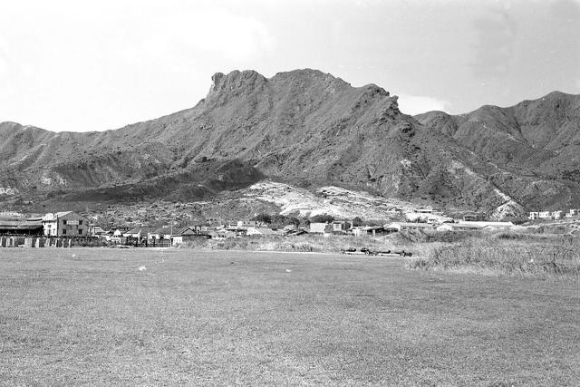
Shows the northern boundary of RAF Kai Tak near today's Wong Tai Sin/Diamond Hill. Barbed wire on the right. Squatter huts have been removed from the hillside making the area appear to be barren. The Japanese Operations Building-cum-Control Tower is also not in view.
Pre-prepartion for the construction of Lung Cheung Road ? Thinking 1959 which also ties in with the likely year of removal of the Japanese building.
Thanks gentlemen for giving the opportunity to review the main photo and its source. The photo is part of a huge photo collection said to have been taken in Hong Kong 1954-55. May have appeared at auction. For now, I cannot find a link online that holds the collection of photographs.
Comments
Re: Photo
I have seen this photo before.
Shows the northern boundary of RAF Kai Tak near today's Wong Tai Sin/Diamond Hill. Barbed wire on the right. Squatter huts have been removed from the hillside making the area appear to be barren. The Japanese Operations Building-cum-Control Tower is also not in view.
Pre-prepartion for the construction of Lung Cheung Road ? Thinking 1959 which also ties in with the likely year of removal of the Japanese building.
Lookin at the type of…
Lookin at the type of housing this picture may be taken in the 1930s.
northen Kai Tak boundary
Looks like a couple of low slung ammunition/bomb trolleys are on the track. Used for re-arming military aircraft post-war.
Re: Photo
Thanks gentlemen for giving the opportunity to review the main photo and its source. The photo is part of a huge photo collection said to have been taken in Hong Kong 1954-55. May have appeared at auction. For now, I cannot find a link online that holds the collection of photographs.