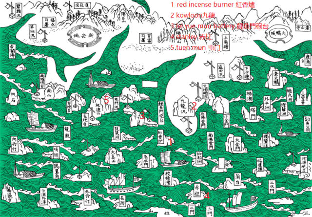
Probably the oldest map of Hong Kong made in 1819 in a book called "Annal of Xin An county" (新安縣志) which includes Hong Kong. Hong Kong island was called Red incense burner 紅香爐 at that time. For some reason, tuen mun 屯门, stanley 赤柱 were shown as islands. They got "Cheung Chau" (4th label from the left at the bottom) mostly right though.
Date picture taken
1816
