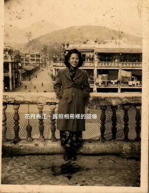
View from a Sham Shui Po rooftop (1940s), one wintry day. Although I moved to this area several years later, the view from my roof top was very similar. Mine was half a block away to the right out of photo.
The view is to the northeast along Maple Street, from the northeast corner of Tai Nan - Boundary Street junction. The first cross street is Ki Lung Street and the triangular island is visible. The next street is Yu Chau Street, then the Maple Street Playground on the left showing (wooden) shops, and further up is Cheung Sha Wan Road.
I got the same view while I was flying kites, as winds were mainly from the south and southwest. Notice the barren hill - current name Bishop Hill, absence of cars, and all shophouses no taller than four levels.
And I played with other children on that rooftop. Thank you for the memory.
Photo source: https://www.uwants.com/viewthread.php?tid=11353334&page=45#pid236498282 by user CM5831@74A