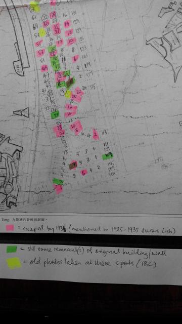
This is an approximate guide to the buildings and remnants of old walls that remain from the original Kowloon Tong Garden Estate, which was constructed over the period 1922-1932. The map to which my notes have been added is taken from Hal Empson's "Mapping Hong Kong: A Historical Atlas" (1992), page 182, and is dated 1934. My notes were made from personal observations in the Kowloon Tong area in mid 2016, as well as the Jurors' Lists of 1925-1935. Lots coloured green are those where either the original building or an old-style bungalow building remains, or where remnants of an old wall can be seen. Lots marked pink are those mentioned as occupied in the Jurors' Lists in or before 1935 (NB: other lots may also have been occupied before this time). Locations marked yellow are those where old photos of the estate on Gwulo may have been taken. Photos of some of the remaining buildings and walls (the lots marked green on this map) will be uploaded to Gwulo in the near future.
