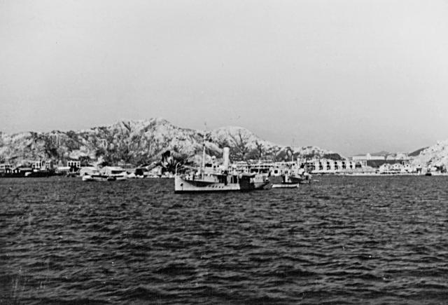
Not many pictures from this angle of an area of Kowloon City on the right hand side that was to be raised to the ground by the Japanese to extend Kai Tak aerodrome in 1942. The Central British School ( now KGV) is prominent in the background
Date picture taken
15 Jun 1938
Gallery
Comments
That's an interesting view of
That's an interesting view of the school. I always think of it as hidden away deep in the heart of Kowloon, and didn't realise it was so prominent when it was first built.
Regards, David
Re: Interesting View
Yes indeed, an interesting view. Whats in the foreground?
Further south?
I think we're looking at the coastline a bit further south than Ping Street and Kowloon City. See if this makes sense - on this 1957 map we can see the KGV school between the Hau and Pui of Hau Pui Loong in the bottom left corner. It is shaped like the mirror-image of an E.
Looking at the photo, we can see the front and the left side of the building, so on the map the photographer is in a 4 o'clock direction from the school.
Then go back to a 1924 map of the area:
If you start from Hau Pui Loong and head towards 4 o'clock, you pass through a gap between two hills, similar to that shown in the photo, and end up on the shoreline near To Kwa Wan. I think that's the area we're looking at in the photo.
Regards, David
Re: View
To the left of the stern, is that Fish Tail Rock in Hoi Sham Park (To Kwa Wan Island)?
It does look like the
It does look like the Fishtail rock. Here's a modern view:
https://www.flickr.com/photos/michael-hansen/242799056/
It looks very similar to the rocks below and slightly to the right of the highest peak in the old photo.
Regards, David