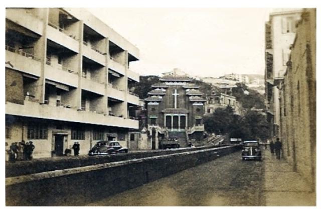
Note the large open nullah running down the middle of the road.
I've guessed the date is 1947. On Flickr it's dated as '1940s', and I've assumed a date in the middle of the post-war 40s.
Source: This image came from Flickr, see https://flickr.com/photo.gne?id=5074396780
Date picture taken
1947
Gallery
Shows place(s)
Comments
Re: Nullah along Tung Lo Wan Road/St. Paul's Convent School
Hi there,
This Nullah was already covered when I was a kid, but I'd say it went into the sea at the location of the so called canel, which is the modern day extended Gloucester Road with a fly over linking up with Moreton Terrace. Back in the old days Gloucester Road ended at Percival Street.
St. Paul's Convent School is visible in the photo too, by the very right, the mud colour block. The white/grey block next to it was the St. Paul's Hospital block. I believe this block still stands today, but I wonder if it would be demolished for redevelopment when the other new highrises are completed.
Best Regards.
T