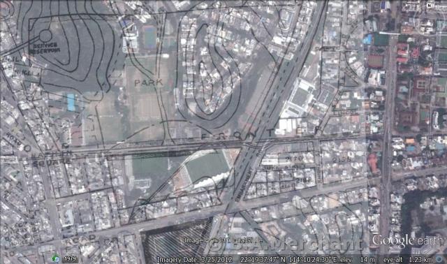
You'd probably know where the present day Flower Market Path is (where there are covers of the nullah on both ends). Try to locate the Northern end of Flower Market in the Map above and the stream is right on the other side of Boundary Street in the overlay of the old map. There is a Y shape branch like thing. That's the stream.
Comments
Nice work with the overlay.
Nice work with the overlay. Which software do you find works well for this?
Regards, David
software
I did this on Google Earth - it's better viewed there as you can toggle back and forth between the overlaid map and the Google Earth map.
Barbara
Re: Nicely done with the overlay
Hi there,
The overlay nicely marked the stream feeding the nullah.
Best Regards,
T
The stream
Hi T - where's the stream again? Barbara
Re: Where is the stream....
Hi Barbara,
You'd probably know where the present day Flower Market Path is (where there are covers of the nullah on both ends). Try to locate the Northern end of Flower Market in the Map above and the stream is right on the other side of Boundary Street in the overlay of the old map. There is a Y shape branch like thing. That's the stream.
Hope the description is clear.
Best Regards,
T