After reclamation works in Sai Ying Pun and Shek Tong Tsui were finished in 1901/02, godowns were built along the newly created praya (Connaught Road). Many marine lots originally were situated between Queen's Road and DesVoeux Road. After the 1900 reclamation, they were extended to the area between DesVoeux Road and Connaught Road. The following relates to the northern part of the lots.
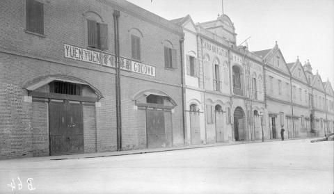
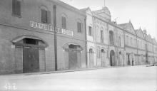
On Marine Lots 198, 204, and 205 godowns were built in (estimated) 1903. These can be seen on a photo taken by Warren Swire:
Yuen Yuen Godown is the flat roof building on ML 198.
The next one is China Navigation Co. Godown on ML 204. It is a somewhat larger building with a tower, possibly for a small crane. This godown belonged to a Swire company - possibly the reason why Warren Swire took this photo.
On ML 205 another godown with four gable roofs and a central tower was built. The name on the wall is illegible, on a photo from 1966 it reads China Provident Co. Godown (hopefully correct).
All three godowns were there until the mid 1970s until Kwan Yick Building Phase 2 opened in 1977
The lots were renamed later to PRML 198 (PRAYA RECLAMATION TO MARINE LOT), ML 432 and ML 433.


Comments
Lot numbers
Hi Klaus,
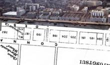
Your map overlay looks good:
Comparing the lots with the buildings, I wonder if the eastern lot ML 198 was split in half, with Yuen Yuen on the east half, and China Navigation Co. on the west?
If the lot was split that way and had different owners, it could explain why the current eastern lot, PRML 198, appears to be split in half with part of Kwan Yick on the western half, and a bunch of smaller buildings on the eastern half.
Regards, David
Re: ML 198
Hi David,
a split could have been made, but there is no indication that it is in the land records (at least the ones that are public available). On hkmaps.hk it shows on the 1901 map that there were two distinct buildings with a gap (lane?) in between. Geoinfo Map often shows splitted lots, but not for PRML 198. So still unclear.
Regards, Klaus
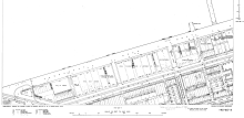
1955 Lot survey Map, by…
Found the land survey map in the 1955. you can see a detail split up of the lot.