Updated.
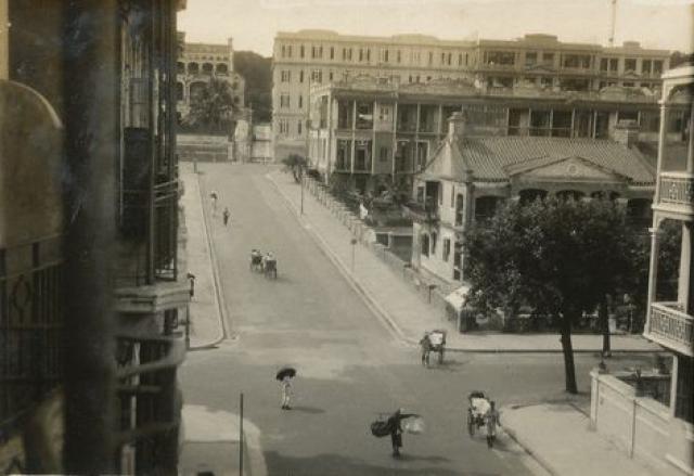
In the foreground is the junction of Carnarvon Road and tree-lined Granville Road. Carnarvon Road proceeds upslope and meets with Kimberley Road. On the southeast junction is Torres Buildings. On the northern side of Kimberley Road from left to right is old Kimberley Villas, then unknown buildings opposite Torres Buildings. Knutsford Terrace (the building) is out of sight. The signal mast of the Observatory can be seen.
Date picture taken
1930 (year is approximate)
Gallery
Shows place(s)

Comments
I think from this angle Luna…
It's a great photo from an unusual angle but I think from this angle Luna Building won't be seen. I am not sure atm what that building is on the right of the photo on Kimberley Road behind Torres Building but if you look at the layout of the very east end Torres Building and the very west end of Luna Building they do not overlap. But definitely at least 1930 0nwards given the buildings on the northern side of Kimberley Road.
Re: Luna Building
Yes, you are correct. Confirmed with the 1949 aerial photo at https://www.hkmaps.hk/viewer.html Have updated the text.
View of Buildings on Northern Side of Kimberley Road
On the northern side of Kimberley Road ...
Kimberley Villas was a bit further to the left, and the building faced at an angle, so I think instead we're looking at the semi-detached buildings that stood to the east of Kimberley Villas on IL 533. They're shown on Gwulo's 1920 map: https://gwulo.com/node/46364#19~22.30103~114.17290~Map_by_GovHK-Markers…;
Re: Kimberley Villas
According to the 1938 Street Index at: 1938 Street Index page 243 (image 447) Kimberley Villas was on K.I.L. 533 and 535 ?
Re: Kimberley Villas
Thanks Moddsey, I understand now that the two buildings were both part of Kimberley Villas.