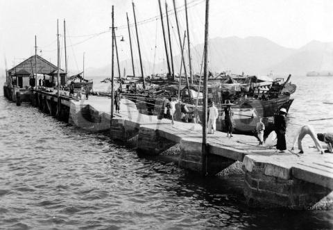
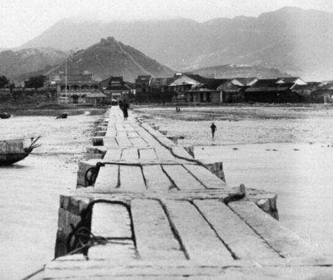
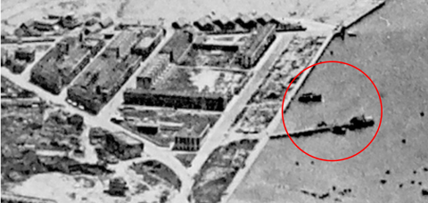
I bought this photo on eBay recently. It was advertised as "Vintage Photograph 1945 Hong Kong Wharf Dock Pier Boats Sharp Photo China". Let's see if that's what I got.
Where
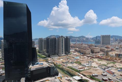
For a quick answer to "Hong Kong or not?", skylines are a good place to start. Usually I'd look at other photos that I already know show Hong Kong, and see if there's a match. In this case I just looked out of the window.
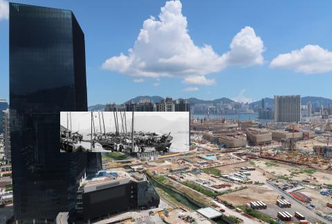
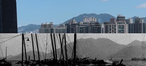
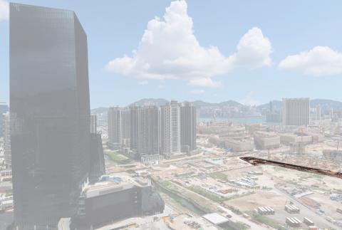
We live in San Po Kong, looking south over the old Kai Tak site towards Hong Kong island. I thought the skyline in the old photo looked familiar:
That confirms the photo was taken in Hong Kong, and more precisely that it was taken in Kowloon. Given how similar the skylines look, we can go a step further and say that the old photo was very likely taken in San Po Kong or somewhere nearby.
To pin down the exact location, we'll need to move our attention to the photo's foreground.
What
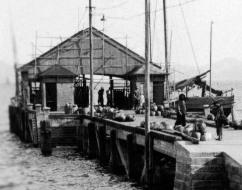
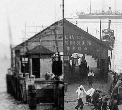
The far end of the pier looks like any other standard, government-issue, reinforced concrete, ferry pier in Hong Kong.
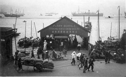
Here's another example from Sheung Wan.
Lining up the two photos next to each other, its clear they share a very similar design.
There's nothing standard about the nearer part of the pier, though.
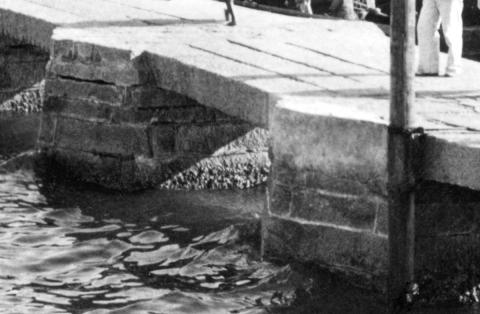
No concrete here: the decking is made from granite slabs, resting on pillars that are also made from granite. I also note that the pillars are a squashed hexagon shape. Does that sound familiar?
The photo shown above comes from the UK National Archives's collection. It was taken in 1898 and shows the Lung Tsun Stone Bridge, later known as the Kowloon City Pier.
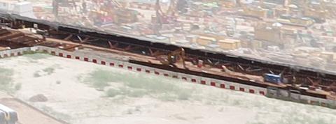
We know exactly where that pier was located, because a good chunk of it is still there today! Looking back at the view from my window, over on the right is a long, narrow piece of land surrounded by sheet piling, and currently being (re-)excavated. An archeological dig found the remains of the pier here in 2008. It was then re-buried to protect it, but it is now being uncovered with the plan to have a permanent exhibit where the public can come and see those remains. I've highlighted it below.
When
The Chinese authorities built the "Stone Bridge" in the 1870s to give easier access to Kowloon City from the sea. (The shore slopes very gently into Kowloon Bay, so you need a long pier to get out to deeper water where boats can moor.) In the 1890s a wooden section was added to the end to reach even further out into the bay. You can see the pier at bottom-right on this 1903 map of the area. The older, granite section runs southeast from the land, with the shorter, wooden section laid out at a slight angle to it.
After Britain leased the New Territories the pier came under their control. They found the wooden section was rotten and dangerous, so in 1910 the wooden section was replaced with the reinforced concrete pier shown in the main photo. That gives us our first date, as it means the main photo was taken some time after 1910.
Next, in the late 1910s / early 1920s, a huge reclamation was carried out in this area. They built a seawall across the head of Kowloon Bay, then dumped material behind it to reclaim the land. That new seawall cut straight across the granite section of the pier, burying its northern part under the reclamation, and leaving the southern part as a much shortened pier.
I haven't yet pinned down exactly when that seawall was built, but the end result is shown clearly in this aerial photo, taken around 1925.
Returning to our main photo, I believe the photographer stood on the seawall to take it, dating the photo to the 1920s or later.
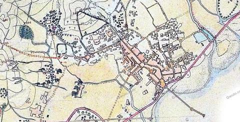
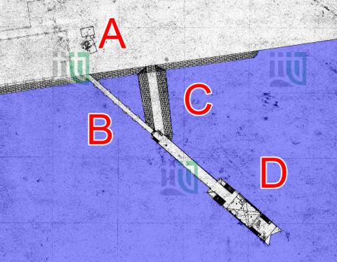
There were more changes to the pier in 1934. A short causeway was added, to give easier access to to the concrete section. This extract from a map shows all the parts we're talking about:
- A - the seawall,
- B - the southern part of the original granite pier,
- C - the 1934 causeway, and
- D - the 1910 reinforced concrete pier.
There's no sign of the causeway in our main photo, so the photo must have been taken before 1934.
Given the range of possible years runs from the 1920s to 1934, I'll say the photo was taken in around 1930. As always, if you spot any clues that can narrow down the date further, please let us know in the comments below.
Who
I can see a few people on the sailing junks, but we don't get a very clear view of them. I don't see any signs of fishing nets though, so is it safe to assume they are traders, rather than fishermen? There certainly look to be various goods lined up along the edge of the pier, but isn't clear whether they're being transported by the junks, or are smaller quantities on offer for the junks to buy for their own use.
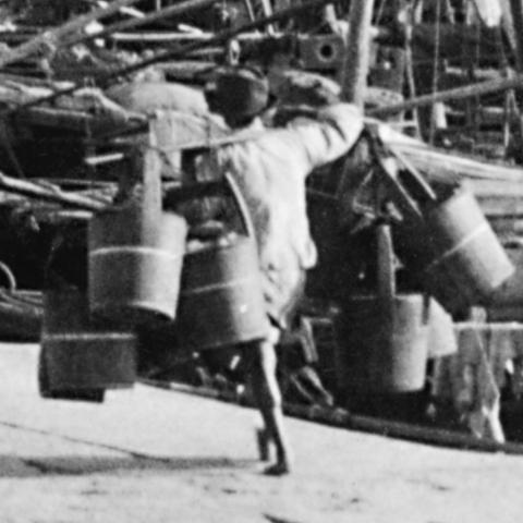
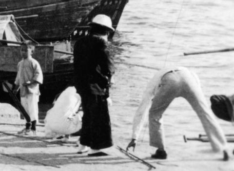
We can also see this man, using a shoulder-pole to carry an assortment of wooden buckets.
Unfortunately there aren't any notes on the back of the photo to explain the scene, so all we can do is make educated guesses about what he's doing with those buckets: delivering them to a junk that will take them away to sell elsewhere? Or bringing them back to a junk after delivering something liquid to land-based customers? Or is he a hawker, trying to sell a bucket or two to the families on the junks? Or ...?
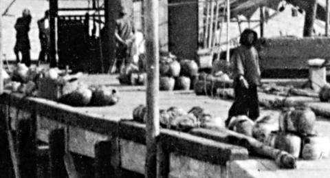
Finally, we have this group nearest to the camera.
In their shoes, white clothes, and even a western-style shirt and trousers, they look very different from the people who are in their working clothes. Are they here for leisure? Maybe for a spot of fishing?
The man in the western clothes is reaching for a cane of some sort which I first thought might be a fishing rod. I can't see any fittings on the cane to confirm that though. The long shadows show it is the end of the day, so perhaps they are just a family out for a stroll in the late afternoon, walking out on the pier to catch the breeze?
"Vintage Photograph 1945 Hong Kong Wharf Dock Pier Boats Sharp Photo China"
The seller was absolutely correct that it is a sharp photo, and it certainly shows a pier and boats in Hong Kong. They were a bit vague about the location, and got the date wrong, but I'm not complaining. Photos of Kowloon are rarer than Hong Kong photos on eBay, and rarer still if they are from before WW2. If the seller had described it as "c.1930 Junks off Kowloon City Pier", I'm sure I'd have been outbid, and would have lost it. Instead the unexciting title meant I was the only bidder, and so won by default!
Gwulo photo ID: A683
Further reading
If you have my books, you'll find other views of the Lung Tsun Stone Bridge in photo 21 of Volume 3, and photo 24 of Volume 4.
While preparing for this newsletter, I've also written up a more detailed timeline of the Lung Tsun Stone Bridge / Kowloon City Pier.
Any memories to share?
If you know anyone old enough to remember this pier, it would be great to read any memories they are willing to share. Here are a few ideas for questions, but anything they can add will be gladly received.
- What did they go to the pier for?
- What did other people use it for?
- Was it a popular place for recreation?
- Do they remember anything about the pier being buried during the Japanese occupation, when the Japanese reclaimed this area to expand the Kai Tak airfield?
Comments
Kowloon City Pier
Hi David,
Welcome back from your hols and thanks for this very interesting article. What a brilliant coincidence that the ridgeline in the photo was the same as from your window!
I'm sure I speak for many others in saying congratulations and thanks so much for all the time, effort and expense you must have put into getting your new website operational.
re: Kowloon City Pier
Thanks gw, it's good to be writing about photos again, instead of writing computer code!!