A couple of weeks ago we traced the history of the Admiralty area, and saw how the land between Kennedy Road and Queensway used to be the British army’s Victoria Barracks. This time we’ll take a walk through what used to be the barracks, to see what’s there today. There are also a few questions along the way, that I hope you can help me with.
We’ll start from the same place as last time, at the junction of Queen’s Road East, Hennessy Road, and Queensway. If you look across Queen’s Rd E. to the hillside, you’ll see the entrances to the old Arsenal Street network of Air Raid Precaution (ARP) tunnels.
Q1. Why is information about these tunnels kept secret?
The tunnels themselves certainly aren’t secret – tens of thousands of people pass them every day on this busy junction. But if you look at government documents about the old ARP tunnels, you’ll find that information about this network is not available, and any references to it in other documents have been blanked out. The only other tunnel network I’ve seen treated this way is the one under Government house.
As we’ve learned, that network can still be accessed from Government house, so it’s to be expected that the details are not public. Since the hill above the Arsenal Street network is still owned by the military, could the secrecy be for the same reason? That the tunnels could be accessed from the buildings on the hills above? Or is it enough that they run under military land, so anything in that area is naturally kept secret?
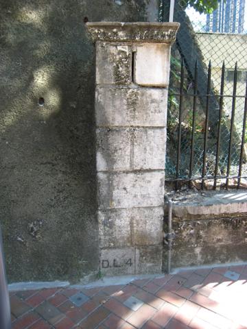
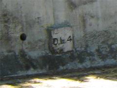
While you ponder our first question, let's cross the road and turn right to walk towards Queensway. Just after the last tunnel portal, you’ll see this pillar.
Q2. What does the “D.L.4” mean at the base of the pillar?
It looks like one of the Lot Markers we’ve seen elsewhere, but I’m not sure what a “D” type of Lot is. The Land Registry’s trusty “What’s that Lot?” page [6] doesn’t give any answers for DL, so no help there. Maybe D for Defense?
Walk on a little further, and then follow the road round to the left. Until the late 1970’s this was one of the entrances to British Army's Victoria Barracks, and would have been off limits to the public. The low building on the left was the guardhouse, as shown in this 1977 photo.
/8-11-75.jpg)
Victoria Barracks. Guardroom east gate, 1977. [1]
It looks basically the same today, though it is now used by the Salvation Army.
Follow the road round and up to the left to walk up Justice Drive. Even in the 1990’s the blocky building down on the left was still a NAAFI store for the British military personnel. Surprisingly if you look at the Centamap website today, it is still shown as a NAAFI store! Is there some long-forgotten contingent of British storekeepers, still waiting patiently and wondering where their customers have gone?

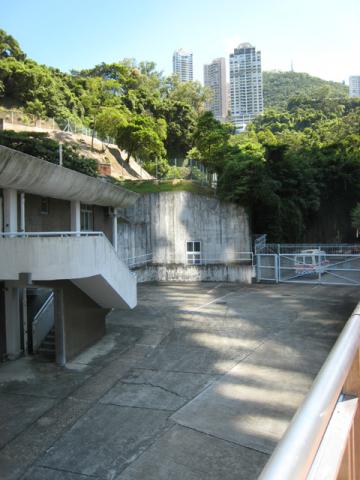
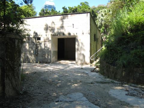
Here's the view today.
The end of the NAAFI building is on the left, then if you look in the centre of the photo you can see a doorway in the white wall. There is a wire gate across it, and appears to be a tunnel leading off behind it.
Q3. Does anyone know what the tunnel was for?
There’s no record of an air-raid tunnel in that area, so I’d be interested to know more about it.
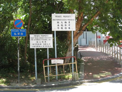
Walk a little further up the hill, and you’ll see a road leads off to the left.
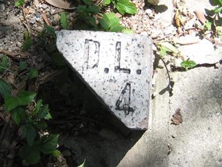
Along the edge of the road you’ll see these little stone markers, again with that DL4 marking.
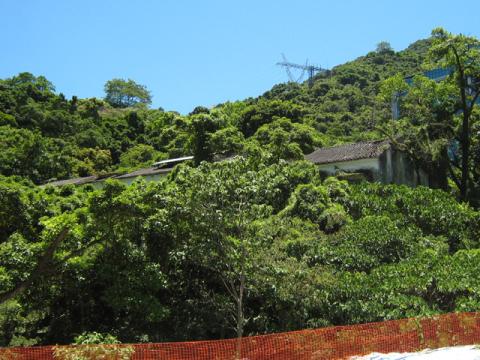
The road leads up to Paget House and Dragon House, which stand on the hill above the Arsenal Street tunnels. This area used to be known as ‘Queen’s Lines’, but the new name is ‘Ching Yi To Barracks’. It is classified as a closed area [2] for use of the PLA’s Hong Kong garrison, ie keep out!
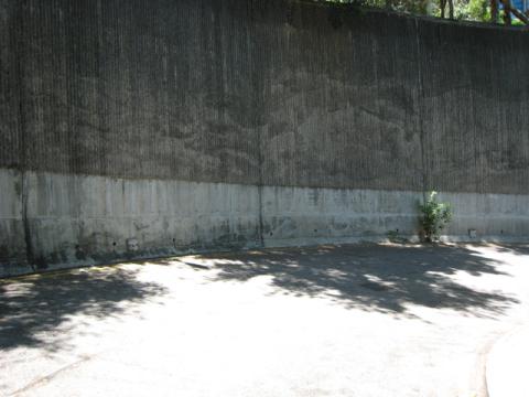
A few steps up the hill is another road on the left, this one curving down and around to the Naafi building shown earlier. And in case you are in any doubt about which piece of land you are looking at, the retaining wall of the road has yet more DL4 marker stones all along it.
A little further up the hill and you come to the British Consulate, with the main road swinging round to the right. On this corner you’d be standing next to the highest of the original Victoria Barracks Buildings. Originally there were five barracks buildings, running from here down the hill to Queensway.
Here’s how they looked in the nineteenth century:

Victoria Barracks, Central District, Hong Kong Island, c.1870-75.
The five blocks for housing troops, known as Victoria Barracks, were completed between 1868 and 1870 (four are visible in the photograph). Well constructed on high ground, overlooking the Royal Naval Dockyard and the harbour, these barracks were a great improvement on the earlier ones-the Murray and the Wellington Barracks. Two lower blocks and part of the 4th block, on the right, were still there in 1979 when the Army had relinquished the area to be taken over by the Hong Kong Government. It has since been converted into a public park. [3]

Victoria Harbour viewed from the east. Victoria Barracks buildings in the foreground with the Naval Yard Beyond, c.a. 1880. [1]
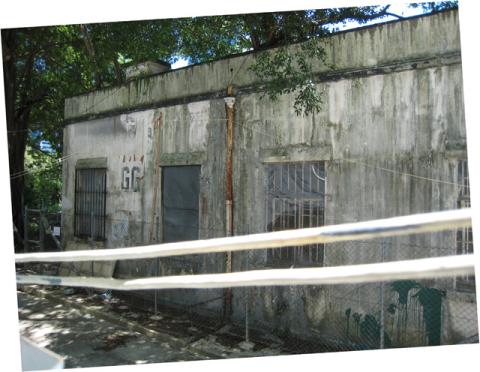
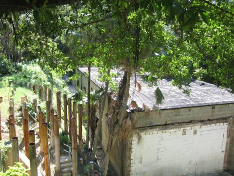
We’ll keep walking up the hill, along the pedestrian-only road. On the left, opposite the consulate is GG block. It is another of the old barracks buildings, but I guess one that is much newer than the buildings from the 1860s shown in the old photo above. There is a construction fence around it at the moment, but if you peep over the top you’ll see:
Here's how it looked in the 1970s:
/8-11-25.jpg)
Victoria Barracks (GG) (south) S.I.B. (Special Investigation Branch) Offices from road leading to P.W.D. area, 1977. [1]
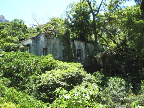
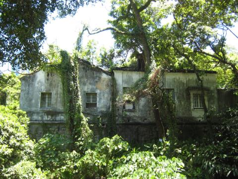
Walk a little further up the hill and you’ll come to an overgrown but solid looking set of buildings. The 1880 map of the military cantonment marks this as a magazine.
That last photo is taken from the far side of the buildings, on Kennedy Road. You can see there is some sort of construction work underway, but fortunately the ‘Former Explosives Magazine’ is classified as a Grade 1 historic building [4]. A note on the gates indicate that the work is related to the Asia Society, and one of their press releases gives this explanation [5]:
On February 10, 2006, Asia Society Hong Kong officially launched the development of a permanent, multi-purpose publicly accessible center to promote education and a deeper understanding of Asia and international affairs. Designed by the acclaimed New York based firm, Tod Williams Billie Tsien and Associates, the facility will transform an important historic but little known site—the former Explosives Magazine—in the heart of Hong Kong Island. This state-of-the-art facility, with exhibition space, a theatre, lecture halls, offices and other amenities, is scheduled for completion in 2008. The projected building and operating costs for this new center are $52 million. The Asia Society Hong Kong Center was established in 1990.
Have you heard of the Asia Society before? I hadn’t, but given that the figure quoted above is USD52million, they’re obviously not short of cash!
Here’s how the magazine area looked in 1977:
/8-11-22.jpg)
Victoria Barracks (FF) (east) P.W.D. Yard. Looking west " Offices Far Rear " workshops on right, 1977. [1]
/8-11-23.jpg)
Victoria Barracks (FF) (east) looking south. P.W.D. Yards, Stores. Note old " Ammunition Train " lines, 1977. [1]
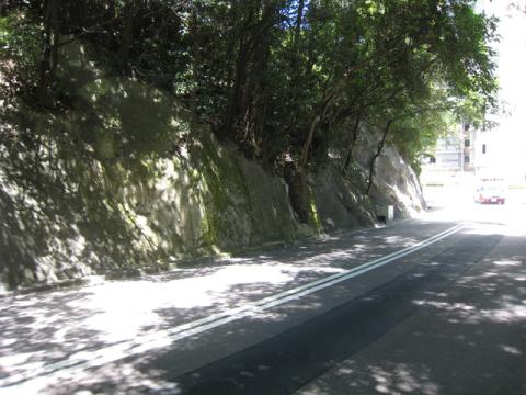
Keep walking up the hill, climb the steps to to Kennedy Road, and we come to our last little mystery. If you turn right heading west along Kennedy Road, you’ll see this nondescript hillside (see map).
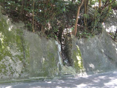
Keep walking and look out for a small cut in the hillside.
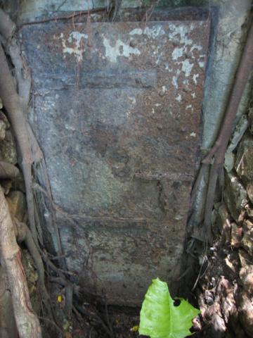
If you cross the road for a closer look, you'll see this sturdy, but very rusty iron door.
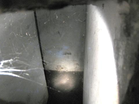
The door is just slightly ajar. It doesn’t open further, but there’s just enough of a gap to poke the camera lens inside:
Q4. So what is it?
It has whitewashed walls, and from the shadow we can see that the short entrance passage turns left around a corner. Does it lead much further, or just to a small room? It doesn’t look like an air raid tunnel entrance, and anyway the narrow passage to the doorway means it wasn’t designed for large numbers of people to go in and out. So was it built by the military, or one of the utilities like water or electricity? Any ideas?
That's the end of today's walk, but you have several options of where to walk next. The easiest is to simply retrace your steps and walk back down to Queensway. Or if you keep walking along Kennedy Road you'll come to Hong Kong park. The park also covers part of the old barracks area, and has several old barracks buildings remaining. You can walk down through the park to Central or Pacific Place. Finally if you're still feeling energetic, you could turn around and walk eastwards along Kennedy Road, and take a look at some of the historic remains around Mount Parish and Hospital Hill.
As always, if you have answers to the questions above, or you have any other information or memories to share about this area, please do leave a comment.
Regards, David
References:
- The Public Records Office (PRO) have a good selection of photos of “Victoria barracks” from the 1970s and earlier.
- 'Closed Areas', see para 32 of this government paper.
- Image from the Hong Kong Public Library online search.
- Listed buildings in Hong Kong
- Asia Society press release about redevelopment of Magazine site.
- To look up the different types of Lot (Inland Lot, Marine Lot, etc) used in Hong Kong, visit the government's IRIS website, click 'English', 'Search Land Register', then click the 'Find Lot Type' button.

Comments
Defense Lot
D.L. is the abbreviation for "Defense Lot". This document may give you more ideas on lot types and the abbreviations representing them.
Apart from Defense Lot marker stones, it is common to see marker stones inscribed with W.D. around lands assigned for military purpose. It seems that W.D. should stand for "War Department". Is there anyone knows between the difference between a defense lot and a war department lot?
Defense Lot
Thanks for the clarification, and to the person that sent in this comment by email:
I think that WDL is simply the old name for DL. On the map from the 1930's/40's you'll see WDL appears at several places within the Victoria Barracks area. But Wikipedia notes that the UK's War Office (which still used the description "War Department" for some of its work) became the Ministry of Defence in 1964, so I guess the naming conventions for military lots changed at that time too.
MrB
Radio Control Drones.
mrb, is there enough space on the iron door slit to slip in a sub compact digital camera AND a radio controlled buggy? If there is you might be able to see more. All you need is a *ahem*:
1x rc buggy
1x sub compact dc
1x compact maglite (for lightings, probably too dim with one but better than nothing)
or
1x rc buggy
1x compact maglite
1x 2.4Ghz wireless cam kit (from ap liu street, $298)
1x notebook or camcorder to record the downlink
1x expectancy to lose the buggy due to poor radio reception
What think?
Narrow gap
The space is very narrow - I don't have an exact measurement, but I'd estimate just 2-3cm. I think it would be hard to fit a buggy through there.
The idea of using a RC buggy to take pictures is a lot more advanced than I was thinking. My original idea was to put my camera inside on a long rod, and use the self-timer to take a picture once it was pointing around the corner. But even though my camera is a compact (Ixus 850), it was much too wide to fit.
It seems some sort of snake camera could be the answer. The ones on the internet aren't cheap though. Have you seen them in Ap Liu Gaai too?
MrB
Disused Tunnels
You may find some more info from CEDD
http://www.cedd.gov.hk/eng/publications/information_notes/doc/in_2006_0…
http://www.asiasociety.org
Asia society
I can only assume you're referring to the http://www.royalasiaticsociety.org.hk/
I think they're well heeled and very reputable - their lectures are also excellent.
Not the RAS
The Royal Asiatic Society may be well heeled, but I don't think they are "USD52million" well heeled!!
The Asia Society are at http://www.asiasociety.org/
Here are another couple of snippets about the barracks & magazine from the web. First, in Nov 1982, Time Magazine noted that the first attempt to sell the Victoria Barracks land failed:
Then a government press release from 2002 refers to the Asia Society, the magazine, and the possibility of a military cable buried beneath it:
MrB
Paris' Toys
Well in that case, good options are:
1. IR wireless pinhole cam on a stick, available in Ap Liu Gaai, $300ish. Comes complete with a wireless receiver that you can hook up to your DV and press record. However the picture would appear all green.
2. Similar to 1 but without the IR + 1 more china copy maglite. You can change to bulb to a Surefire™ one to get a really bright light source. Again just hook a normal pinhole cam on a stick.
The problem however, is that after you've got everything set up, you find what's behind that corner is another black door marked "nosey nosey" lol.
Btw, the reason why I was interested by your article was because I also look at these things sometimes and wonder what they were. I was lucky enough to visit the bomb tunnel below Kowloon Park when I was small and always wanted to see more, but when I was old enough I left for Canada and by the time I am back, they're all closed.
Later I've been involved with wargaming here and we used to play up on Mount Davis. The barracks there are real cool. If you're interested in tunnels, there's one more still opened but I forgot whether it was in Tai Po or Ma On Shan country park. It's a famous cross country race site.
Could it be the battle box?
Could it be something concerning the battle box-the underground fortress where the British army commander Maltby directed the war against the Japanese in 1941?
Mr. Tony Banham wrote on P.27 of his book "Not the Slightest Chance" '.....Maltby and staff descend, via an entrance immediately north of Kennedy Road near today's British Consulate, into the Battle box fifty feet under the Murray Barracks.'
Though the rusty door is south of Kennedy Road instead of north, the position, I guess, is quite near to the British Consulate.
Any comment?
Could it be a pillbox?
The steel door may be the entrance of a pillbox. You may find a small rectangular structure just above the steel door (left hand side of the abandoned traffic cone). The rectangular structure may be the vent of the pillbox. The vent is covered with small stone chippings which act as a kind of camouflage, and this design was common to pillboxes built at the time.
Not the Battle Box
If you look at the map below, you can see markers showing the approximate locations of:
[gmap markers=blue::22.276736510926525,114.1640317440033 |markers=yellow::22.276974784536694,114.16456818580627 |markers=green::22.275068584289666,114.1648256778717 |zoom=21 |center=22.275842981273186,114.16523337364197 |width=510px |height=400px |id=macro_map4983 |control=Small |type=Map]
It would have been fascinating to have a chance to see inside the Battle Box, but unfortunately it no longer exists, Its removal was described in the article Wartime network of 'streets under fire' by Guy Searls in the 6th April 1992 edition of The Standard newspaper:
I'm not convinced that the portals on Queensway were connected to the Battle Box, but at least we know when it was removed.
MrB
Probably not a Pillbox
A pillbox would have loopholes that you can fire a gun from, so it's not likely to have been a pillbox. However if it is built in a similar style to a pillbox, at least we could assume it was for military use. One of the things I wanted to look at inside was the ceiling, to see if was similar to this one at Jubilee Battery. Again it would point to military use, and also give an idea of when it was built.
Please do you have any photos of other vents with the stone chippings for comparison?
MrB
How old is that pillar?
The pillar with the "D.L.4" markings shown above looks like it's been standing there a while. I've just been sent this picture, which shows it was already there in the 1910s.
MrB
Another anchor stone?
Apart from the numerous DL4 marker stones, there is an eye-catching WD37 stone on Kennedy Road. When I visited the area two weeks ago, I also found this near the entrance to the former explosives magazine. I first thought it was another WD37 stone but was surprised to have noted this written by another web-mate more than a year ago. I think the stone which was tied up is just the #101 anchor stone (the 4-digit below the anchor should read 1910).
Thanks for the links
Unfortunately I can't read Edmund Chow's blog, but from the photos it looks like there are several good articles about old buildings and history around Hong Kong. If you can read Chinese it's worth a look.
MrB
Radio room?
Following the comment about the 'ventilation shaft', I went back to take a closer look:
It looks as though the shaft was meant for cables, though maybe it could have been for ventilation too. Time to deploy the sophisticated batgung surveillance device (ie I used a long bit of string to dangle my camera down the hole!):
The bottom of the shaft is solid concrete. A smaller shaft slopes off to one side, carrying the cables further down.
The bottom of the shaft is surprisingly free of the pile of leaves and other debris we'd usually expect to see. Looking again at a photo I took from above, there is cement around the top of the shaft that would have held a cover in place. Also if you look to the right of the shaft there's what looks like a concrete square under the leaves. That was probably the cover, and given the lack of debris I guess it has been removed fairly recently.
So, if the shaft was covered it wasn't likely to be used for ventilation. Here's another view:
If you look a little way up the hill you can see a metal pole. Here's a view of the pole from the side, and then a close-up of the end section that would have been the top:
The pole has fallen over now, but you can see the cables that were used to hold it upright. It doesn't look very much like a telegraph pole that would carry cables off to another place above ground. Can anyone confirm whether the pole is the right shape to be a radio antenna?
If yes, would all three of the cables have gone to the antenna, or just one?
Despite these extra clues it's still not clear what the room behind the iron door would have been used for. Given the lack of ventilation it seems unlikely anyone would have worked in there. Maybe it held some sort of equipment related to the cables and arial? Any other ideas?
MrB
The Iron Door Victoria Barracks
Is this the door you are looking for ?
In the 1960's the HQ telephone switchboard was located in an underground network of rooms that were accessible via 109 steps below the HQ Land Forces building.
Personnel - Telephonists and technicians of 252 Signal Squadron worked down there 24/7 on a shift basis. Other staff included Chinese civilian telephonists.
If you were on shift during a typhoon you had to stay down there until it passed as the water tumbled down a gully adjacent to the steps and overflowed making the steps inaccessible.
From this level there were other steps that led down to an IRON DOOR from which you could only exit (not enter)
From this door it was a short walk to the old Victoria Barracks Sgts Mess.
Circa 65 to 68, my wife was a switchboard supervisor and I was a shift technician in this area then known as Force Exchange and Fault Control.
All communications from this area was by cable.
The other rooms in the complex were only opened during security alerts when they were manned by key personnel from the HQ.
We visited HK in 2003 and hope to return again in either 2009 or 2010.
Not that door - but great to hear from you
I've seen the underground network you mention described as 'Combined Services Underground Operating Headquarters' in a report from the 1980s, but in the 1940s it was simply known as the Battle Box. What was it known as while you were stationed there?
If you scroll back up the screen a bit you'll see a couple of messages that talk about the Battle Box. They also show on a map where the iron door we're looking at is in relation to the Battle Box. Do you remember Kennedy Road, which ran along the southern boundary of the barracks area? The door is set into the hillside on the south of the road, not far from the magazine buildings in the south-east corner of the barracks area. It looks as though it was related to the barracks in some way, but we're not sure what!
Thanks very much for writing in. I'd always assumed the Battle Box was completely underground, but from reading your message and re-reading the report more carefully, it seems they dug away the hillside, built the complex, then covered it with earth again. So most of it was under a hill, but the northern edge was a concrete retaining wall, which held the iron door that you mentioned.
Do you know when they stopped using this underground complex?
Cheers, MrB
Combined Services Underground Headquarters
Reader Malcolm Bradbury has kindly emailed us the following background information:
Malcolm also notes that the book includes several photos of the underground HQ, one of which has the caption "The underground headquarters have not been used since the internal security operations of 1967, when it was found necessary to form combined operations rooms with the Hong Kong Police."
Thanks to Malcolm for sending in this extra information.
MrB
Strange Room
Gentlemen,
Just took a visit of this site and came up with this particular room.
We came with some friends to try find the Battlebox, but we anticipated it is now gone and somewhere under pacific place. Wandering through the slope we came to this room enterance.
Well i can't tell you the histroy of this room as i have no idea,
but you may wish to know the enterence ground was dug down for about 1/2 a feet last summer when we tried to open up the gate...
Unfortunately too much debris was slipping down to the road, and we had to give up as we don't have sufficient equipment... you may wish to know the traffic cone we left there was once placed on the driveway to alert drivers during our operations..
I'd be equally interested to know the true function of the room, i agree a radio room is a good guess.
If you walk over the to the other side of the road, climb through the fence inside HK park you will find some old stairs hiding inside the trees and there's a PB along the hillside. The design of that PB is slightly different than others, and i guess it worth paying a visit.
Strange room
VHHHATC,
Thanks for writing in. If you do find anything more about the room, please do let us know.
I happened to be talking to someone about this yesterday, and they thought the metal pole was more likely for carrying cables than as an aerial. He thought an aerial would not have been postioned so low on the hillside. I hope someone will be able to look at the picture of the pole above and give us a firm answer.
Thanks also for the details of the PB, I haven't heard of that before.
Regards, MrB
Radio/Switch/Cable room
Mr. B
It may not be a radio room which the radio mask is located, perhaps it could be a switch board room for the field cables, communication etc... like those radio room located inside East Brigrade HQ in Tai Tam.
Regards,
VHHHATC
Montgomery Block, Kennedy Road Photos
Hi there!
Greetings from a cold, damp UK !
I enjoyed “A Walk through Victoria Barracks” very much and wondered if you had a photo of Montgomery Block, Kennedy Road . I believe it is where we used to live years ago when my Dad was stationed in Hong Kong with REME. From what I can gather through the internet, Montgomery Block is grade II listed building and is occupied by Mother’s Choice but so far I have been unable to trace an image of it. If you do have a photo it would be very much appreciated if you could e-mail it to me as I am putting together an album of our time in Hong Kong .
Very best wishes
Ruth Brown
Montgomery Block
Hello,
I currently work for Mother's Choice in Montgomery block and would be happy to supply you with a photo or two.
I would also b very interested in any old photos of Montgomery from years gone by as we are naturally quite interested in the history of this great building.
Great article as well, thanks for all the effort people have put into this.
Best regards
Stuart
Photos of Montgomery Block
Stuart,
If you're willing to make the photos public, we'll be happy to show them here. You can either e-mail me the digital photos (mrb at batgung dot com), or just send the links if you have them up on the web already.
Hopefully we'll get to learn more about the history of the building as other people find these notes and photos.
Regards, MrB
that mysterious door........
I lived in victoria barracks in the mid 70's till the 80's and i can tell you exactly what is behind that door i used to go there with friends to explore and be scared by massive black spiders ( we were young teenagers then).
As you enter the complex through the rusty door there is a passageway to the left which goes alot deeper into the bunker and there is a short passage to the right that only has a 'fire hole' in the wall behind wich was a small guard room. This was to allow soldiers to visually vett anyone entering and if needed open fire on intruders from a 'pillbox' opening.
The passageway goes deeper into the hillside and the first corridor feeds back on itself and leads to the guard room and at the same place there is a sand pit that was used to check that anyfire arms were not loaded on entry.( the duty seargent would take the rifle/pistol and 'fire' it into the sand ensuring the chamber was empty)
After this the passageway ( there is only one ) has three or four ( it's getting to be a long time ago!!) rooms, one of which was circular. They were mainly used for communications and when we were there there was a sheet of glass standing upright in the centre with an outline map of HK island, stonecutters and kowloon.
We found loads of other bits such as pens, cups, empty cartridge cases, documents, maps and so on which we tended to play with or take home. But we were good lads really and did not break the map, i wonder if it's still there or is hanging in some chineese officials office now...............
The other rooms were a mess and small kitchen, a briefing or ready room with long tables and BIG telephone cables sticking out of the wall and a store room that was bare ( as i remember ) except for racking and shelving.
I asked my father about it without giving away that we actually used to go there and he was quite knowledgable on it, it was built before the second world war and was used by the japanese as a coms site untill they surrendered. It was then used in the fifties/sixties as an emergency shelter and comms (standby)in case of nuclear war and was abandoned once hms tamar and it's systems were brought online.
There is ( or was ) a sister bunker on Stonecutters that we also visited more than once which had a direct phone /telex cable link.
I hope this helps in your quest, i also had the unstoppable urge to explore ( still do ) and to see you there 30 years later is great, i should of written some graffitti!!!! ( but as i said we were good boys, angelic by todays standards)
I lived in Dragon house, 13th floor and your post suggests it's still there, any pictures?
I hope this answers some of your questions.
Almost forgot, the cage door by the naaffi was a store room, nothing else. It was great though, at night we could reach in and steal anything in arms reach ( cream soda, crisps e.t.c. ) and have midnight feasts on the roof of dragon house.
that mysterious door
Mac, great to hear from you. The building that you're describing sounds a lot like the 'Combined Services Underground Operating Headquarters' (aka 'the Battle Box') that was situated inside the Victoria Barracks. The book 'VICTORIA BARRACKS 1842 - 1979 ' mentioned above has a photo of the glass sheet and outline map that was inside the underground Operating HQ.
Can you remember where the door was that you used to enter the building? That building had two, one near the Seargants' Mess by Queensway, and one at the bottom of a long staircase leading down from just next to the 'HQ Land Forces' building. The little iron door we've shown in the photos above is on Kennedy Road, just above/outside the boundary of the Victoria Barracks. So I think it's probably different from the one you remember.
Thanks for the clarification on the cage door by the naaffi, too. Shame it isn't anything more exciting than a store, but it's good to know what it is.
I only found one old photo of Dragon House (click the camera icon to view). This current photo of the Naaffi store room has some of Dragon House showing too.
regards, MrB
Montgomery Block
Hi Stuart!
It was great to hear that you would be willing to supply photos of Montgomery Block! Unfortunately I have no photos of the building myself. My Dad wasn't into photography at all! He was much more interested in his pet birds which he kept in cages on the verandah, and aeromodelling at Kai Tak airport with his friend Mr Stonier! I would be fascinated to see how my memories of the building compare with the way it looks today!
Just before my brother died a couple of years ago, he told me that he used to play in underground bunkers, pill boxes and small buildings across the road from where we lived. He mentioned that there were many lengths of dynamite fuse hidden in the grass around the buildings which would crackle when lit. He and his friends would use the lit fuses as torches so that they could see in the underground areas! He encountered huge, hairy spiders which they believed ate birds!
Best regards.
Ruth Brown
Montgomery Block
Hi Ruth
Thanks for the reply, I am sending in some photos of Montgomery as it is today which hopefully will not be too different to what you remember. The verandah areas have all been enclosed, in true Hong Kong fashion as we wanted to fully utilise the space available. The work was done back in the days when less thought was given to preserving all the intricate features of these old buildings. It would however be feasible to return it to its original state without too much trouble should the need arise.
Roberts block is also still standing next to us and I may try and sneak a photo of that as well although there is another organisation currently using that building.
Best regards
Stuart
Could it be a pillbox?
Here are some photos of a pillbox in Hong Kong. So although this door doesn't lead to a pillbox, it does seem to be built in a similar way. So it it's likely that this structure on Kennedy Rd was built around the same time as the pillboxes.
MrB
Youtube link
It's my mission in life to get behind that door...
Anyway, if anyone is interested, here is a youtube link to some footage shot during the invasion, occupation and Japanese surrender. Quality's not great, but it's good to see, especially as there's hardly any footage from the time:
http://www.youtube.com/watch?v=E-A3jMC7UyU
Not exactly what the maps shown
Hello, Rusty again. In fact, I was one of the member who dig with VHHHATC in Kennedy Road. And actually, I have copied a set of maps from a document about the Battlebox...
That document was dated Oct 1983, made by Mott, Hay & Anderson Far East. It is now stored in the library of Geotechnical Engineering Office and it is opened to everyone! The document was made because of the construction of the Supreme Court Road. In the construction site they found three ventilation shafts and they "realized" they had a construction over the underground building, and that's why they made such reports...
According to the reports, the Battlebox (they used the term "Underground Operations Headquarter") was located 100m south of Queensway and 350m to the east of Garden Road. One side of the Battlebox FORMED A RETAINING WALL running east-west! There were two way to get in, one was "via steps leading UP from Queensway to a portal at the eastern end of the northern retaining wall (beware of the direction)", and the other was "via an access tunnel, approx 60m long, which leads down from a portal situated in a slope to the south east side of the headquarters, Land Force Building."
And it is about 15.5m deep underground except the northern side, where down to 8.5m.
That so-called Land Force Building seems had quite a lot of names, according to the maps in the document, it named as "Combined Services HQ" and in the book "Victoria Barracks, 1842-1979" stated it as the "old" headquarter. And now it should be located nowadays entrance of the Hong Kong Park (Supreme Court Side)...
The Battlebox itself should be the area under the Two Pacific Place (the landscape is matched with the old photos). And according to the document, the room were not so big in size. The biggest one was in rectangular shaped, named "RAF Sector OPS centre". Then there were six second-large room, all in square shape, named as "BRITISH WAR ROOM", "RN Operation RM", "Engine Room", "FORCE Exchange", "Frame Room", "RN Signals Office" and "RN Underground Receiver RM". I guess the glass map shown in the book "Victoria Barrack" was inside either the "War Room" (usually places for such map) or the "RN Operation RM" (the map was showing the naval operation).
The Battlebox itself is in fact visible in the book "Victoria Barrack 1842-1979". On page 100, you can find an aerial photo showing the area of the headquarter. On the top right hand side, you can see the Staff House. Then move slight down left hand side, you can find two long buildings, one is in rectangular shape (the new HQ) and one in curved shape (the old HQ). Focus on the curved one, it was the HQ built in 1937. Just outside of it had a park, a kind of grassland. You may noticed there was a strangle shape objects, something like a mushroom facing to Queensway (the Victoria Harbor). That is a "fort" according to the document. From the fort moving right, towards the Queensway, you can find an obvious straight line between a grassland and a bunch of trees, that was the "Retaining Wall" mentioned by the document. That is the northern side of the Battlebox!!
I believed that the Battlebox may not be destroyed by the Pacific Place, perhaps just being covered. Because I noticed that the underground car park of the Pacific Place had a straight wall at the south while the other sides were in a irregular shape. Perhaps "something" was behind that wall, may be the "northern border" of the Battlebox. But so far we are not sure...
About that tunnel on Kennedy Road, i dont think it was related to the Battlebox. But perhaps something related to the Barrack itself. A radio room is also my guess. I do hope that someday we can get inside to take a look...
Landslide in Kennedy Road
Have anyone notice the landslide in Kennedy Road some days before? Is it close to the strange iron door behind the Hong Kong Park?
re: landslide in Kennedy Road
I passed there last week, and there is no sign of any landslide around the iron door.
The cannons found last week
Does anyone have any links to pics the 4 cannons found last week at the barracks? Such a great find.
The SCMP reported it like they were discovered by accident, one would think that on a sight as important as that some prep work should have been done by the archeologist boffins.
Cannons?
Hi Paul, I missed that news. Anything more you can share about it please?
Saturday's SCMP
I think it was in the Saturday issue, they found 4 cannons of various sizes (several metres long) and have packed them off to the Museum of Coastal Defence to be cleaned up and restored in view of them going on display.
wow i really enjoyed reading
wow i really enjoyed reading your article. i serioulsy believe that there are so many things hidden from us on hong kong island and i'd love to learn more about them.
last year when my father came to hong kong to visit me we went walking around stanley and walked to the end of the road to the stanley barracks and on our way up the road we passed by a huge slab of exposed rock sticking out the side of the mountain. i didnt think anything of it but then we heard what seemed to be machines grinding away behind it and my father said it was most likely hollow. i wonder what is behind it.
Montgomery Block Photo.
There's a photo in the HK PRO claiming to show Montgomery Block.
That is most certainly not the Montgomery block I lived in for the best part of two years between 1956 and 1958.
The block in the PRO photo, is a similar style, but has only two levels, Monty had three.
Regards, G.
Everyone, I planned to go
Everyone, I planned to go with my friends again next week to do more digging and try to get in that place. Anyone would like to join us?
Take lots of photos
Chrissy, I won't be able to join you, but I'm very interested to know what you find. Take lots of photos!
Hi Chrissy If you are
Hi Chrissy
If you are planning to go to Kennedy Road to try to get into that little door, you will be disappointed. There are slope strengthening works going on around that part of the road and lots of workers will be there during the day. I think the works will continue for months.
However, I suspect the foreman/engineer there would know what's behind that little door. It seems that they will also strengthen the slope surrounding that little door.
So if you do go with your friends, perhaps you may get some interesting info from the workers there.
A
The Lands Department use the
The Lands Department use the term DL to mean District Lot. WD was also used to refer to Works Department - later PWD (Public Works Department). Most contracting jobs in the early days was done by the WD.
Hi all, I went past the spot
Hi all, I went past the spot in the last couple of days (in a cab) and found the "mysterious door" opened. The sloping works are continuing (and will be for the next few months at least) and the workers have apparently gone in and connected some of the pipings / wirings.
I suspect that the door will be locked again at night- but I may be wrong. I think the workers / foreman may also be willing to share their knowledge of what lies behind that door.
This may be a golden chance for us to find out the truth. Any takers? Please put up a post here if you manage to find out further info.
A
Mysterious door
Thanks for the heads-up. I'll try and take a walk past there one day this week. If you get get there first please let us know.
Behind the mysterious door
Yesterday I waked past it, and the door was open. I called to the workers nearby, and was allowed to take a quick peek inside. As we saw previously, a very short passage leads from the door then turns left. Turning left, this is what we see:
It's a small, white-washed room. One of those times where the anticipation was better than the arrival!
There's a sloping duct cut into in the ceiling, carrying the cables that we saw coming out from the 'chimney' above.
At the bottom of the left wall you can see a round hole with a cable leading into it. Near the front of the same wall, and also at ground level, are several more of these tube-shaped openings, heading out and down.
So in it's current format, it's just a passage for some cables. It seems like a lot of work to have built this just to route cables through. The walls have the little wooden pegs in that would have supported something in the past. Maybe there was some equipment installed in here at some stage? I'm not sure what though. I didn't see any ventilation shafts, so noone could have worked in here for long.
On the way out the back of the iron door has some very sturdy bolts to lock it. I thought I'd taken a video of them..., but in the excitement it seems I didn't press the record button!
So, no secret passageways to be found. I'm still curious to know why the room was built though. Please leave a comment if you know any more about its history.
Great job and thanks for the
Great job and thanks for the photo! I'm glad that one of us has finally been able to get in and take a peek.
I think the door is kept open even at night when all the workers have left the site.
My guess is that the "mysterious room" was used as a radio / transmission machineroom for the barracks / Battlebox closeby (may be with an antenna / transmission device at the top of it). That would explain the cables going into the floor (and then possibly linked to the Barracks / Battlebox via an underground duct). If you look at a map you will see the close proximity of this mysterious room to the barracks buildings and also the site of the Battlebox.
I suspect there may be more military installations around that part of Kennedy Road / Borrett Road too. I recall seeing what looks like a military water tank near a footpath from Kennedy Road to Borrett Road (near New Life Hostel). I also had a look at old maps around that area and recall that Kennedy Road in the early 30s / 40s did not connect to Wanchai and it in fact ended around the Barracks area. This may mean that other military installations may have been demolished when they built the connection (and also the HK Electric building) after the war.
A
re: Mystery door
Yes, it was good to see inside at last. Thanks for letting us know about the open door - and thanks to whoever did the work to get the door open.
Something connected with communications / radio seems a likely explanation. Did you see the earlier photos of the metal pole on the slope above this room?
There may well be more things to find in the area, but I don't think it will be to the East of the HK Electric Building. Kennedy Road is older than you think - it appears on maps from before 1900. Keep a look out though, and let us know what you find.
regards, David
Victoria Barracks Magazine
looks like work there is near completion - infrastructure-wise anyway. looks pretty good given the state the area was in before. Here's some shots by the architects
http://www.twbta.com/#/2714
re: Victoria Barracks Magazine
Originally I'd hoped that the Northern building would have a view out, and in turn could be seen from further down the hill. From the drawings on the site you linked to, it looks as though it will be hidden behind the new building and the covered walkway. Time for another walk up there to see how it looks in practice.