Text on Flickr:
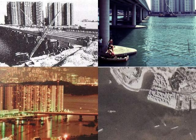
The upper left picture was taken in July 1968 showing how the Mei Foo bridge was built over the sea.
Lower right picture was taken in 1974, showing the Lai Chi Kok bay was still in existence.
The same area was a park in the 80s before it finally becomes a part of the West Rail Mei Foo Station.
Source: This image came from Flickr, see https://flickr.com/photo.gne?id=4117696238
Date picture taken
1974
Gallery
Shows place(s)
Comments
Lai Chi Kok Bay in July 1979
The bay was just filled in before the swimming pool, library etc was put in. The bridge was still over water. The Kwai Chung incinerator can be seen in the distance spewing out a lot of pollution. Princess Margaret Hospital in the centre. Lai Yuen Amusement Park on the right side. Kau Wah King Village behind Lai Yuen.