There are different opinions about where exactly Felice Beato (the photographer) took these photos.
Wai Tse (who posts many photos on his facebook under his name) opines that the photographer took these photos at today's East Ha Man Tin Service Reservoir Playground,which CM Shun shares the same view, whereas someone whose user ID is x215137 did a quite detail analysis in uwants.com and came to the conclusion that Felice Beato took these photo somewhere near Hong Kong Rugby Union King's Park.
http://www.uwants.com/viewthread.php?tid=15184666&extra=page%3D5&page=16
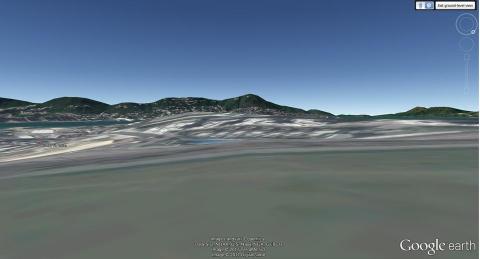
I tried to base on google earth to identify the location of the photographer but are not very effective, particularly when you view from ground level
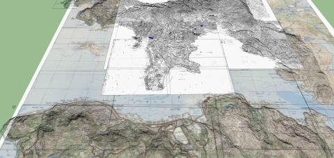
As such I tried to create a 3D model of Hong Kong Victoria based on old map for compariosn. Firstly I combined several maps (malnly 1864 TST, 1867, 1900 & 1927). Based on the old map, I can create the contour by using a free software named Sketchup.
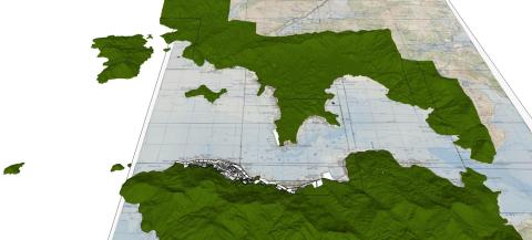
By using sketchup, i can convert the contour into 3D model as follows:
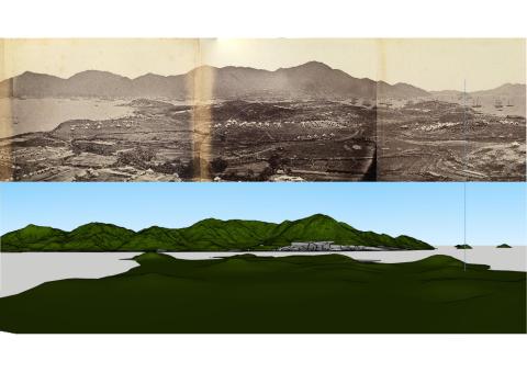
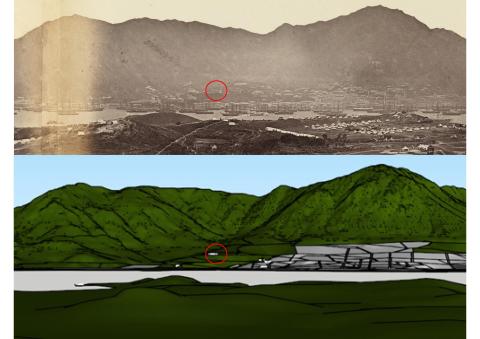
I can then compare the photo by setting the camera into different locations inside the model.
In view of the relative location of Green Island, Sunshine island, the peak, Signal Hill & Governer House (circled red).
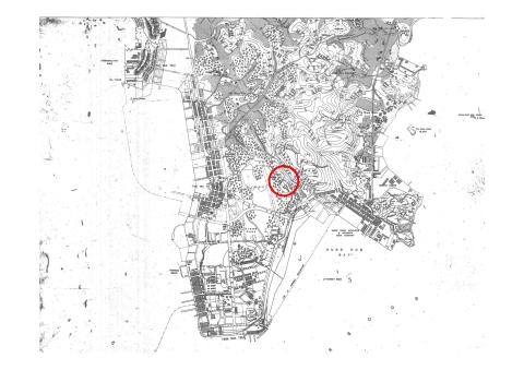
I can reconfirm that uwants.com is correct, Felice Beato took these photo at a the hill which i mark the circle below (near todays Hong Kong Rugby Union King's Park.)

Mapping skills
Have noted the incredible mapping skills of X215137 on uwants.com. Good work HF.
You can see the hill in the
You can see the hill in the two panoramas of Hong Kong Beato took from the Island looking towards Kowloon
Very good Match
Hi HF,
Very good match indeed... may I ask you to also post the model and photo comparison for the East Ho Man Tin Service Reservoir location, just to confirm if the difference is within error margins? Thanks.
CM
firstly i mark the location
firstly i mark the location of East Ho Man Tin Service Reservoir Playground (red) and King's Park High Level Service Reservoir Playground (yellow) on the current map
Then I set the camera on these locations and capture the images.
the view taken from East Ho Man Tin Service Reservoir Playground would be obstructed by King's Park because the King's Park was higher as shown on the 1900 map.
I also compare view taken from King's Park High Level Service Reservoir Playground
Zoom in and compare the relative location of signal hill, governer house and peak, seems they are different from Beato's photo.
The comparison is convincing
Many thanks HF.
The differences shown at the two locations are signficant enough to confirm that Beato took the panorama from nearby the King's Park Hong Kong Ruby Union.
CM