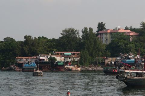
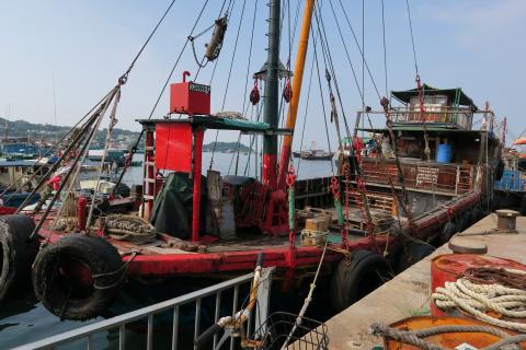
Last weekend I joined a couple of friends for a wander around Cheung Chau. As the ferry pulled in to the bay, we noticed the boatyards across on the north shore:
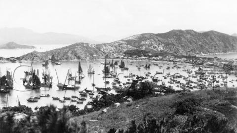
They reminded us of the boatyards in this 1930s photo of Cheung Chau:
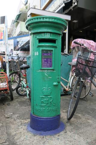
So, something to take a closer look at. The first stop though, was to see this Queen Elizabeth postbox. It's just to your right as you get off the ferry:
Then to see the boatyards we followed the shoreline north til it took a turn to the left. This wooden-hulled ship was tied up near the corner. I wonder how old it is?
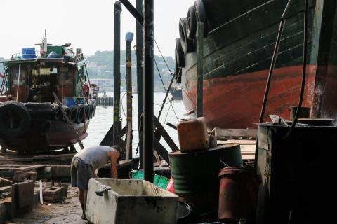
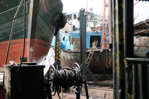
Along at the boatyard they had several boats hauled up to be worked on. No signs of any boat construction around here, so it looks as though the yard's role is just maintenance:
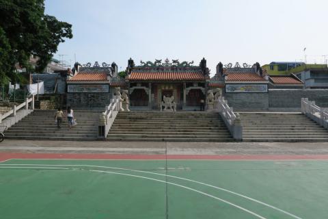
We retraced our steps til we came to the Pak Tai temple. It's easy to spot across the sports pitches:
The pitches form an open corridor from the temple to the shore, giving the temple a clear view to the sea. I don't know if it is by coincidence or design, but it's similar to how the HSBC headquarters have open land from them to the shore.
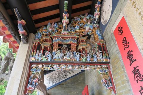
I always enjoy looking at the carved scenes in the old temples. This one is on the left of the main entrance:
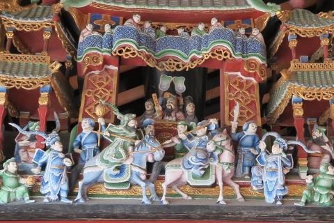
A closer view:
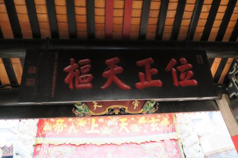
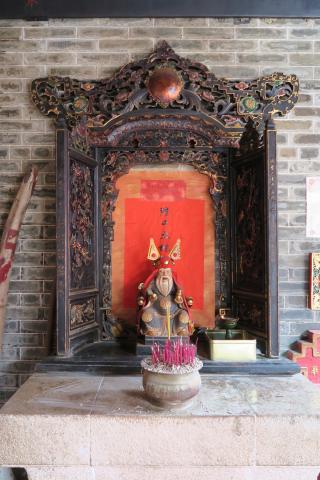
Inside the temple, Thomas pointed out a couple of items that had dates carved on them in the old "Nth year of the reign of ...." style:
They're reminders of just how old the temple is. It was built in 1783, over 50 years before the first British buildings appeared on Hong Kong island.
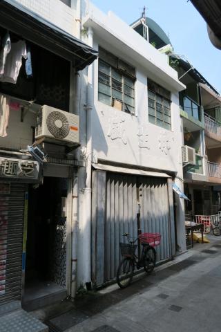
From the temple we headed south along Pak She street. The buildings along here are just two or three storeys high. You get the feeling they could be old, but it's hard to know for sure as the facades get upgraded over the years. This one still shows its old business name - painted over but still clear to see. Thomas says it reads "Lam Sang Sing", and is the name of a company that produced shrimp paste:
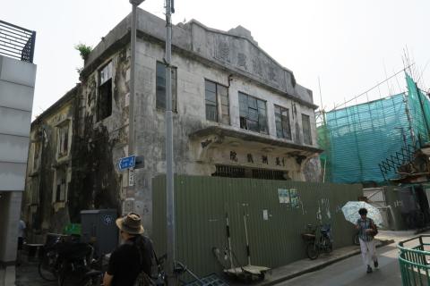
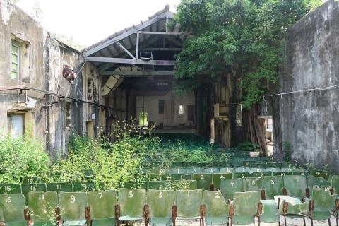
Further south and away from the shore, we came to the old Cheung Chau Theatre, a cinema built in the 1930s, but now derelict:
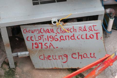
It's on Sun Hing Back Street according to Google Maps, Church Road according to the sign below. (I guess it's on the junction of the two roads.)
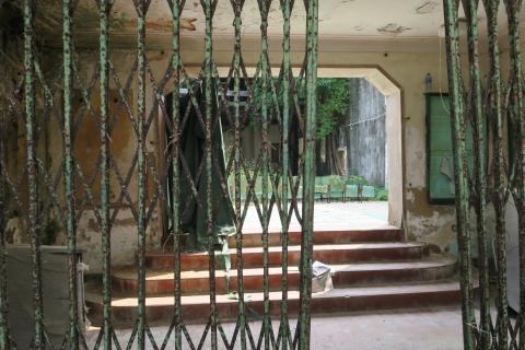
You can see it has a construction hoarding around it, but as the gate was open we took a quick look inside. Here's the lobby:
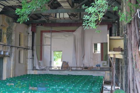
Inside it becomes clear why the seating area looks so well lit - half the roof has fallen in! From the size of the tree growing on the right wall, the roof must have been gone for several years already:
The AAB's notes for this cinema say it originally showed silent movies, with "interpreters (解畫人) hired to explain the contents to the audience." Thomas wonders if the yellow coloured box on the right wall is where the interpreters were stationed:
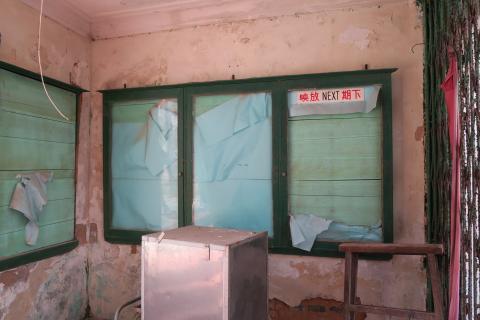
The old noticeboards are still there in the lobby, but don't give any clue to what is going to happen to this building next:
Fortunately the developer says they plan to restore and adapt the building. Fingers crossed!
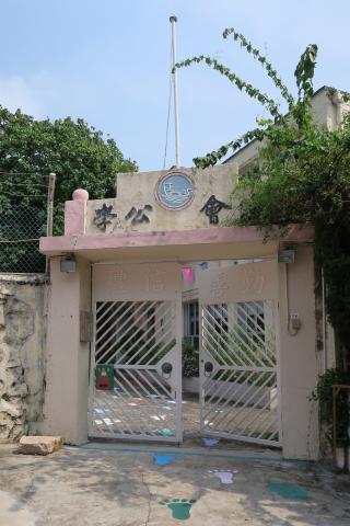
From the theatre we carried on south to Tung Wan Road, then turned east. Another interesting building with an open gate:
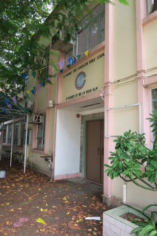
A peep inside shows it is the "Cheung Chau Fisheries Joint Association Public School, in memory of Mr. Aw Boon Haw."
As far as I can tell from the internet, the school closed down several years ago.
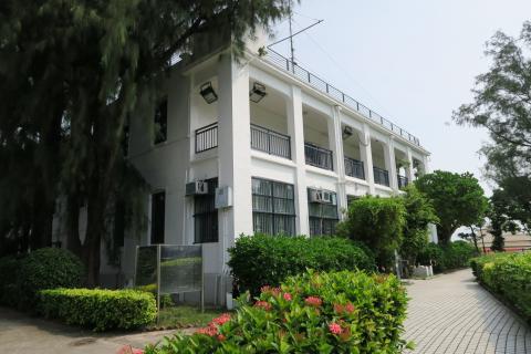
Not far from the school is a low hill with a building on it that is definitely still in use, the Cheung Chau Police Station. I believe this is the oldest building on the island with a colonial connection. It was built in 1913, so it recently passed its hundredth birthday:
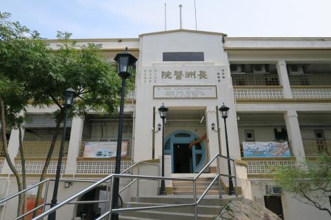
At the foot of the hill below the Police Station is the St. John Hospital:
At least, that's how it is named on the maps. A closer look at the sign reveals the full name is:
St. John Ambulance Association Haw Par Hospital
Donated by Mr. Aw Boon Haw & Mr. Aw Boon Par.
That's the second building that mentions Aw Boon Haw. It makes me wonder whether the Fisheries Joint Association school was named after him in gratitude for his donations to fund the hospital, or if he also provided money to build the school.
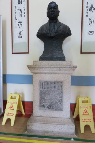
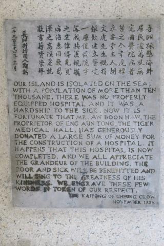
Inside the entrance hall is a bust of the man himself, and a sign with the islanders' thanks:
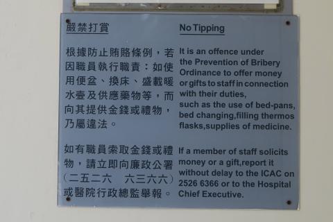
Inside the lobby there is another important piece of Hong Kong history:
It seems an odd sign if, like me, you're a relatively recent arrival in Hong Kong. Why would you need to tip in a public hospital?
But if you talk to older residents who lived in Hong Kong before the formation of the ICAC, many interactions with government staff needed an under-the-table payment before they'd happen. This ranged from expensive bribes when applying for licenses, down to small "tips" for basic services like those shown on this sign.
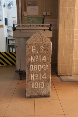
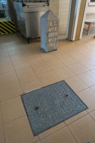
So this hospital is fertile ground for history, and we're not done yet. Down at the southern end of the building is this boundary stone:
It is one of the stones along the boundary between mid-Cheung Chau where the local residents lived, and the southern section that was reserved for European houses. We'll come back to that in a moment, but before we leave take a look at the floor in front of you:
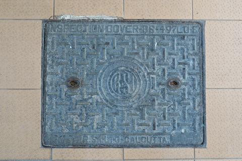
Here's a close-up. Can you see what's unusual?
Bottom-right we can see that this manhole cover was made at the RSI ironworks in Calcutta. Thanks to Moddsey for pointing this one out to us. The hospital was built in 1934, so perhaps this cover dates back to then as well.
From the hospital, our next destination was the southern part of the island, to see if we could find traces of any of those pre-WW2 European houses.
A map of the area from the 1930s shows the houses and the boundary line. The boundary ran through the hospital, explaining why the boundary stone shown above is inside the building! The next stone is on Peak Road, so that's where we went.
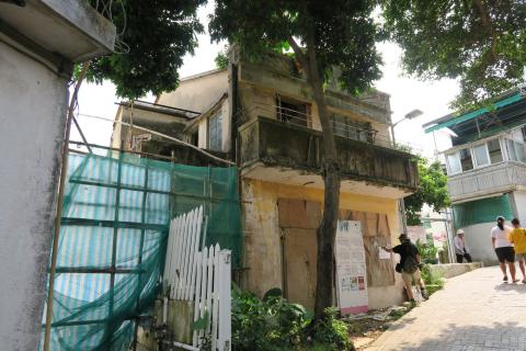
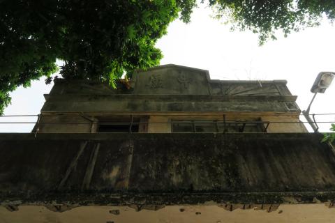
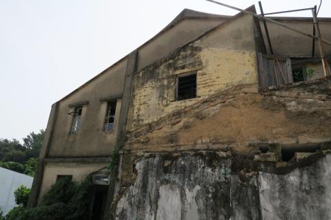
A brief detour to take a look at another old building at the start of Peak Road, this one with a pitched, tiled roof:
It looks as though its neighbour was demolished fairly recently, and this building will be next:
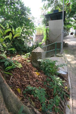
Continuing up Peak Road we saw the next boundary stone, to the left of the path:
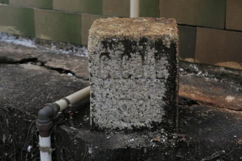
And further up the hill we saw one of the Cheung Chau style of lot marker stones. CCIL = "Cheung Chau Inland Lot":
From here we walked in a loop along Fa Peng Road to the western tip of the island, then back along Don Bosco Road to Nam Tam Wan. We were looking for traces of the old European buildings. Most of the building plots on that 1930s map still have buildings on them today, but it's hard to be sure how old they are.
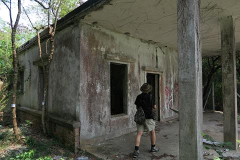
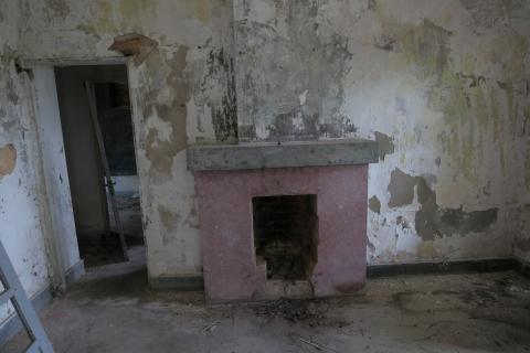
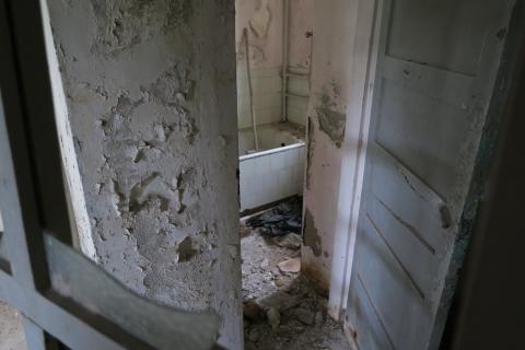
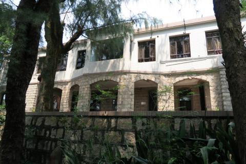
That part of the island is very quiet, and has an unusually large number of unused buildings. It's odd to see land in Hong Kong sitting idle. Here's one example, on Don Bosco Road:
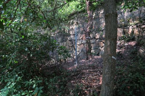
We're not sure of the date of the building, but the retaining wall below the site certainly looks old:
Further along Don Bosco Road is the Salesian Retreat House:
Another one that's on the same plot as a building form the 1930s map, but is it an original or a later re-development?
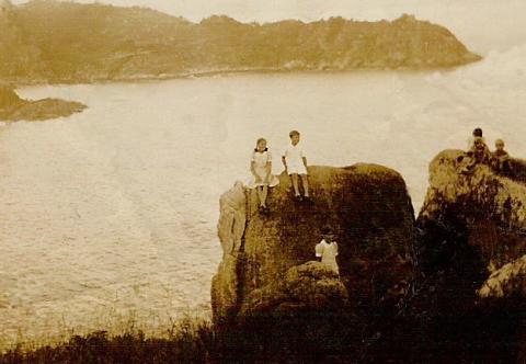
Nothing very conclusive from this part of the walk, so on to the last goal for the day. I first got interested in the European Houses on Cheung Chau when I met Mrs Laura Darnell, nee Ziegler. As a young girl in the 1940s she had lived in one of these houses, ending up in Stanley Civilian Internment Camp after the Japanese attacked Hong Kong. One of her family photos, taken around 1940, shows this view:
The children are on a rock somewhere below today's Meterological Station, with a view across Nam Tam Wan to the peninsula where the Salesian Retreat House is. I wanted to recreate this view for Laura.
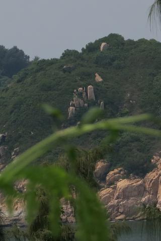
As we were by the Salesian Retreat House, here's the view in the opposite direction, with a strong candidate for the rocks shown above in the centre of this photo:
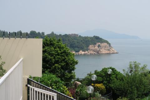
We set off towards the area where we think the rock is, but despite trying several possible paths shown on the map, there weren't any clear routes to it. The closest we got was this view from near Nautilus Villas, which you can see shows a similar view across the bay to the headland:
Last Saturday was a very hot, still day, so by this point we'd had enough and decided to call it a day. I'd still like to have another go at finding that rock, but we'll save it for a cool, wintry day when the undergrowth has died back and so have the mosquitoes!
We headed on along Peak Road West, walking back to the ferry pier in a big circle. Just before we reached the first houses of the CARE Village at Sai Wan, Thomas took us up some steps to show us Boundary Stone number 2. Can you see it?
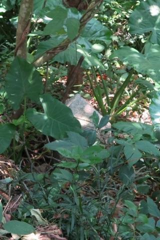
Me neither! Thomas had to point it out to us. It's in the centre of the photo above. Here's a blow-up to make it clearer:
It's mostly buried now, but still in good shape.
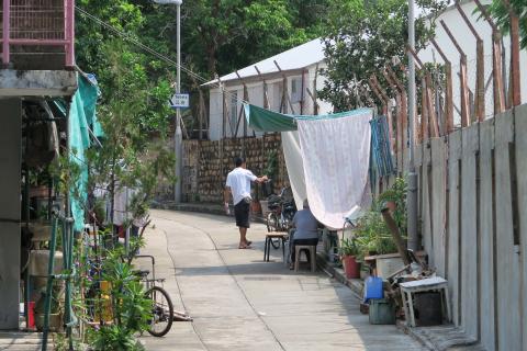
(If you're out on a hot day, look out for this lady's stall, as she sells refreshing cool herbal teas. She's on the left of the path as you walk towards the sea. This photo was taken looking back from further along the path.)
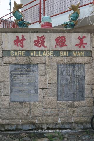
Just two more photos before we headed back to the ferry. The first shows the tablets commemorating the building of the CARE Village:
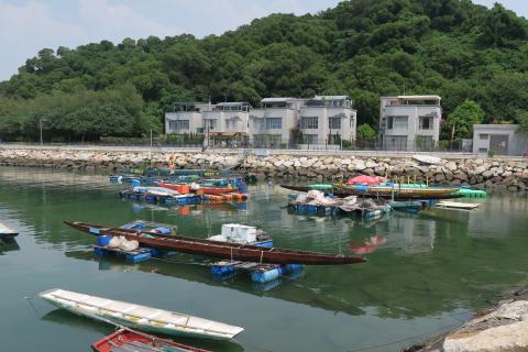
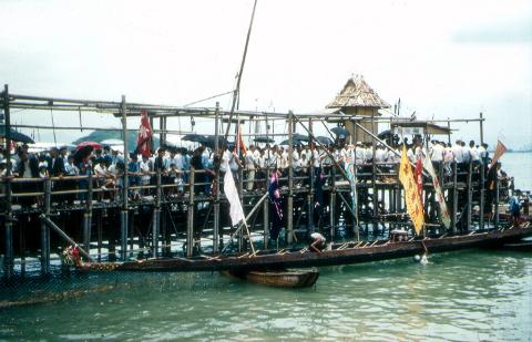
Then just after we left the village we saw these dragon boats:
This photo is in response to a photo that Andrew Suddaby took in 1958 of dragon boat races off Kennedy Town:
He writes:
The extremely long wooden dragon boats were some of the most elegant boats that I have ever seen. Do any still survive?
So yes, you can see a wooden dragon boat in the 2015 photo above. There are changes though - in the background there are also dragon boats made of fibreglass.
I hope you enjoyed joining us on our stroll. If you can add any information about anything mentioned above, or tell us about any interesting places we missed, please let us know in the comments below.
Regards,
David
Further reading:
- 1930s photo of Cheung Chau
- Colonial postboxes in Hong Kong
- Pak Tai temple
- Cheung Chau Theatre
- Cheung Chau Police Station
- St. John Hospital
- The European reservation and its boundary
- Old British-made Inspection Covers
|
Also on Gwulo.com this week:
|
Comments
Hi David, The boatyard that
Hi David, The boatyard that you saw on the Nothern shore as you entered the harbour at Cheung Chau is the one that replaced the slipways on my Slipways Cheung Chau photograph in my folder from 1957/8. Some time in, roughly, 2005 when I was making my Then And Now 'film' I spoke with the owner there and he told me that the 1950s slipways had been moved into the harbour a bit to make way for the new road. Andrew (Suddaby)
Boatyard
Thanks Andrew, your 1957/8 photo adds another step in the timeline from the 1930s photo to the present day:
Regards, David
Remembering Cheung Chau...
Thank you David
for sharing your photos, I enjoy viewing them very much. It seems to me there are still some smaller Erythrina trees by the Afternoon Beach.
And, the Laura's Mystery Rock area is indeed so mysterious. Glad to see the Nature is so protective for their Integrity. For your safety, maybe a heli-ride next time if you like to see them in close proximity?
Regards
Tung
Thanks Tung, glad to hear you
Thanks Tung, glad to hear you enjoyed them.
I think the visit by helicopter will have to wait for me to win the mark six! But maybe a cold winter day to put the mozzies to sleep will be good enough to let us make our way through the bushes.
Regards, David
Don Bosco Road
I was very intrigued by the Salesian Retreat House and Don Bosco Road because I was a cheerleader for Don Bosco High School in Boston and the school was run by the Salesian brothers. I was surprised to see this in Hong Kong.
Re: The old house on Don Bosco Road which we traspassed upo....
Hi There,
It had been almost 10 years since the gathering.
The old house we traspassed upon had been demolished for quite a few years. In its place, a very BIG building had been built and is in the latter stage of the construction. The short steps leading from Don Bosco Road to the site had already disappeared. There is a big retention wall there now. The entrance of the big building is from the top side, next to the ruins of the mansion (it still stands, to my surprise) at the junction where Fa Peng Road meets Don Bosco Road.
T