This map appears at Page 240 of "Mapping Hong Kong". Its accompanying text at Page 76 states that it was published between 1960 & 1970 on a sheet containing three other maps, namely of south Kowloon, Central and most of Hong Kong.
The Peak map contains the "new" road names for Old Peak Road, Mount Austin Road, Pollocks Path and Peel Rise that came into effect on 1st September 1960 (Moddsey's post of 23-4-2014 at www.gwulo.com/media/13017 ) indicating it was published after that date.
The Central map has a dotted line to the north west of Connaught Road labelled "Line of Future Reclamation". Blake Pier is shown still standing at the bottom of Pedder Street, within the area to be reclaimed. It was demolished in June 1965. The south Kowloon map has Kowloon Wharf No.1 in the location where Ocean Terminal was opened in 1966 ( "Wharf, The First Hundred Years" ).
Considering the above points together, the Peak map seems to date from sometime between 1st September 1960 and the mid-1960's.
Comments
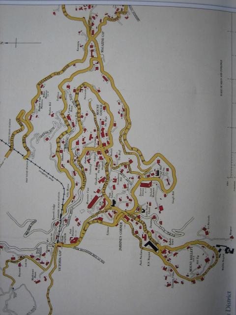
Peak Map
This map appears at Page 240 of "Mapping Hong Kong". Its accompanying text at Page 76 states that it was published between 1960 & 1970 on a sheet containing three other maps, namely of south Kowloon, Central and most of Hong Kong.
The Peak map contains the "new" road names for Old Peak Road, Mount Austin Road, Pollocks Path and Peel Rise that came into effect on 1st September 1960 (Moddsey's post of 23-4-2014 at www.gwulo.com/media/13017 ) indicating it was published after that date.
The Central map has a dotted line to the north west of Connaught Road labelled "Line of Future Reclamation". Blake Pier is shown still standing at the bottom of Pedder Street, within the area to be reclaimed. It was demolished in June 1965. The south Kowloon map has Kowloon Wharf No.1 in the location where Ocean Terminal was opened in 1966 ( "Wharf, The First Hundred Years" ).
Considering the above points together, the Peak map seems to date from sometime between 1st September 1960 and the mid-1960's.