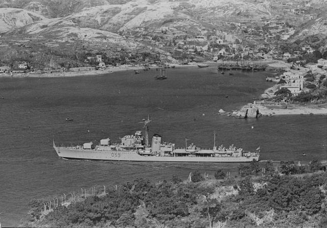
Click through for very high resolution. Nov.15,1957: Battle Class destroyer HMAS ANZAC [II] enters Hong Kong via the Lei Yue Mun Passage - Photo AWM/RAN
Source: This image came from Flickr, see https://flickr.com/photo.gne?id=5722823626
Date picture taken
15 Nov 1957
Gallery
Shows place(s)

Comments
Re: Oyster Shell Beach?
Hi there,
Would somebody please highlight where exactly is Oyster Bay Beach as there are quite a few locations with sandy beaches in the photo. Anyway, according to GeoInfo Maps the approximate locate where fishing junks are seen in the photo above are called Tsau Wan (酒灣). Modern day Tsau Wan is the small bay behind the causeway.
Also, the Kowloon side of Lei Yue Mun had been well known for granite quarries and stone works.
Best Regards,
T
Oyster Bay
HI T - it's the beach on the extreme right in the middle of the photo, adjacent to the rocks
Re: Oyster Bay
Hi there,
Thanks for the update. I have been to the neighbourhood a few years ago. It is a bit litterred and part of the bay had a few buildings on it, right along the high water marks. As far as I could recall the part close to the navigation beacon would be under water at high tide.
Here's two photos I took:
Best Regards,
T
Lei Yue Mun (North) Beacon
This photo offers a rare view of the No. 88 beacon (Known commonly as Lei Yue Mun Lighthouse) before it was renovated in 1964.
Before the beacon was rebuilt into its current form with its distinct design, it was a pillar with black and white checkers as seen in the photo.