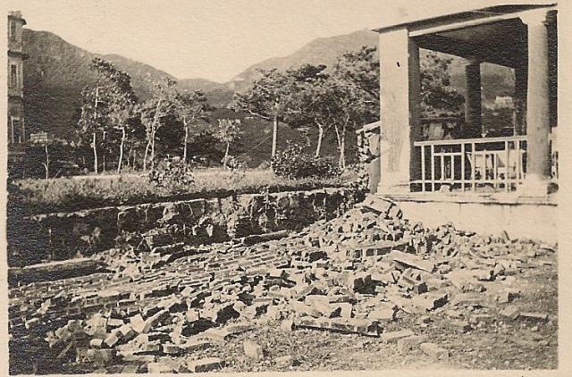
Have finally found the date of the typhoon damage to the wall between 19 Broadwood Road, home to Leslie Warren and his family, and no. 20, The Towers, which can just be seen on the left. It is 24 July 1930. The annual report of the Botanical & Forestry Department provides a good record of the number of times the typhoon signal was hoisted and the worst typhoon of each year, if any. For 1930 the report states: "The typhoon which passed close to the Colony blew down over 2000 roadside shade trees, most damage being done between Castle Peak and Au Tau." For 1934 and 1935 the reports state that no damage was done by either of the gales which approached the Colony, but 1936 and 1937 made up for that. Even after the lesser 1936 gale, the report states that annuals and small shrubs were stripped completely bare. The two gales reached velocities of 132 mph and 164 mph respectively.
Comments
Well done for tracking down
Well done for tracking down the year. It must have been a frightening place to be in a strong typhoon, very much in the open on top of the ridge.
Regards, David