compare to a later photo 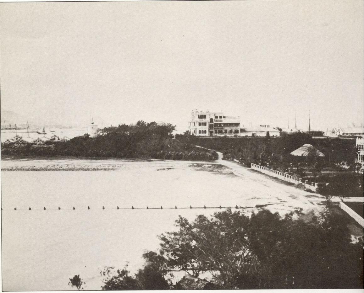
Source: This image came from Flickr, see https://flickr.com/photo.gne?id=4644290613
Date picture taken
unknown
compare to a later photo
Source: This image came from Flickr, see https://flickr.com/photo.gne?id=4644290613
Comments
A different Mosque
Please can you delete the current 'Kowloon Mosque' place from this photo? That location is away to the right of this photo.
It's an interesting photo. Any ideas when it was taken? I'm surprised to see the hill behind the Marine Police Station was originally so high - still higher than the building in this photo.
It certainly looks to have been taken several years before this 1886 photo, which shows TST already more built up.
Caption on Govt photo
I've put it in because it is the caption on the photo http://hkclweb.hkpl.gov.hk/hkclr2/igateway?svc=ctcvr&hid=1&itemid=2&ss=…; In some history I read, there was a temporary (perhaps matshed) place of worship requested by the Muslim troops before the Kowloon Mosque was built. Let's leave it here until we find the facts, shall we? The caption date is 1865, but that is the date on lots of the ISD photos.
There is something funny about this photo. I want to know what the large building extreme left is.
Here is another view that is more detailed http://hkclweb.hkpl.gov.hk/hkclr2/object?svc=objrtv&src=CM&itemid=R%249….
re: Caption on Govt photo
Sorry, I wasn't clear - I meant please delete it from the 'Places shown in this photo' not from the caption, since even if it is a mosque, it will need a different place.
Looking at the more detailed photo, I think that large building extreme left is the mosque. It seems to have the right sort of domes. It would also explain the title of this photo, and might also be behind this jumbled-up note in Wikipedia:
The Kowloon Masjid and Islamic Centre was first established in 1896, on the site where the Tsim Sha Tsui Police Station now stands.
So was the first Kowloon Mosque was built on the site where the Water Police Station would stand later?
Is this the same building?
This photo comes from the HK Museum collection, and has the caption:
Police station, Tsim Sha Tsui, Kowloon, c.1865-1870.
Original Police station - TST
"the ornate castellated building on the left is the original Police Station"
Hong Kong: a rare photographic record of the 1860s by Arthur Hacker - 1997
view from The Albany
I have to say that I can't see how the view can be from near Albany or the Botanic Garden. This has to do with basic triangulation, the apparent angle between Kowloon and Blackhead Points and the 'head on' appearance of the Hung Hom peninsula's west shore.
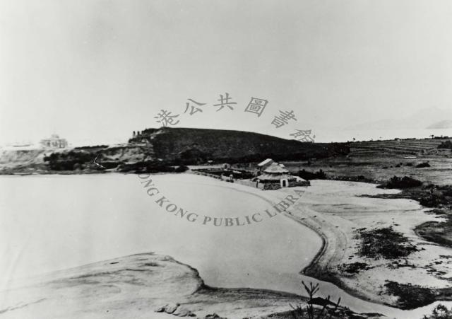
Matshed structure on beach
My understanding is that the matshed structure on the beach provided swimming changing facilities for rent.
Ian
1868 tst point, by simtangIt…
It may be useful to specify what the buildings in the picture are. The information is from Uwants.
A = The wooden sheds behind the straw hut constitute a temporary military hospital which had 80 beds reserved for wounded soldiers. It was built in 1860 before Britain launched their campaign in the second Opium War.The straw hut itself is staff quarter. The source is a book published in 1918 about history of British medical facilities of the army. As for those huts in the picture, it was just a guess by the commenter based on the descriptions in that book.
B=bell shaped military camps for European soldiers
C=first generation TST police station
The flat area up the hill was the training ground for 8000 soldier Sikh cavalry unit and Sikh Fane's Horse unit..
1868 buildings
I don't think the British Army would build a hospital on sand next to the water's edge, as it would be hard to keep clean and easily damaged in a storm. Some type of recreational use like Ian describes above is a more likely explanation.
Mortality of Troops (China)
Came across the captioned subject in Parliamentary Papers: Report from the Select Committee of Mortality of Troops (China) etc . Published in 1866. Some information contained therein is relevant to early Kowloon.
Further reading about Kowloon from the Journal_of_the_Royal_Army_Medical_Corps - Echoes of the Past: Hong Kong 1845-1865 by Major W. K. Morrison Scroll to Page 453
The “Hong Kong fever”…
The “Hong Kong fever” alluded to in the second link that plagued the early troops in Kowloon can only be malaria.