Skip to main content
Menu
Menu
Home
Free newsletter
Shop
Explore
Add new...
What's new
FAQs
About
Gwulo menu for header
Show — Gwulo menu for header
Hide — Gwulo menu for header
Home
What's new
Gwulo
Old Hong Kong
Cart Flyout
Photos tagged:
map
Primary tabs
View
Books
Events
Organisations
Pages
People
Photos
(active tab)
Places (map)
Places (list)
Streets (map)
Timelines
Items per page
25
100
- All -
Year
Title
Sort ascending
1850s
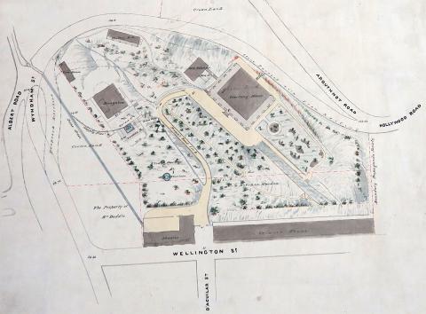
1850 Green Bank
1850s
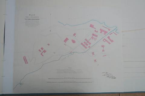
1850 Cast iron tanks and pipes in Victoria Cantonment
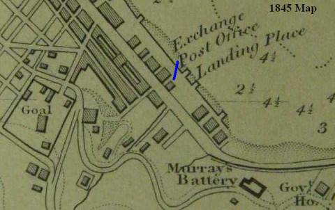
1845
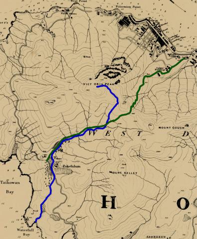
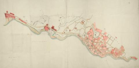
1845 map, Pok Fu Lam to Central
1845
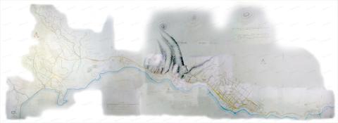
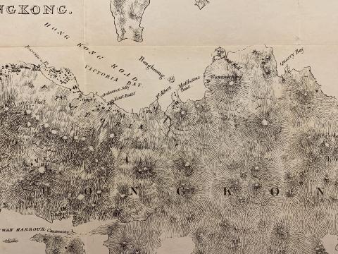
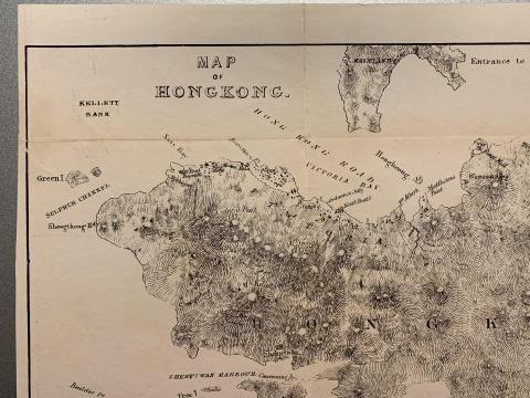
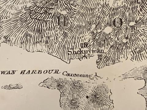
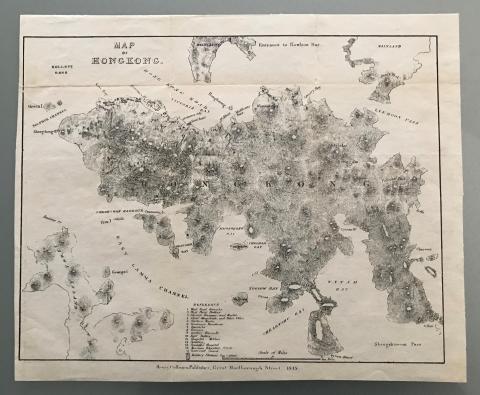
1845 Map of Hong Kong
1845
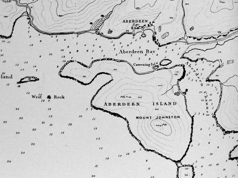
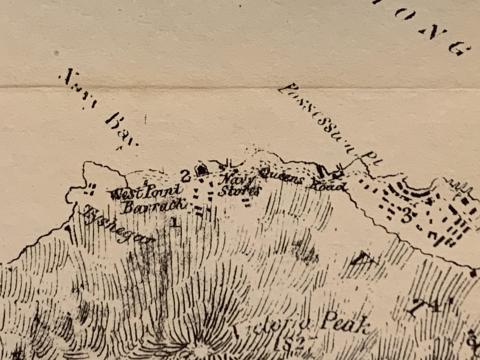
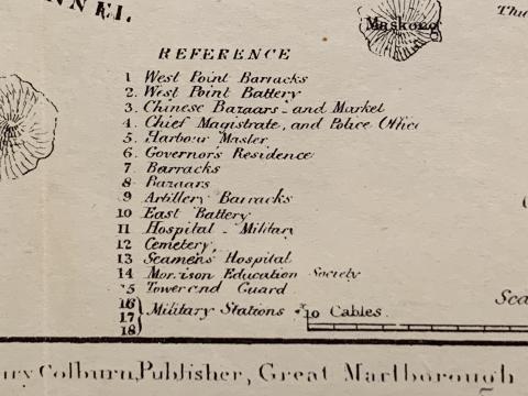
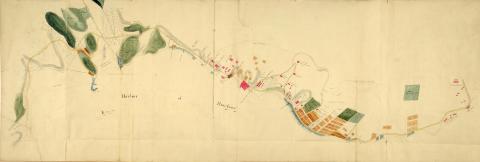
1845 Map of Aberdeen
1845
1845 map 08.JPG
1845
1845 map 07.JPG
1845
1845 map 06.JPG
1845
1845 map 05.JPG
1845
1845 map 04.JPG
1845
1845 map 03.JPG
1845
1845 map 02.JPG
1845
1845 map 01.JPG
1845
1845 map 00.JPG
1845
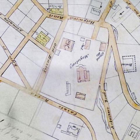
1845 map - Magistracy & Jails
1845
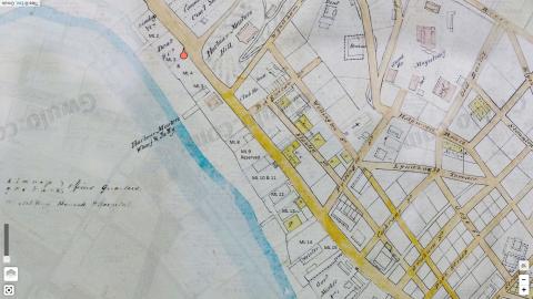
1845 Map (detail) Central
1845
1845 Map
1845
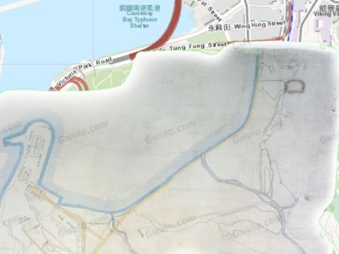
1845 Causeway Bay map
1845
1845 Belcher.jpg
1845
1845 - Developed Marine Lots, Central
1842
1842 Map of Initial Land Sales in the Colony
1840s
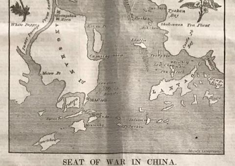
1840 Cum-sing moon.JPG
1953
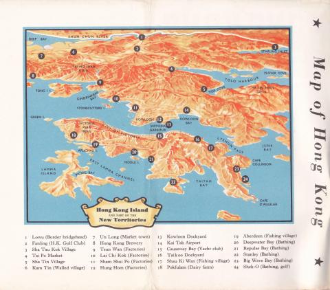
02 HK Guide Book Inside Front Cover Map
2015
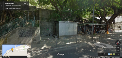
'Shed' which the city boundary of Victoria cuts through on Victoria Road
1920s
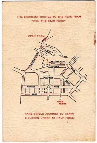
"Star Ferry to Peak Tram" Map
Pagination
First page
« First
Previous page
‹‹
…
Page
17
Page
18
Page
19
Current page
20
Page
21
Next page
››
Last page
Last »