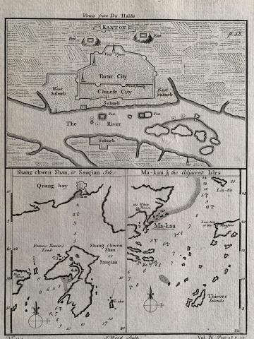
| 1745 |
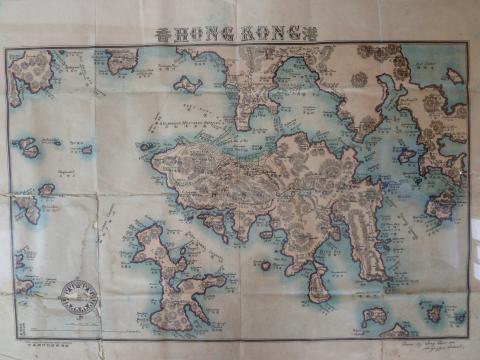
1745 Map of Waters between Macau and Hong Kong
|
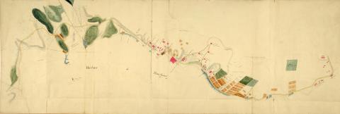
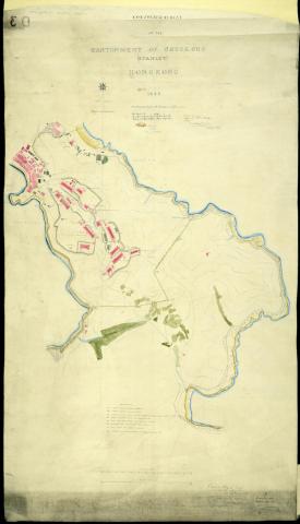
| 1842 |
1842 Map of Initial Land Sales in the Colony
|
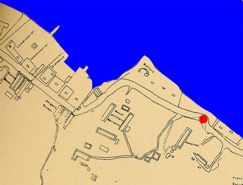
| 1843 |
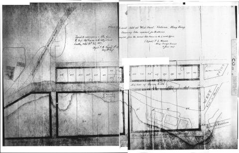
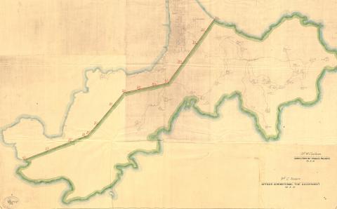
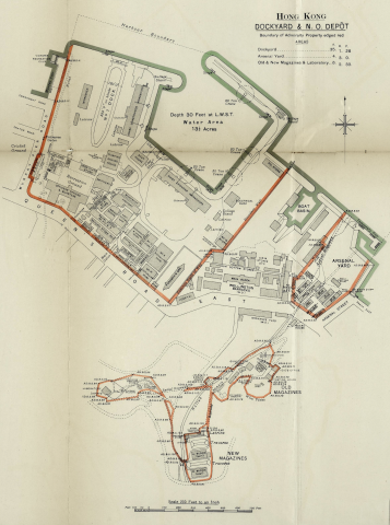
Admiralty, 1843
|
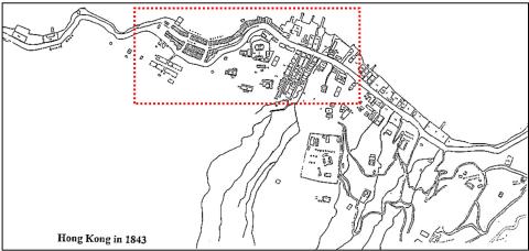
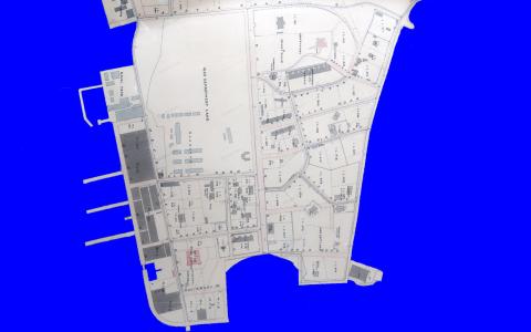
| 1843 |
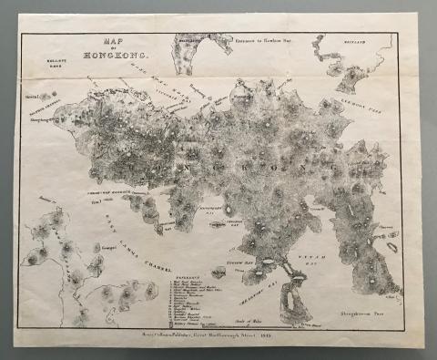
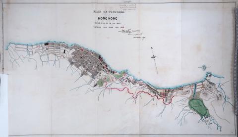
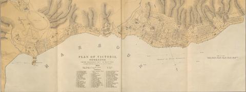
HK in 1843
|
| 1843 |
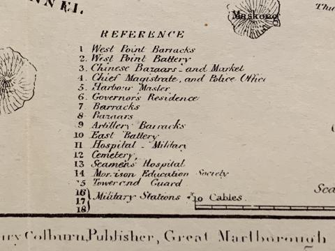
HK in 1843 - detail
|
| 1844 |
Stanley cantonment reduced.jpg
|
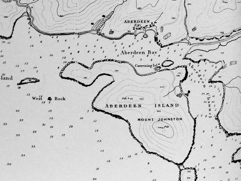
| 1845 |
1845 Map of Aberdeen
|
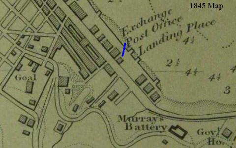
| 1845 |
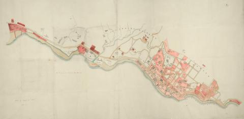
1845 Map of Hong Kong
|
| 1845 |
1845 Map (detail) Central
|
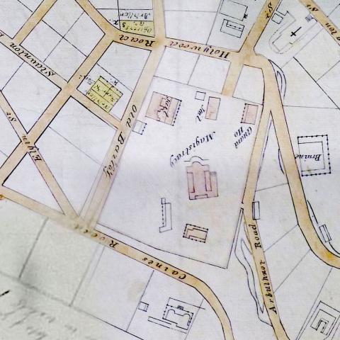
| 1845 |
1845 map - Magistracy & Jails
|
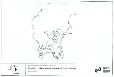
| 1845 |
Tsim Sha Tsui sketch based on 1845 Collinson map
|
| 1845 |
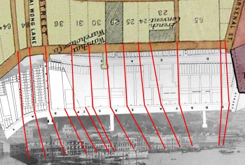
1845 - Developed Marine Lots, Central
|
| 1845 |
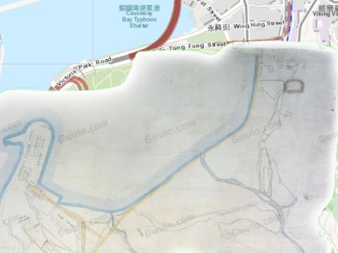
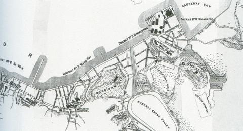
1845 Causeway Bay map
|
| 1845 |
1845 Map
|
| 1845 |
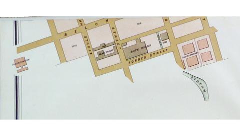
1845 Belcher.jpg
|
| 1845 |
1845 map 00.JPG
|
| 1845 |
1845 map 01.JPG
|
| 1845 |
1845 map 02.JPG
|
| 1845 |
1845 map 03.JPG
|
| 1845 |
1845 map 04.JPG
|
| 1845 |
1845 map 05.JPG
|
| 1845 |
1845 map 06.JPG
|
| 1845 |
1845 map 07.JPG
|
| 1845 |
1845 map 08.JPG
|
| 1845 |
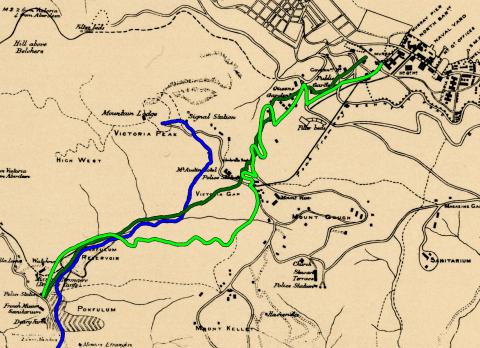
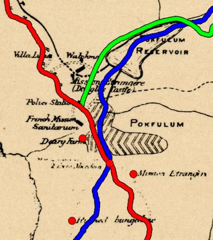
1845 map, Pok Fu Lam to Central
|
| 1845 |
City of Victoria map 1845
|
| 1845 |
Wellington Barracks map 1845
|
| 1846 |
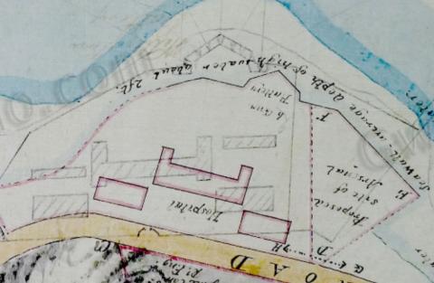
Harbour Master's House
|
| 1840s |
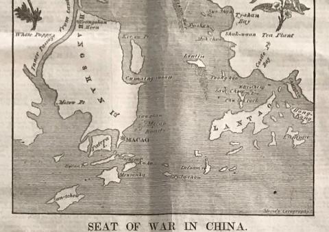
1840 Cum-sing moon.JPG
|
| 1853 |
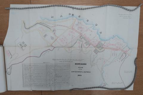
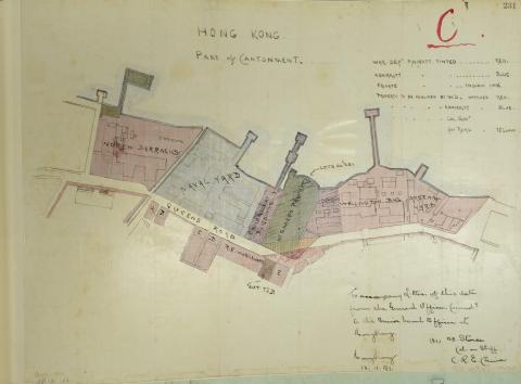
1853 Plan of the Cantonment at Victoria
|
| 1853 |
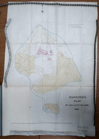
Kellett Island 1853
|
| 1853 |
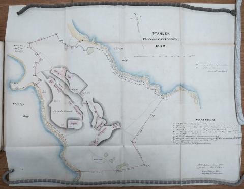
Stanley Military Cantonment 1853
|
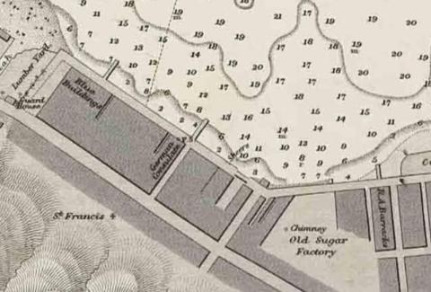
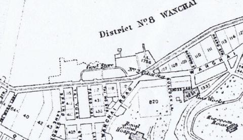
| 1855 |
Mid 1800s Wanchai Map
|
| 1856 |
Admiralty, 1856
|
| 1856 |
Map 1856 - Admiralty

|
| 1856 |
1856 Map - Detail - Sai Ying Poon
|
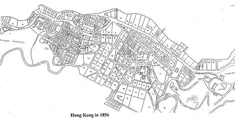
| 1856 |
HK in 1856
|
| 1857 |
1857Map copy.jpg
|
| 1858 |
1858 map of Hong Kong, Macao, Canton, Pearl River
|
| 1850s |
1850 Green Bank
|
| 1850s |
1850 Cast iron tanks and pipes in Victoria Cantonment
|
| 1850s |
Cast iron tanks
|
| 1850s |
Mid 1800s Wanchai Map

|
| 1861 |
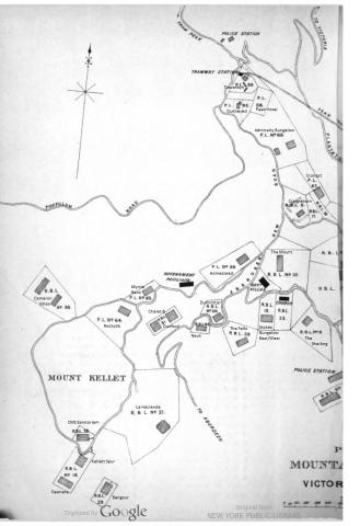
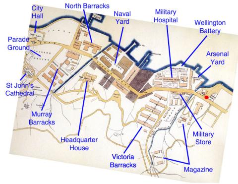
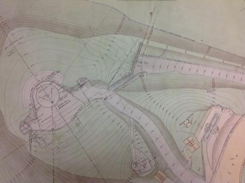
Plan of Victoria Military Facilities
|
| 1862 |
1862 Map of Hong Kong
|
| 1863 |
1863 Tsim Sha Tsui map
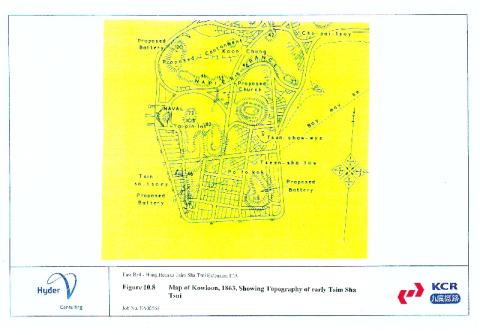
|
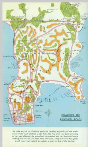
| 1863 |
1863 kowloon map
|
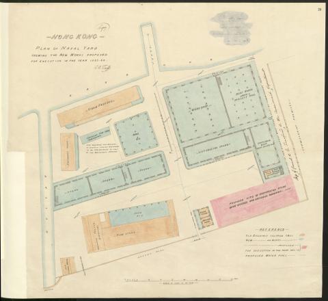
| 1864 |
Plan of Naval Dockyard 1863-64
|
| 1866 |
Victoria-Harbour - map of 1866
|
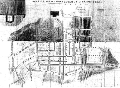
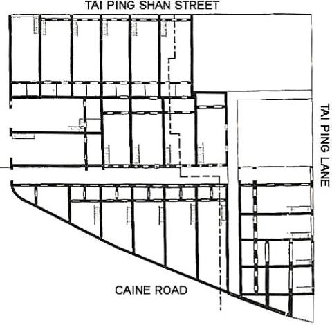
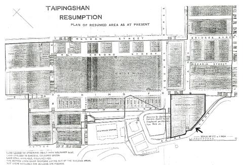
| 1866 |
Tai Ping Shan
|
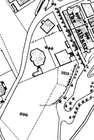
| 1869 |
RBL 648
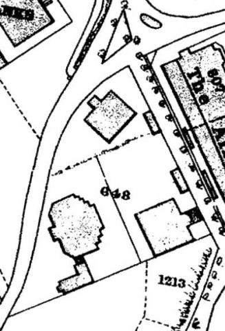
|
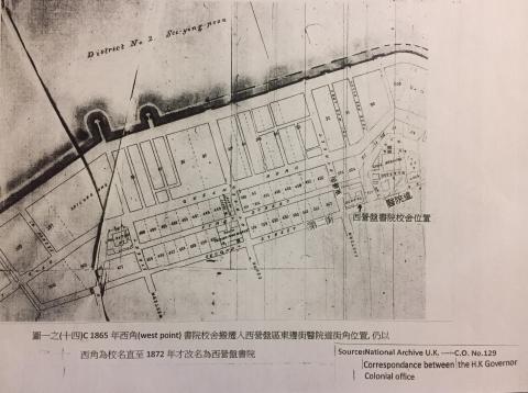
| 1872 |
syp 1872
|
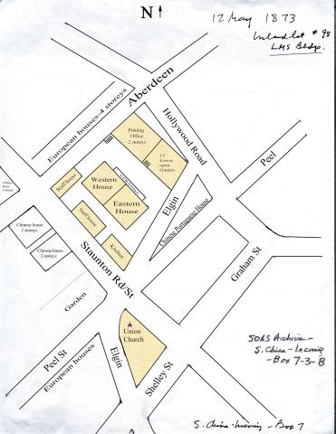
| 1873 |
Map of the LMS compound
|
| 1873 |
Victoria Harbour-Plan 0f 1873
|
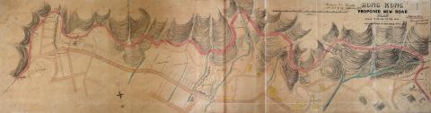
| 1873 |
1873 Proposed new road
|
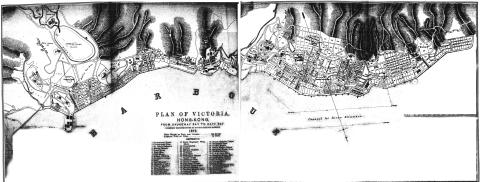
| 1873 |
Plan of Victoria 1873
|
| c.1873 |
1873 map of Sai Ying Pun
|
| c.1873 |
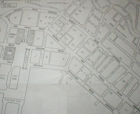
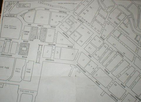
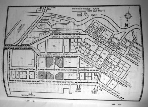
1873 map of Central
|
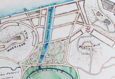
| c.1873 |
1873 "Brighton Hill"
|
| c.1873 |
1873 Western district
|
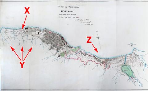
| c.1873 |
Doubts about the 1873 map
|
| c.1873 |
1873 map showing route of proposed Kennedy Road
|
| c.1873 |
1873 map as overlay
|
| 1874 |
1874 Map of Central
|
| 1874 |
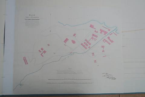
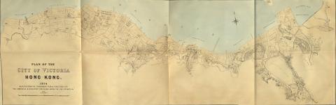
1874 Plan of the City of Victoria
|
| 1874 |
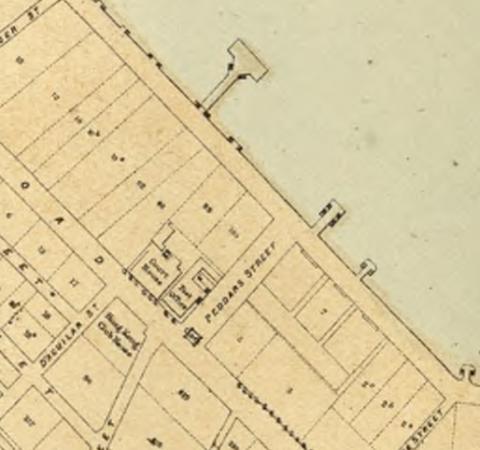
1874 map with Pedder's Wharf (2nd gen)
|
| 1875 |
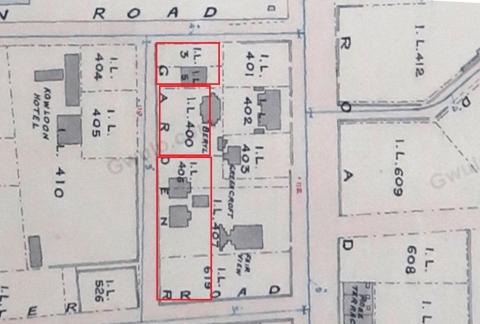
Garden Terrace - original lot numbers
|
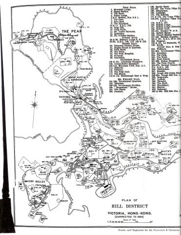
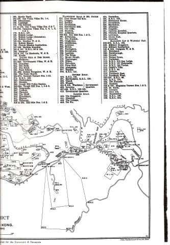
| 1882 |
Tai Ping Shan
|
| 1882 |
Victoria Harbour Waterfront 1882.jpeg
|
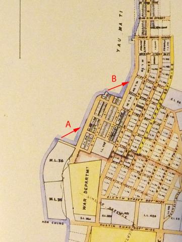
| 1887 |
1887 Map of Yau Ma Tei
|
| 1888 |
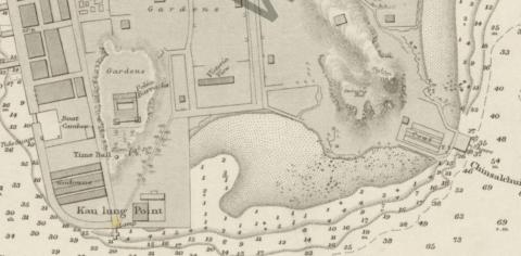
TST point. c1888
|
| 1888 |
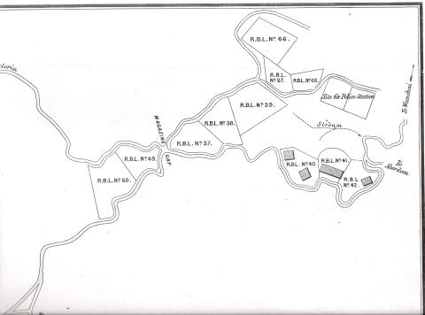
Magazine Gap map 1888
|
| 1888 |
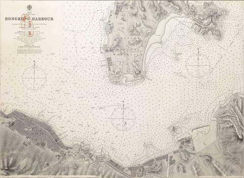
1888 harbour chart
|
| 1888 |
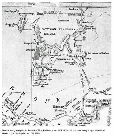
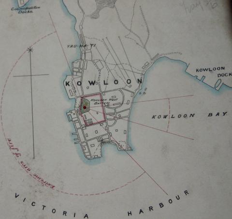
Map of Hong Kong - with British Kowloon (ca. 1888)
|
| 1888 |
Fenwick Shipyard's boat pool
|
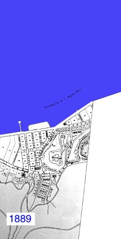
| 1889 |
Wanchai 1889
|
| 1889 |
Map showing Star Ferry Pier
|
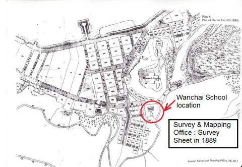
| 1889 |
Survey sheet of Wanchai in 1889
|
| 1889 |
1889 Map of Kennedy Town
|
| 1889 |
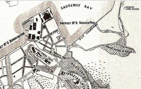
1889 map Sookumpoo school
|
| 1889 |
1889 Peak Map (left side)
|
| 1889 |
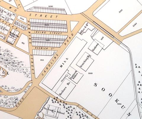
1889 Map showing 8-sided "Hospital Tank"
|
| 1889 |
Kowloon East Bty 1889.JPG
|
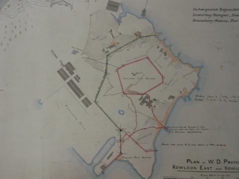
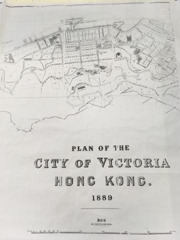
| 1889 |
Plan of the City of Victoria Hong Kong.jpg
|
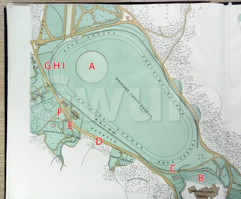
| 1889 |
1889 map of Happy Valley
|
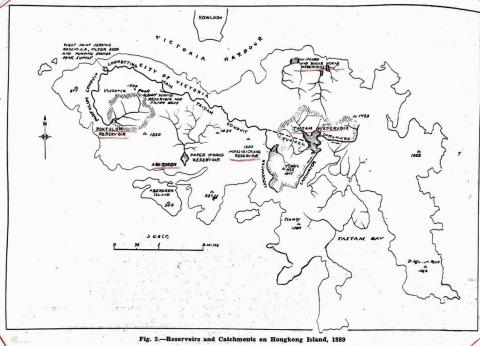
| 1889 |
Reservoirs and Conduits 1889
|
| 1889 |
1889-map-of-Pokfulam-conduit.jpg
|
| 1889 |
1889 - ML 111
|
| 1880s |
Admiralty, 1880
|
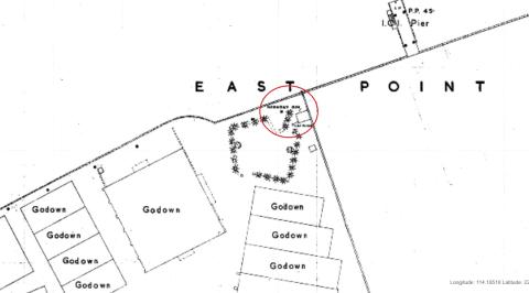
| 1880s |
East Point - map 1880
|
| 1880s |
Wanchai map 1880
|
| 1891 |
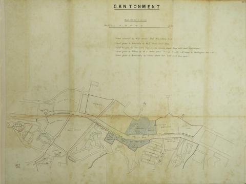
Part Plan of Hong Kong Cantonment
|
| 1891 |
Fly Point Bty 1891
|
| 1891 |
Plan of Hong Kong Cantonment
|
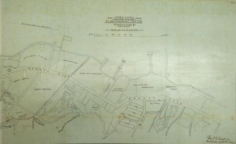
| 1892 |
Plan of Hong Kong Foreshore
|
| 1892 |
Cheung Wan Map ca. 1892
|
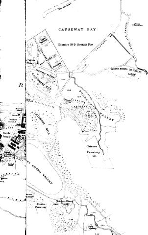
| 1892 |
Central + Causeway Bay Map ca. 1892
|
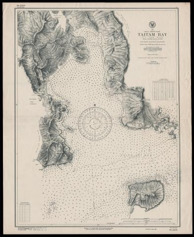
| 1893 |
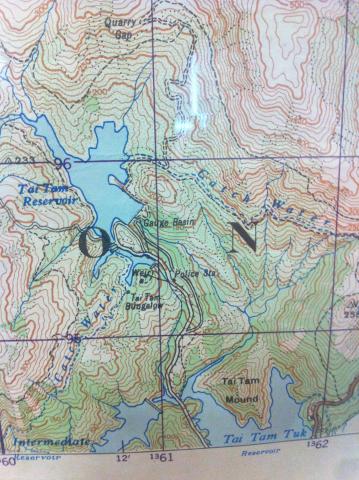
Map of Tai Tam Bay
|
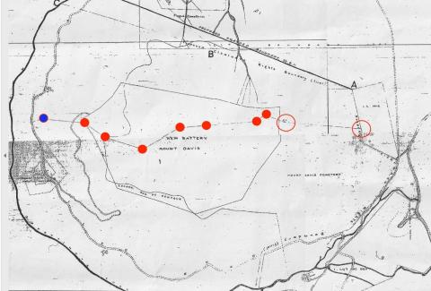
| 1895 |
1895 Map of Mount Davis Area
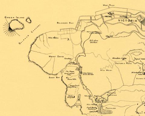
|
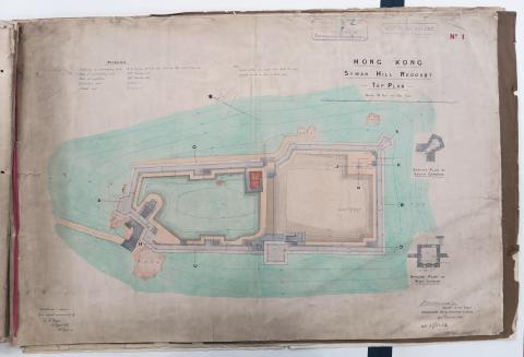
| 1895 |
Plan of Saiwan Redoubt
|
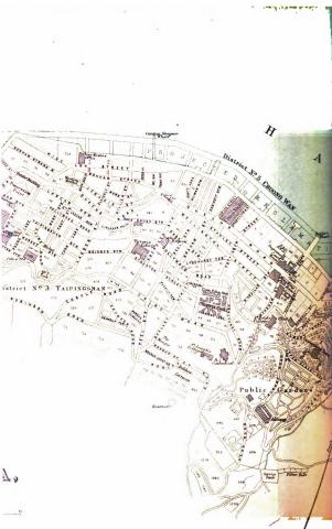
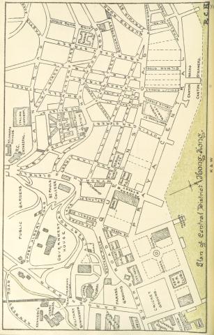
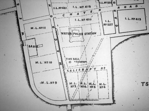
| 1895 |
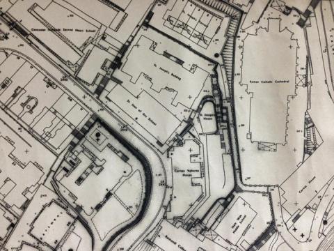
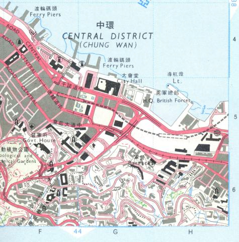
1890s Map of Central District
|
| 1895 |
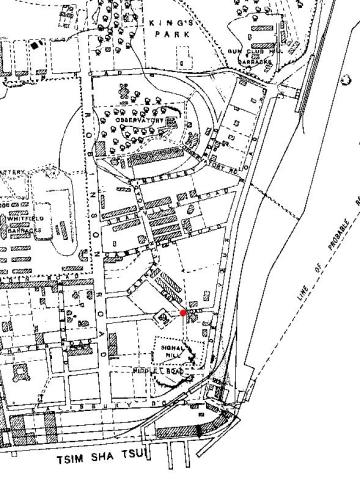
1890s Kowloon TST Map.jpg
|
| 1895 |
1895 map, Pok Fu Lam to Central
|
| 1895 |
1895 map, Pok Fu Lam
|
| c.1895 |
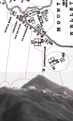
Mt. Kellett buildings c.1895 (photo and map)
|
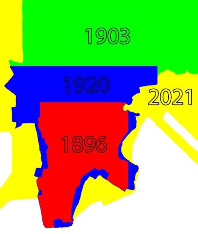
| 1896 |
European Houses on Hankow Road
|
| 1896 |
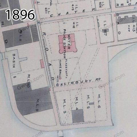
Map of TST in 1896
|
| 1896 |
Map of Yau Ma Tei in 1896
|
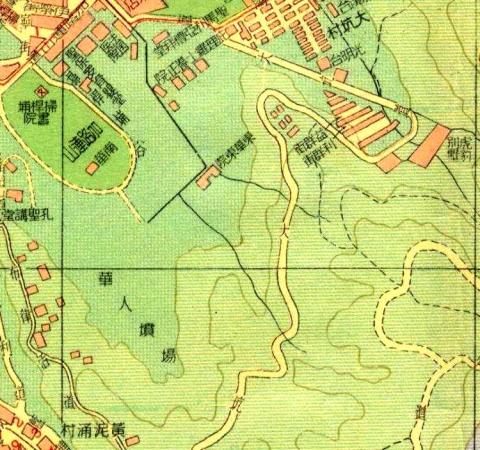
| 1896 |
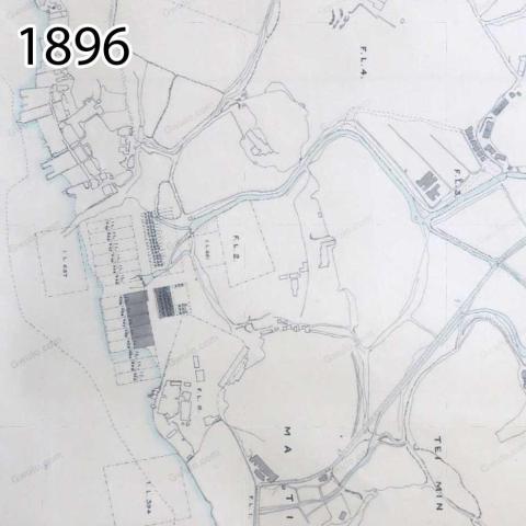
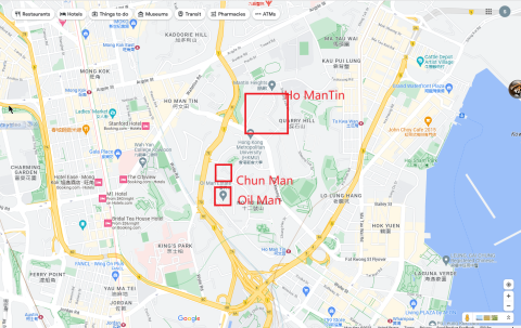
Map of Ho Mun Tin in 1896
|
| 1896 |
Map of Hung Hom in 1896
|
| 1896 |
Ho Mun Tin watercourses in 1896
|
| 1896 |
1896 TST
|
| 1896 |
1896 Mongkok
|
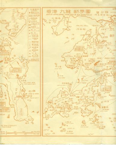
| 1897 |
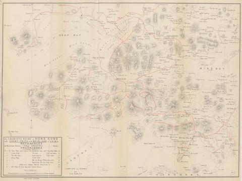
1897 Tourist Map of China and Soon to be New Territories
|
| 1897 |
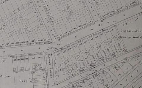
1897 map of Cochrane Street
|
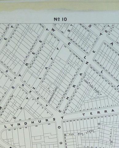
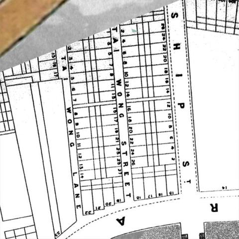
| 1897 |
1897 map of Tai Wong Lane & Street
|
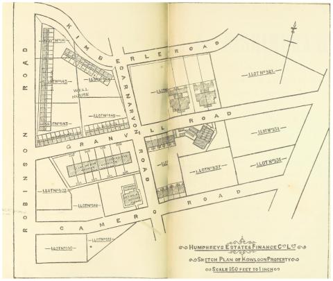
| 1897 |
HURLEY(1897)_p172_Map_of_the_KOWLOON_ESTATE_Property
|
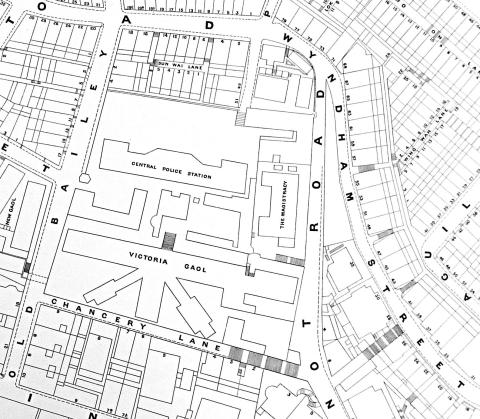
| 1897 |
Map of CPS + Wyndham Street
|
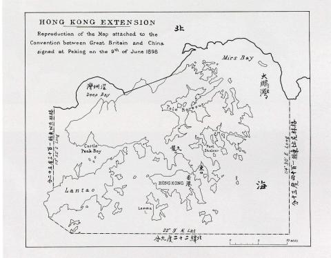
| 1898 |
Map of Hong Kong in The Convention for the Extension of Hong Kong Territory in 1898
|
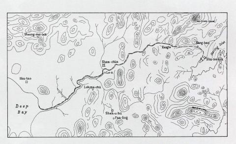
| 1899 |
Detailed map of the boundary for the Extension of Hong Kong Territory in 1899
|
| 1890s |
1890 Site plan of Victoria Battery
|
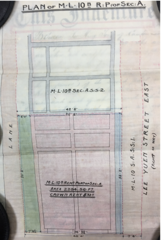
| 1900 |
Plan of ML 10B Remaining Portion Section A
|
| 1901 |
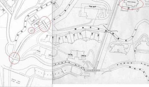
1901 Map - Kennedy and MacDonnell Roads - Sheet 16
|
| 1901 |
1901 Map - Kennedy and MacDonnell Roads - Sheet 16 (Rotated View)
|
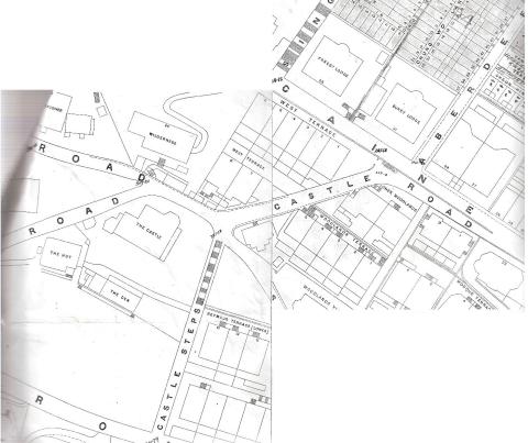
| 1901 |
Castle Road - 1901
|
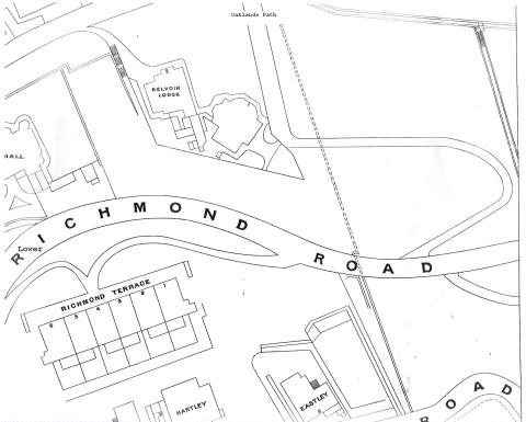
| 1901 |
Richmond Terrace
|
| 1901 |
1901 sheet 9 map, Robinson Road & Richmond Road etc. with house names
|
| 1901 |
1901 map High Street
|
| 1901 |
1901 Macdonnell and Bowen road bridges over Albany Nullah
|
| 1901 |
Queen's Gardens layout
|
| 1901 |
1901 map sheet 7 Bonham Road
|
| 1901 |
Hospital Tank
|
| 1901 |
1901 map showing the cotton mill in Causeway Bay
|
| 1901 |
1901 City Map
|
| 1901 |
1901 Lot Map
|
| 1901 |
Robinson Road
|
| 1901 |
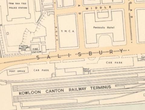
Tsim Sha Tsui Map 1901
|
| 1901 |
Stonecutters Island Central Bty 1891.jpeg
|
| 1901 |
1901-map-of-Pokfulam-conduit.jpg
|
| 1901 |
1901 Tsim Sha Tsui Map
|
| 1901 |
Rougemont
|
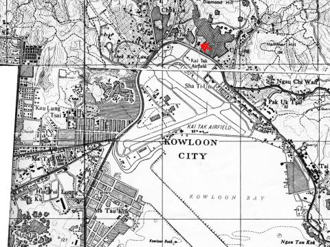
| 1902 |
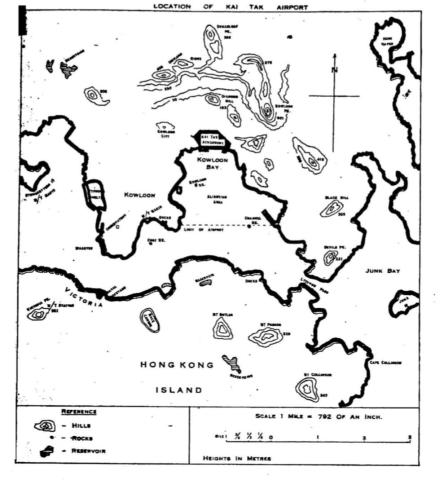
Kai Tak airport area
|
| 1902 |
Maps of Wanchai seafront, 1897 & 1903
|
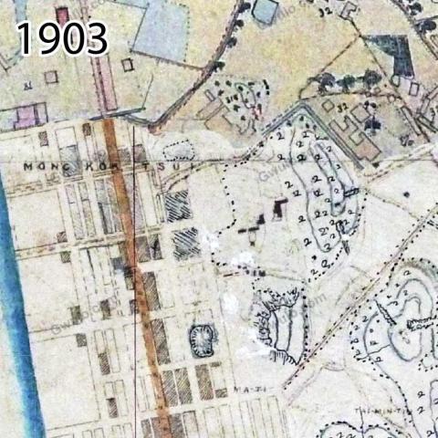
| 1903 |
Kowloon West Bty.1.jpeg
|
| 1903 |
1902-3 Map of Tsim Sha Tsui
|
| 1903 |
1903 Map of area around Ma Tau Wei
|
| 1903 |
Map of Peak Road
|
| 1903 |
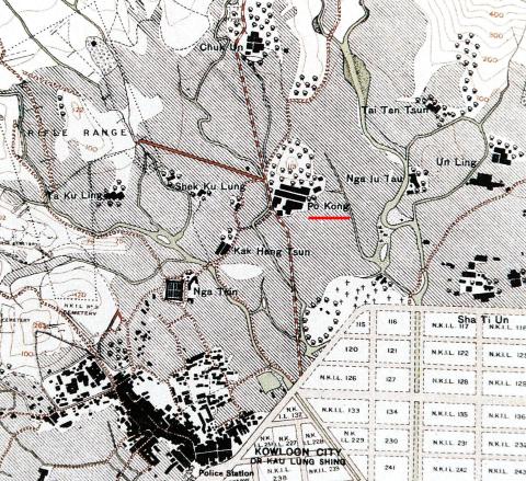
1902-3 Po Kong village
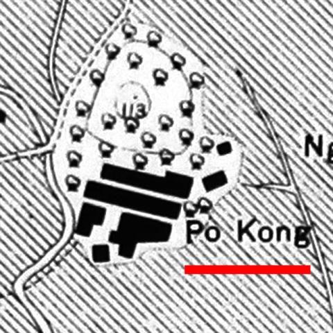
|
| 1903 |
1902-3 Po Kong village and surroundings
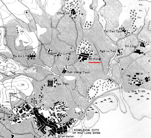
|
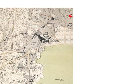
| 1903 |
1903 Kowloon City
|
| 1903 |
1903 Mongkok
|
| 1903 |
1903 TST
|
| 1903 |
1903 Kowloon City annotated
|
| 1903 |
1903 Ma Tau Chung
|
| 1903 |
1903 Ma Tau Chung (annotated)
|
| 1903 |
1903 Sam Ka Tsuen
|
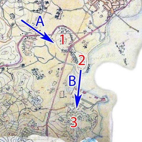
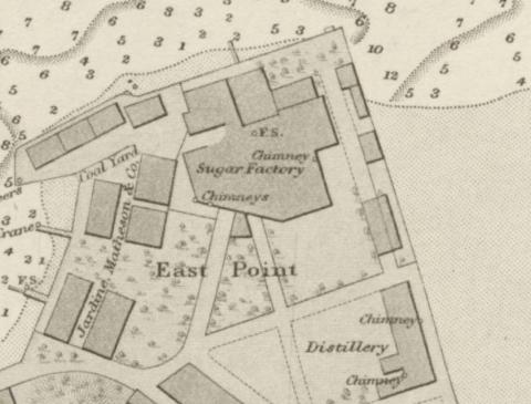
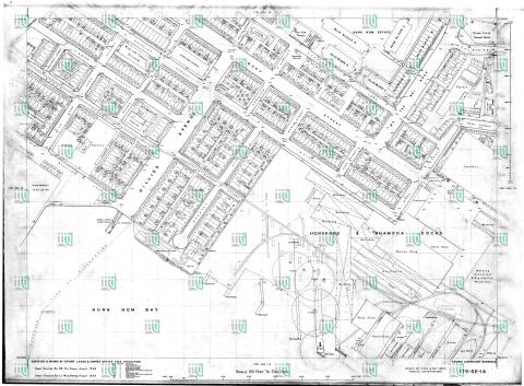
| 1903 |
1903 East Point map
|
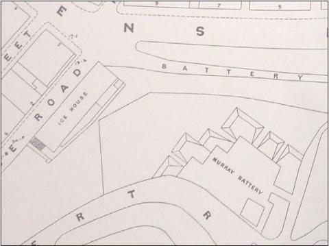
| 1904 |
Ice House and Murray Battery
|
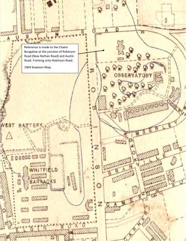
| 1904 |
chater_bungalow_site_1904.jpg
|
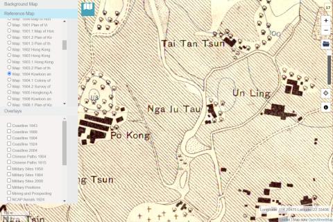
| 1904 |
1904 Nga Iu Tau
|
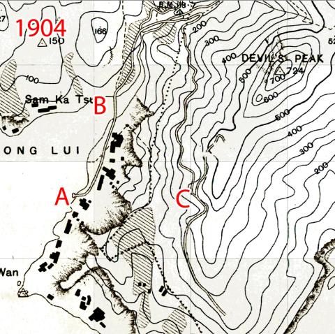
| 1904 |
1904 Sam Ka Tsuen A-C
|
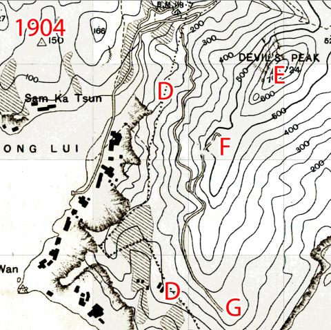
| 1904 |
1904 Sam Ka Tsuen D-G
|
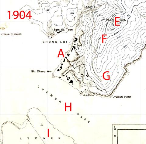
| 1904 |
1904 Lyemun Pass
|
| 1905 |
Plan of the CITY OF VICTORIA 1905
|
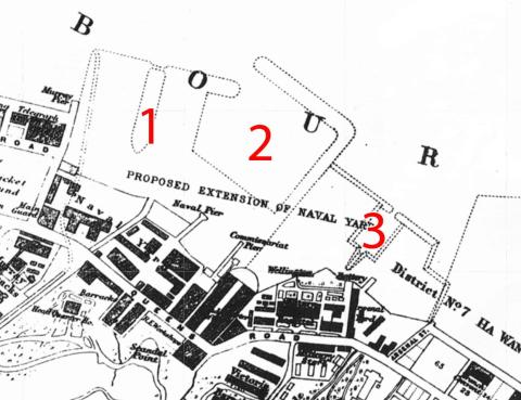
| 1905 |
1905 map of the Naval Yard Extension
|
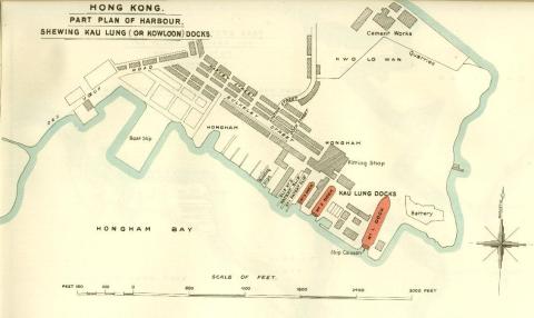
| 1909 |
British Admiralty Plan “Shewing the Kau Lung or Kowloon Docks”
|
| 1909 |
1909 Map of Hong Kong
|
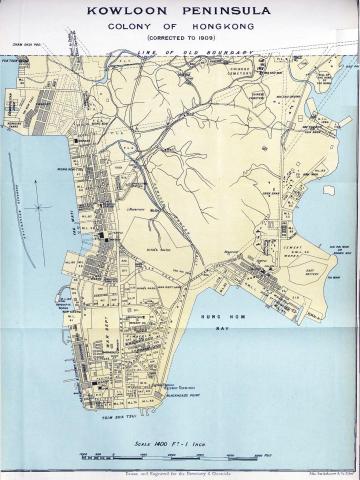
| 1909 |
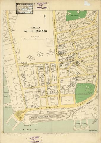
Map of Kowloon Peninsula - 1909
|
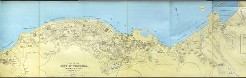
| 1909 |
City of Victoria - Street Map 1909
|
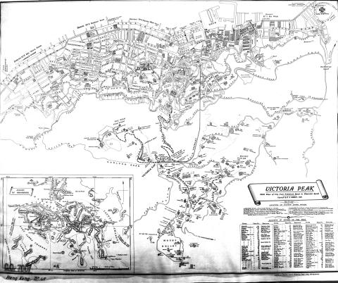
| 1909 |
1909 - The Peak - Plantation Rd

|
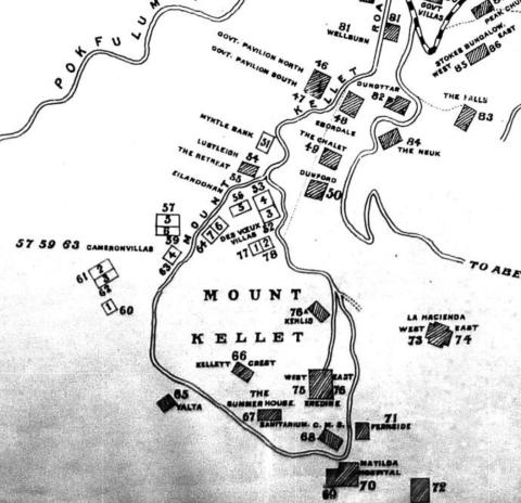
| 1909 |
Mount Kellett map 1909
|
| 1900s |
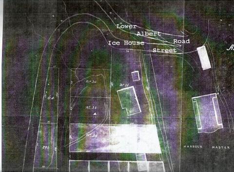
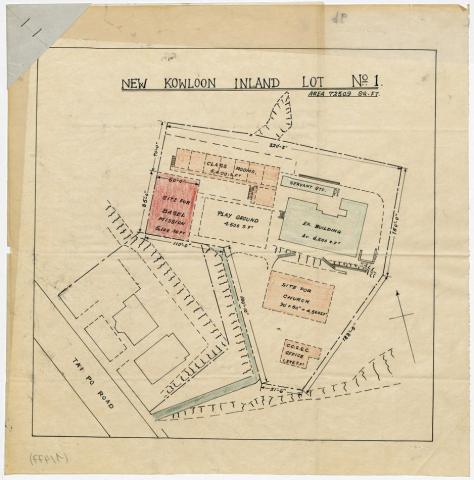
Map N.K.I.L. 1/Basel Mission House
|
| 1911 |
1911 Map of Central
|
| 1911 |
Plan of Taikoo Dockyard
|
| 1911 |
LYM DEL 2.2.jpeg
|
| 1911 |
LYM DEL 5.jpeg
|
| 1912 |
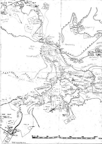
1912 Peak Map
|
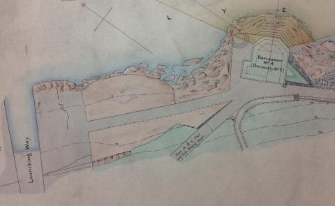
| 1912 |
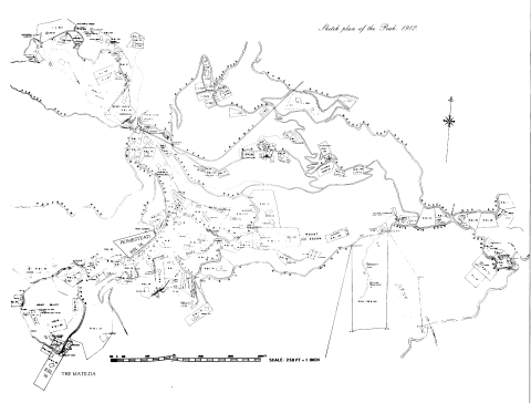
Sketch Plan of the Peak 1912
|
| 1913 |
Wanchai Lot Map 1913
|
| 1913 |
Wanchai map_1913
|
| 1913 |
1913 hunghom map
|
| 1913 |
1913 - Pok Fu Lam
|
| 1915 |
1915 Hong Kong Map
|
| 1919 |
1919 Government Map of Cheung Chau European Reservation
|
| 1910s |
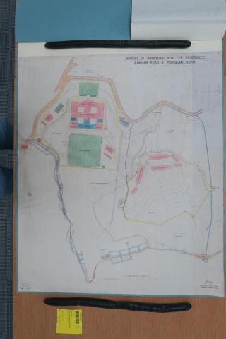
1910 plan of proposed university
|
| 1910s |
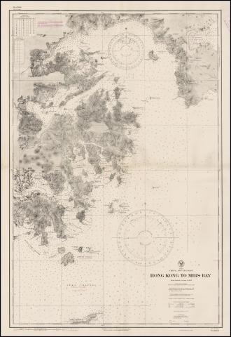
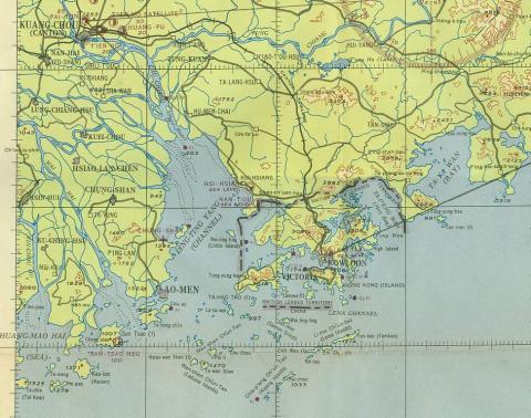
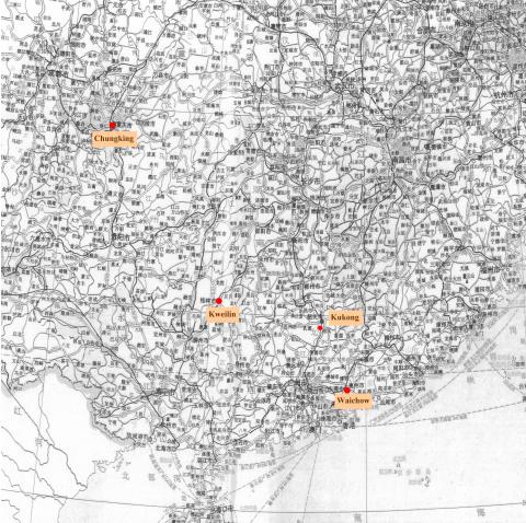
Hong Kong to Mirs Bay map.jpeg
|
| 1910s |
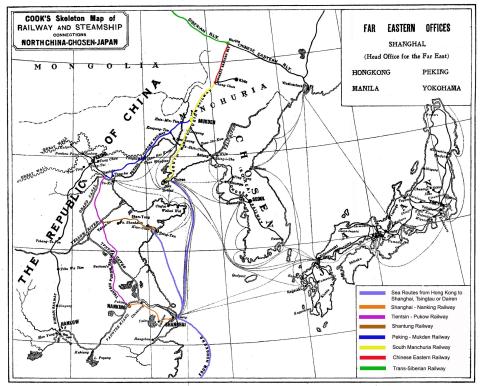
Overland Rail Route to Europe - Map-Showing Options
|
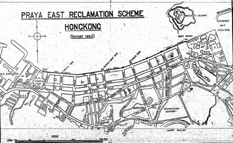
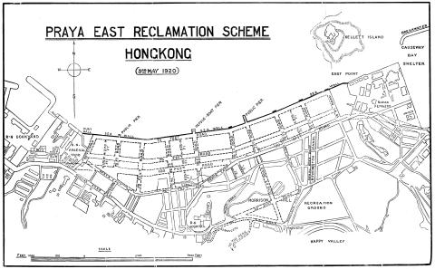
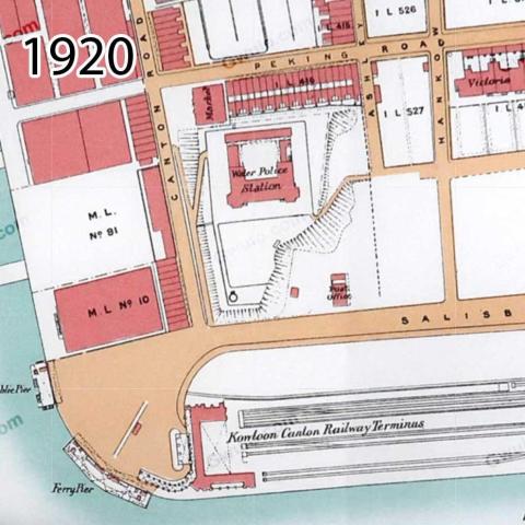
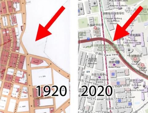
| 1920 |
1920s Praya East Reclamation Scheme
|
| 1920 |
Map of Mong Kok in 1920
|
| 1920 |
1920 map of Kowloon
|
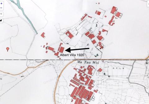
| 1920 |
Albert Villa
|
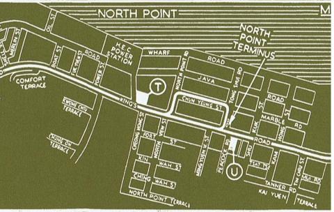
| 1922 |
1922 North Point Map
|
| 1922 |
1922 map Chatham/Mody Roads
|
| 1922 |
TST map 1922_detail
|
| 1922 |
TST map 1922_KCR
|
| 1922 |
1922 IL 2039 with Broadwood Terrace
|
| 1922 |
1922 map of block: Connaught Rd C - Wing Wo St - DVRC - Rumsey St
|
| 1922 |
1922 Map of Pokfulam Road between Second and Third Streets
|
| 1923 |
Map showing proposed Kowloon Tramways - 1923
|
| 1923 |
Cheung Sha Wan
|
| 1923 |
Kowloon City
|
| 1923 |
Sham Shui Po / Prince Edward
|
| 1923 |
Shek Kip Mei
|
| 1923 |
Kowloon City
|
| 1923 |
Kowloon Tong
|
| 1923 |
Lai Chi Kok
|
| 1924 |
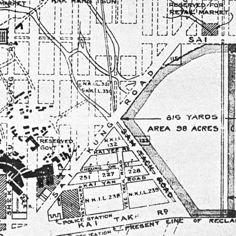
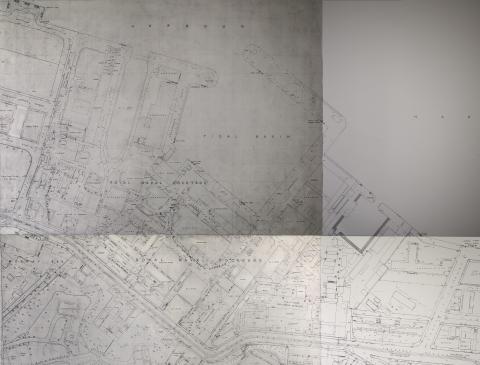
Port development
|
| 1924 |
Kai Tak airport area
|
| 1924 |
The Peak - Map 1924 (1 of 2)
|
| 1924 |
The Peak - Map 1924 (2 of 2)
|
| 1924 |
1920s Kennedy Town Map
|
| 1924 |
1924 Map of Kowloon
|
| 1924 |
Kowloon Map - 1924
|
| 1924 |
1924 Kowloon map - Quadrant 14
|
| 1924 |
1924 Kowloon map - Quadrant 8
|
| 1924 |
1924 Kowloon map - Quadrant 9
|
| 1924 |
1924 Kowloon map - Quadrant 7
|
| 1924 |
1924 Kowloon map - Quadrant 4
|
| 1924 |
1924 Kowloon map - Quadrant 2
|
| 1924 |
1924 Kowloon map - Quadrant 4
|
| 1924 |
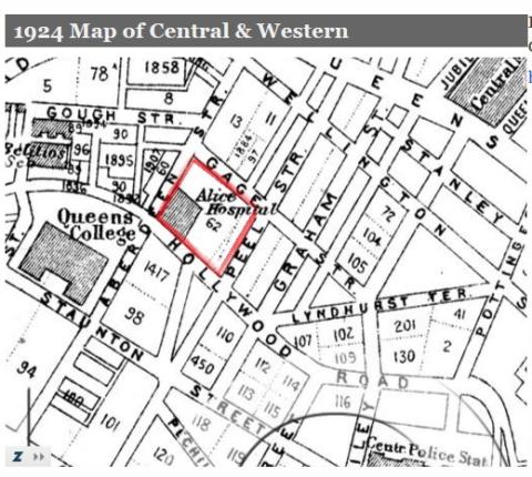
1924 Map of Central & Western
|
| 1924 |
1924 Map of Kennedy Town
|
| 1924 |
IL 62
|
| 1924 |
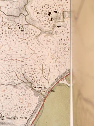
1924 map of Lok Lo Ha
|
| 1924 |
ML.2,3(&4),5,7. 2A,2B,2C
|
| 1924 |
Water Tank 1924 Map.jpg
|
| 1924 |
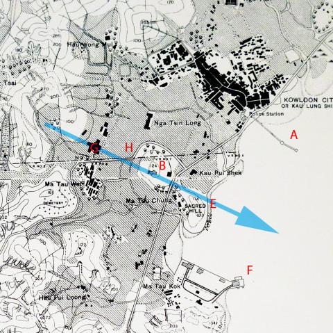
1924 Po Kong village and surroundings
|
| 1924 |
1924 Thomas Cook 01.JPG
|
| 1924 |
1924 Praya map with 5 urinals
|
| 1925 |
1920s East Point Map
|
| 1925 |
Kowloon City proposed hospital
|
| 1925 |
Tunnels Kowloon 1925
|
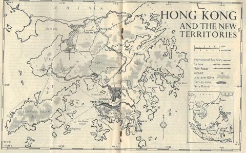
| 1925 |
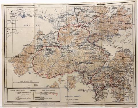
New Territories 1925
|
| 1928 |
1928 Kai Tak airfield
|
| 1928 |
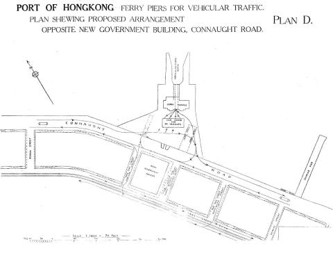
Vehicular Ferry Pier Central: Plan 1928
|
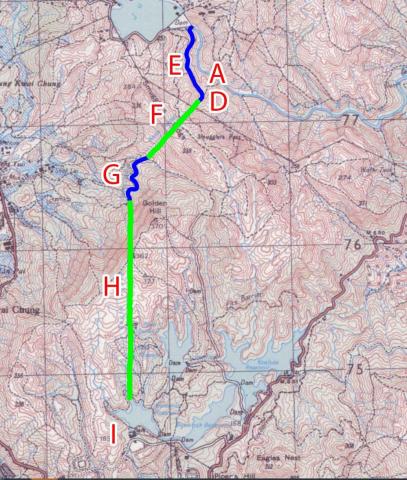
| 1928 |
1928 map of the Shing Mun / Golden Hill area
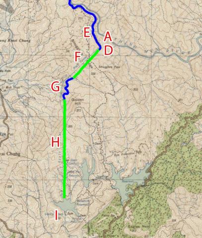
|
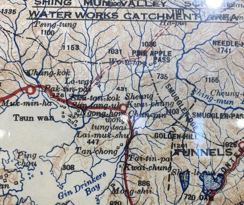
| 1928 |
1928 map of the Shing Mun Valley
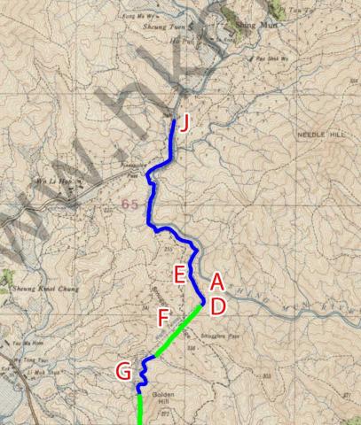
|
| c.1928 |
Map of the junction of Nathan and Jordan Roads [1927-1930?]
|
| c.1928 |
Junction of Nathan and Gascoigne Roads map [1927-1930?]
|
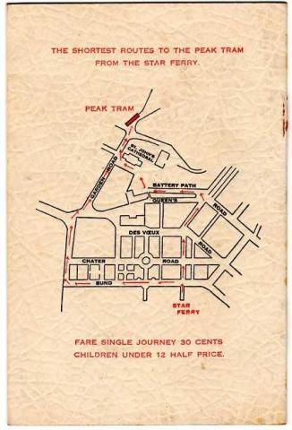
| 1920s |
"Star Ferry to Peak Tram" Map
|
| 1920s |
Map of area around Po Hing Fong
|
| 1920s |
1920 map of Kowloon showing area around the Observatory
|
| 1920s |
Hung Hom Dockyard Quarters.jpg
|
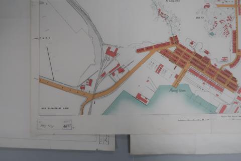
| 1920s |
Praya-East-Reclamation-1920s.jpg
|
| 1920s |
1920 Kln - Sheet 4 - Bottom-left
|
| 1920s |
1920 Kln - Sheet 4 - Middle-left
|
| 1920s |
1920 Kln - Sheet 4 - Top-left
|
| 1920s |
Map of TST in 1920
|
| 1920s |
Map of Yau Ma Tei in 1920
|
| 1920s |
Yau Ma Tei landmarks
|
| 1920s |
Map of Ho Mun Tin in 1920
|
| 1920s |
Ho Mun Tin highlights
|
| 1920s |
Map of Hung Hom in 1920
|
| 1920s |
Ho Mun Tin watercourses in 1920
|
| 1920s |
1920 Mongkok
|
| 1920s |
1920 TST
|
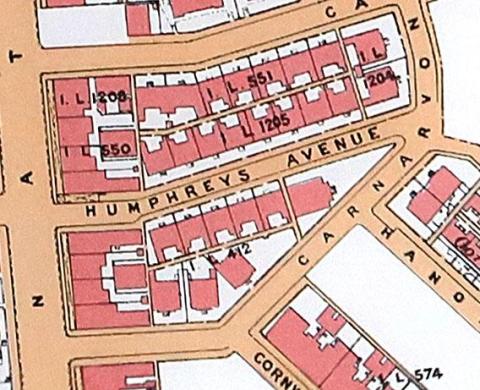
| 1920s |
1920 Humphreys Avenue
|
| 1920s |
1920s / 30s top of Broadwood Road
|
| 1930 |
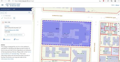
N.K.I.L. 1382
|
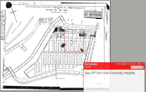
| 1931 |
IL 1381 - Kennedy Rd - MacDonnell Rd - Peak Tram
|
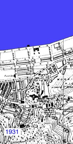
| 1931 |
Wanchai 1931
|
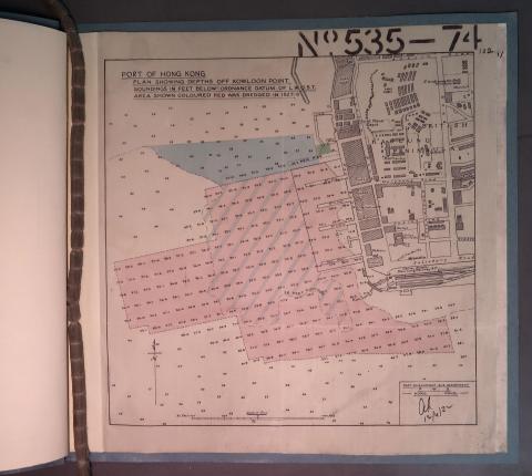
| 1932 |
Depths off Kowloon Point
|
| 1933 |
Government Hill redevelopment - proposed 1933
|
| 1933 |
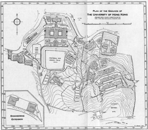
HKU Map 1934
|
| 1935 |
Kai Tak airport area
|
| 1935 |
1935 map of shiu fai terrace and Catholic Cemetery
|
| 1935 |
Kai Tak aerodrome-northern extension-1935
|
| 1936 |
1930s Sai Kung Police Station
|
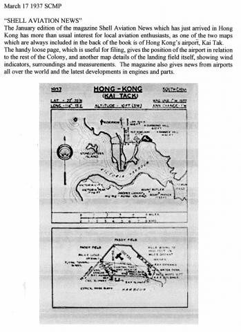
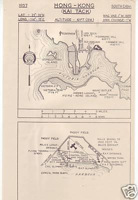
| 1937 |
KAI TACK airport location diagram-1937
|
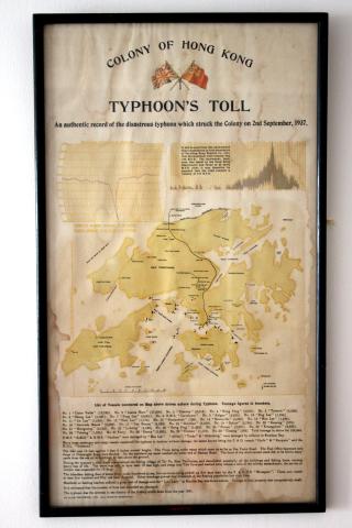
| 1937 |
1937 Typhoon's Toll Document
|
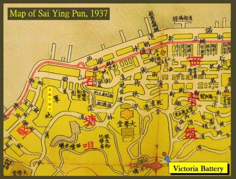
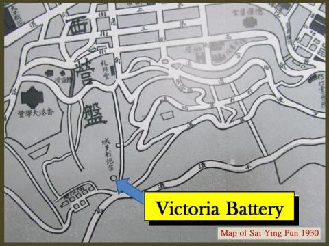
| 1937 |
Victoria Battery
|
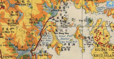
| 1937 |
Kai Tak Map
|
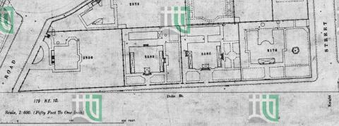
| 1938 |
1938 map of Duke Street
|
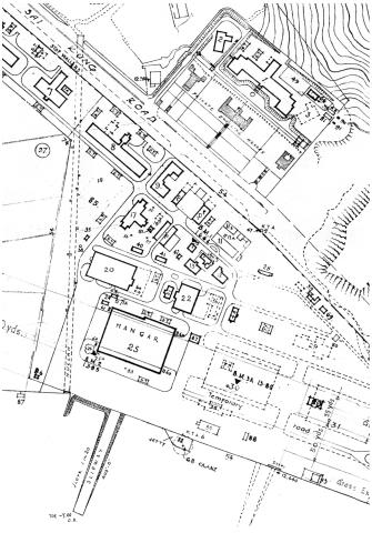
| 1938 |
RAF Hangar location in 1938
|
| 1938 |
1938 HK & Whampoa Dockyad KCR Extension.jpg
|
| 1938 |
Map used by Osler Thomas, BAAG
|
| 1938 |
LTR escape route map 1: SSP Camp to Three Fathoms Cove
|
| 1938 |
LTR escape route map 2: To Yeung to Waichow
|
| 1939 |
Map-North West New Territories-1939
|
| 1939 |
1939 OS Map of Stanley Main Beach
|
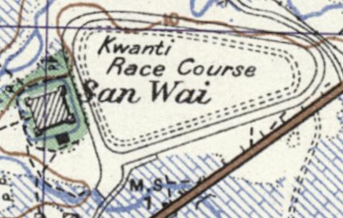
| 1939 |
Map of San Wai
|
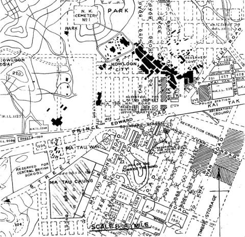
| 1930s |
1930s Kowloon City Street Map
|
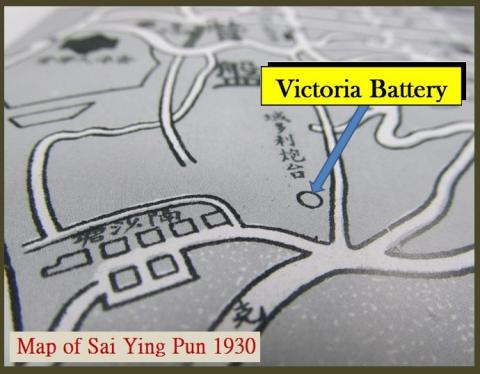
| 1930s |
Victoria Battery
|
| 1930s |
Victoria Battery
|
| 1930s |
1930 map section
|
| 1930s |
42302s.jpg
|
| 1930s |
Connaught Road Houses between the Central Fire Station and the Harbour Office 1930
|
| 1930s |
Kowloon City Pier
|
| 1940 |
Tsim Sha Tsui-Kowloon Point-development proposal-1940
|
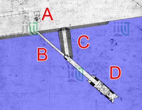
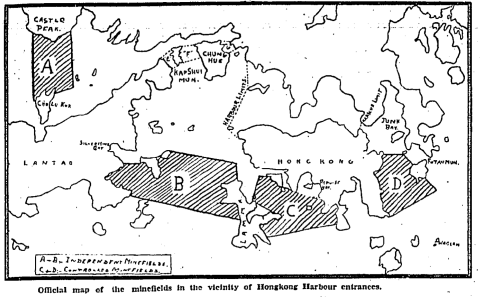
| 1940 |
HK minefield map
|
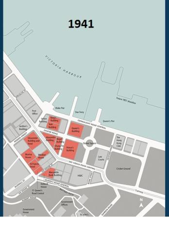
| 1941 |
1941 Hong Kong Land properties
|
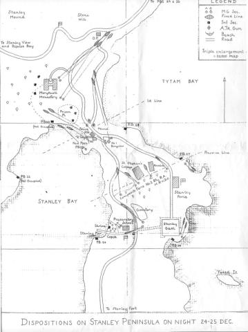
| 1941 |
Stanley 1941
|
| 1942 |
Morley's map of SSPo.jpg
|
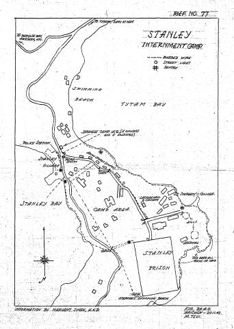
| 1942 |
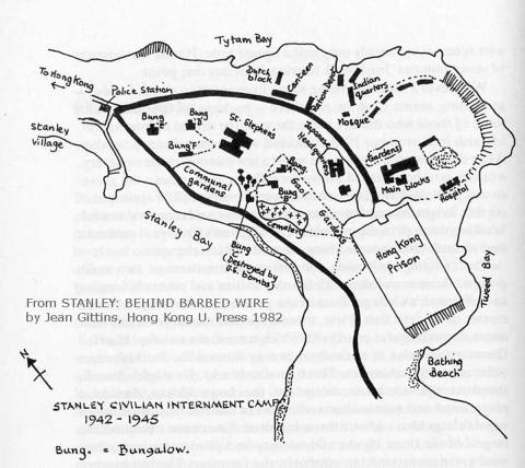
Map of Stanley Civilian Internment Camp
|
| 1942 |
stanleymap_1942
|
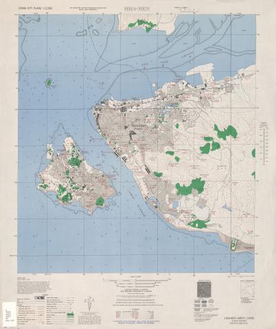
| 1944 |
1945 Map of Amoy
|
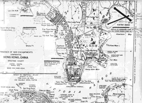
| 1945 |
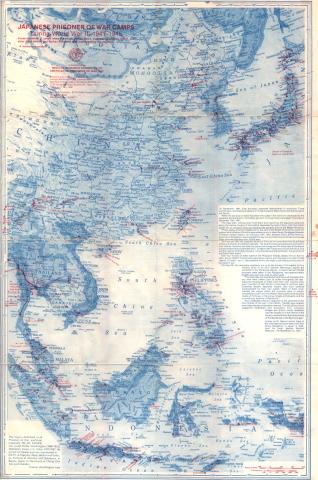
Map of Japanese P.O.W. Camps in Hong Kong, March 1945
|
| 1945 |
American Air Force-Hong Kong Island Map-segment.jpg
|
| 1945 |
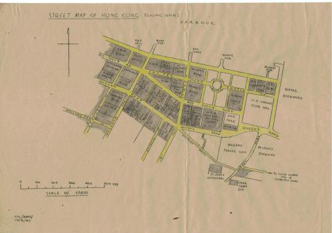
Chung Wan
|
| 1945 |
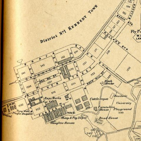
Kennedy Town, Shek Tong Tsui
|
| 1945 |
Sai Ying Pun, Sheung Wan, Chung Wan
|
| 1945 |
Chung Wan, Wan Chai
|
| 1945 |
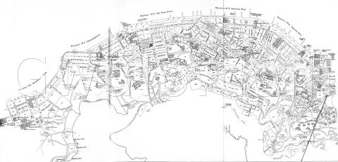
Hong Kong street maps index
|
| 1945 |
Causeway Bay, North Point, King's Road
|
| 1945 |
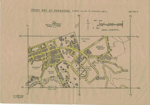
Happy Valley, Causeway Bay
|
| 1945 |
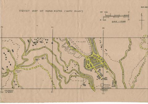
Happy Valley
|
| 1945 |
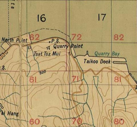
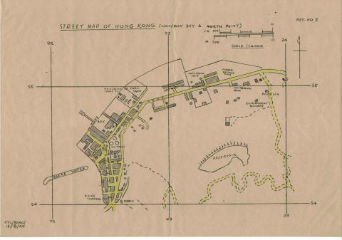
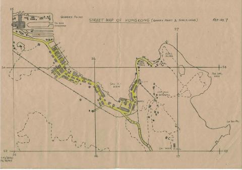
Quarry Point, Shau Ki Wan
|
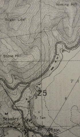
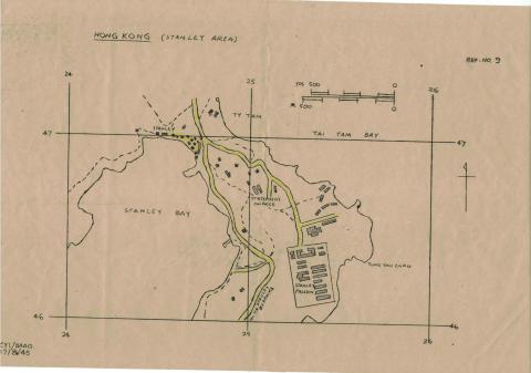
| 1945 |
Stanley
|
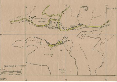
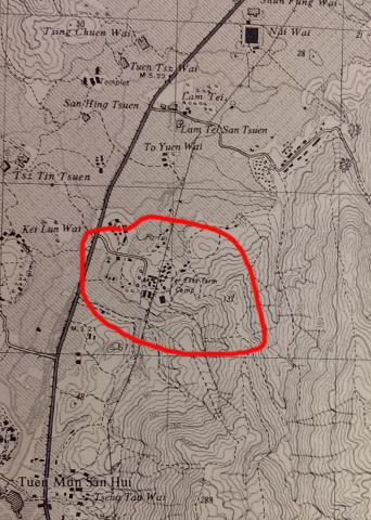
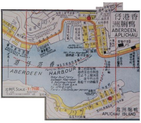
| 1945 |
Aberdeen, Aplichau
|
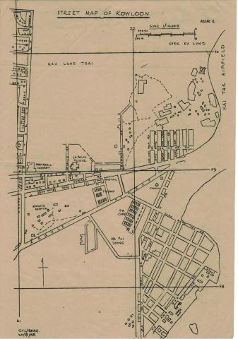
| 1945 |
Kowloon, Boundary Street, Prince Edward Road, Kau Lung Tong
|
| 1945 |
Kowloon, Boundary Street, Waterloo Road, Kau Lung Tsai
|
| 1945 |
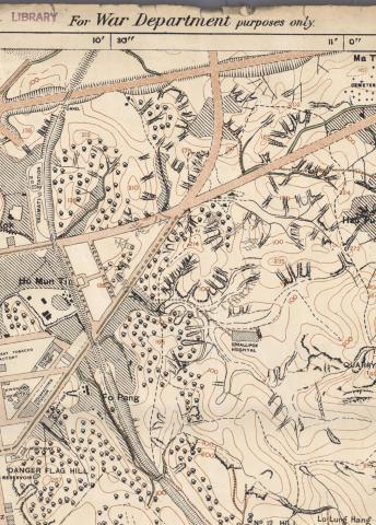
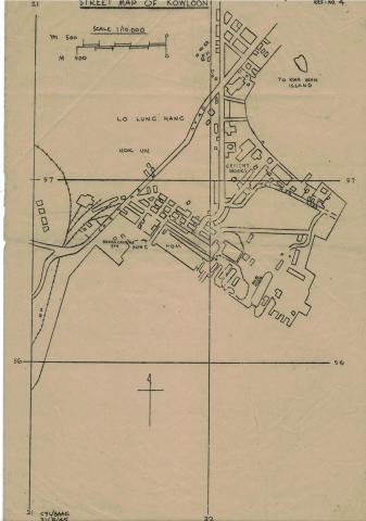
Kowloon, Chatham Road, Lo Lung Hang
|
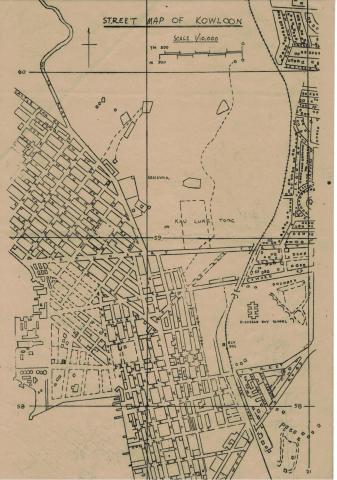
| 1945 |
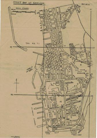
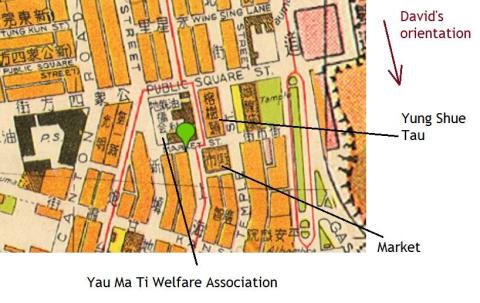
Kowloon, Nathan Road Star Ferry, Yau Ma Ti
|
| 1945 |
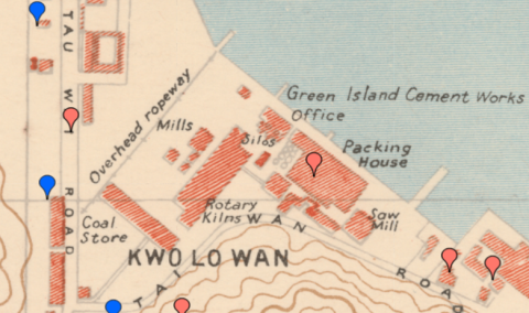
map 1945 Kwo Lo Wan
|
| 1945 |
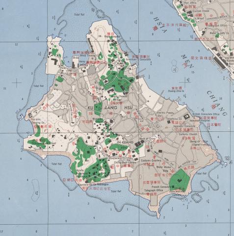
1945 Map of Kulangsu
|
| 1945 |
American Air Force map from 1945
|
| 1945 |
Tai Po Bridge map.png
|
| 1945 |
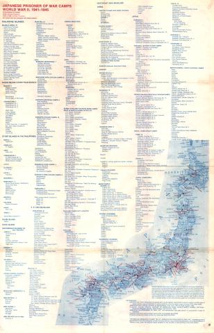
Japanese POW Camps in WWII (front)
|
| 1945 |
Japanese POW Camps in WWII (back)
|
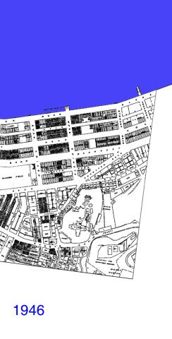
| 1946 |
Wanchai 1946
|
| 1947 |
Kai Tak Map 1947

|
| 1947 |
1947 KCR Railway Siding to Holt's Wharf & KWGC
|
| 1947 |
1947 KCR Railway Siding to Hong Kong Whampoa Dockyard
|
| 1947 |
1947 Map of Kowloon near Chatham Road
|
| 1948 |
Abercrombie development map-1948
|
| 1940s |
Admiralty, 1936-46
|
| 1940s |
Sketched Map of Tsim Sha Tsui, 1930s or 1940s
|
| 1940s |
1940s map.jpg
|
| 1940s |
LTR escape route map 3: BAAG HQ and British Embassy
|
| 1940s |
1940 Wanchai Map
|
| 1940s |
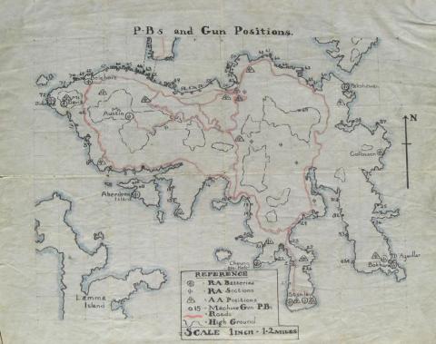
HK Island Pillbox Map
|
| 1940s |
1940 Location of Kai Tak Airport
|
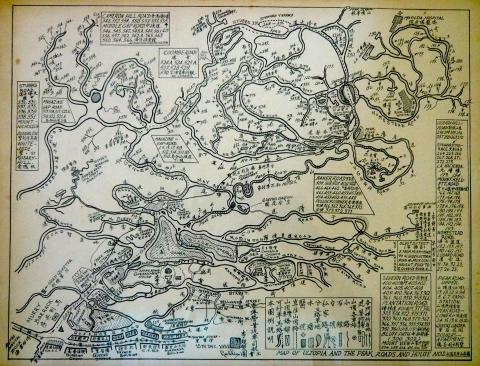
| 1951 |
Map of Ultopia & The Peak 15 Dec 1951.JPG
|
| 1951 |
Kai Tak - map 1950/51
|
| 1951 |
1951 hong kong & whampoa dock company
|
| 1952 |
1952 map of Naval Dockyard
|
| 1952 |
North Point 1952
|
| 1952 |
1952 Kai Tak Aerodrome Pillboxes
|
| 1952 |
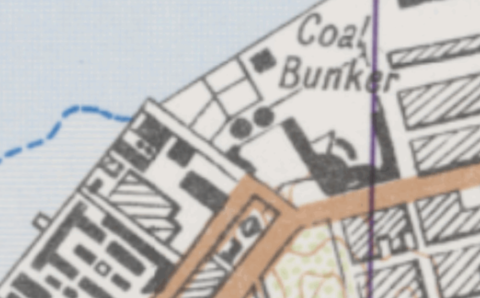
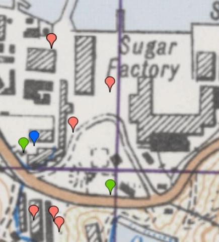
1952 map of Sugar Refinery
|
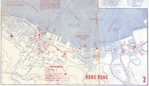
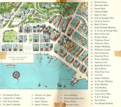
| 1953 |
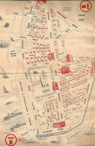
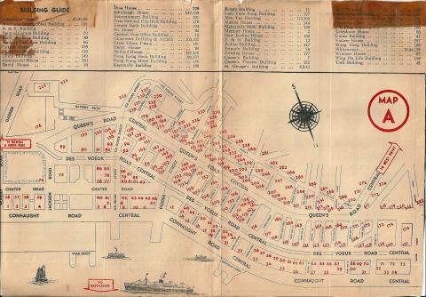
02 HK Guide Book Inside Front Cover Map
|
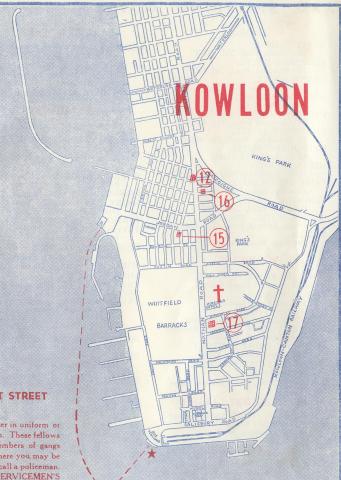
| 1953 |
27 HK Guide Book Page 48 & Inside Back Cover
|
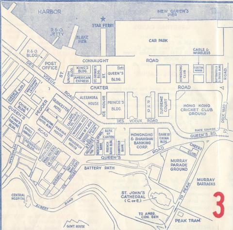
| 1953 |
28 HK Guide Book Page Map Inside Back Cover
|
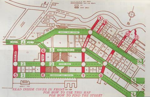
| 1953 |
Before and after Route Twisk
|
| 1954 |
1954 HK Tramlines - Kennedy Town to Sai Ying Pun
|
| 1954 |
1954 HK Tramlines - Sheung Wan to Central
|
| 1954 |
1954 HK Tramlines - Central to Wanchai
|
| 1954 |
1954 HK Tramlines - Wanchai to Causeway Bay
|
| 1954 |
1954 HK Tramlines - Happy Valley Racecourse
|
| 1954 |
1954 HK Tramlines - Causeway Bay to North Point
|
| 1954 |
1954 HK Tramlines - Quarry Bay to Sai Wan Ho
|
| 1954 |
1954 HK Tramlines - Sai Wan Ho to Shaukiwan
|
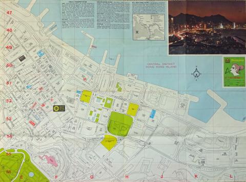
| 1955 |
1955 The Peak
|
| 1955 |
Hong Kong-Pictorial map-1955
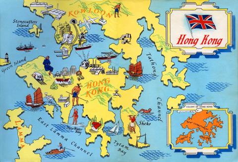
|
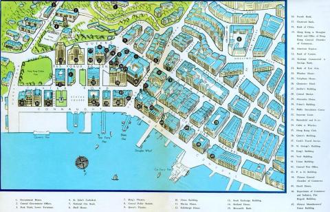
| 1955 |
Hong Kong-Central Business District-Pictorial map-1955
|
| 1955 |
1955 1-600 map of Wyndham Street
|
| 1955 |
1950s North Kowloon Map
|
| 1955 |
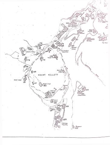
1950s Map of Mount Kellett
|
| 1955 |
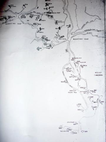
1950s Map of Wanchai Gap & Mount Cameron
|
| 1955 |
Hong Kong Flotilla Armed Motor Launch on Patrol -The Crew
|
| 1955 |
1950s Map of Central District
|
| 1955 |
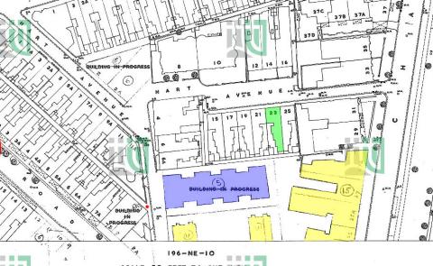
1955 1-600 Robinson Road 196-SW-9
|
| 1955 |
Shek Tong Tsui Godowns (1950s) and map (1905)
|
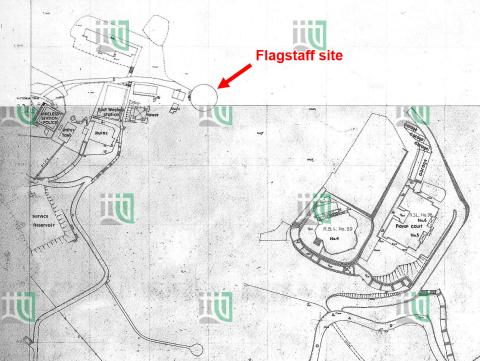
| 1955 |
1955 Area around the old flagstaff site
|
| 1955 |
1955 Lot survey Map
|
| 1956 |
Peak Map
|
| 1956 |
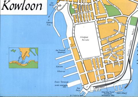
Hong Kong Guide 1956 Map Of Kowloon
|
| 1956 |
Map West Point Pier (Tong Shui Road) 1956
|
| 1957 |
1957 Map #1
|
| 1957 |
1957 Map #2A
|
| 1957 |
1957 Map #2B
|
| 1957 |
1957 Map #3
|
| 1957 |
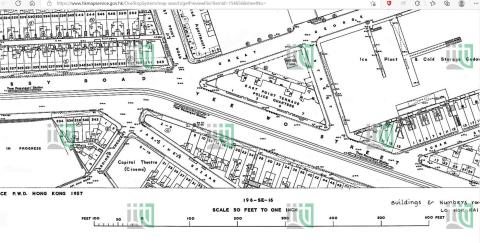
1957 Map of Central
|
| 1957 |
1957 map f.
|
| 1957 |
1957 map key o.
|
| 1957 |
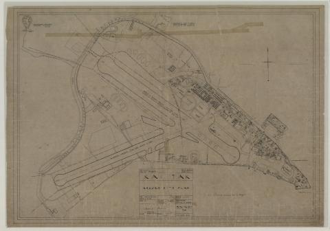
Kai Tak airport area
|
| 1957 |
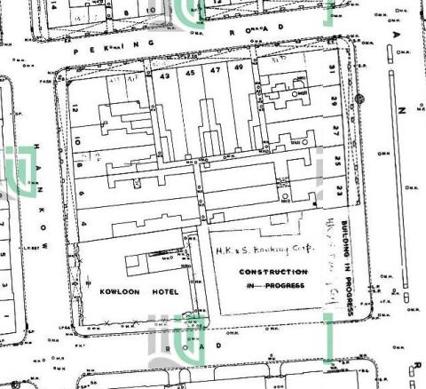
Hong Kong map 1957
|
| 1957 |
Kowloon street map 1957
|
| 1957 |
Hong Kong street map 1957
|
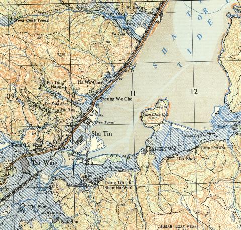
| 1957 |
1957 Map of Shatin area
|
| 1957 |
1957 Sham Tseng map
|
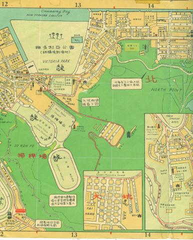
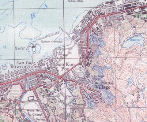
| 1957 |
1957 map of Tai Hang
|
| 1957 |
Dairy Farm Aerial Ropeway - 1957 Map
|
| 1957 |
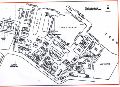
Dockyard 1950s upload.jpg
|
| 1957 |
Wanchai Road
|
| 1957 |
Map Wanchai Road 1957
|
| 1957 |
1957 Map of Tai Po Market
|
| 1957 |
1957 map of the Shing Mun / Golden Hill area
|
| 1957 |
1957-1-1-200-Lai-Chi-Kok-161-SE-B-(Ed-1957).jpg
|
| 1957 |
Detailed map of Hong Kong G.S.G.S.3961
|
| 1957 |
1957 Yi Pak and Tai Pak, Lantau
|
| 1958 |
1950s TST Street Map
|
| 1958 |
1958 Map of Kennedy Town Area
|
| 1958 |
Far East Camp map
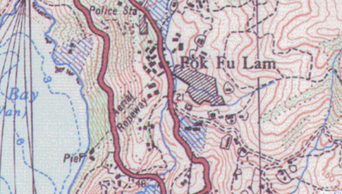
|
| 1958 |
1958 map of Aberdeen
|
| 1958 |
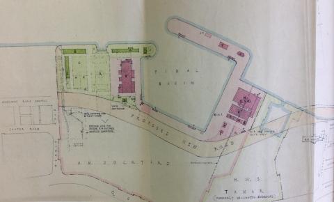
Tamar.jpeg
|
| 1958 |
1958 Map of Pokfulam / Pokfield Roads junction
|
| 1958 |
1958_kcr_hunghom_rail_siding.jpg
|
| 1958 |
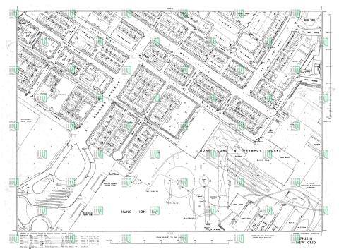
Hung Hom map 1958/59
|
| 1958 |
1958 Yau Tong Bay [Kwun Tong Tsai Wan] layout plan
![1958 Yau Tong Bay [Kwun Tong Tsai Wan] layout plan](/sites/default/files/styles/large/public/2023-02/2447358387_77e9fe49a4_o.jpg?itok=H7IKNT2Q)
|
| 1958 |
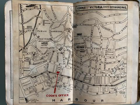
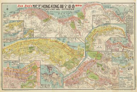
Jan Jan's Map of Hong Kong, 1958
|
| 1959 |
Harcourt road_proposal
|
| 1959 |
1959 Map of Central
|
| 1959 |
1959 BOAC Street Map of Central
|
| 1959 |
Bus & Tram Route. Central, Hong Kong, 1956
|
| 1959 |
1959 1:600 Dairy Farm
|
| 1959 |
1959 hunghom map showing bulkeley market bottom.jpg
|
| 1959 |
1959 map East Point
|
| 1950s |
1950 Sookunpoo Map
|
| 1950s |
HK map 1950's 2.jpg
|
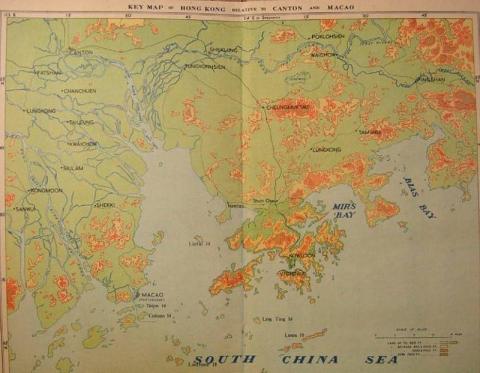
| 1950s |
1950s Map Of Hong Kong (Relative to Canton and Macao)
|
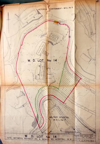
| 1950s |
WDL14_HKRS156-1-11657.JPG
|
| 1950s |
HKRS913-1-360.jpg
|
| 1950s |
The long-forgotten Foot Paths to the HKU main campus
|
| 1960 |
TST map 1960_febr_detail
|
| 1960 |
Sea Terminal-location Navy Street
|
| 1960 |
Yee Wo Street map 1960
|
| 1960 |
1:600 196-NE-6 (Ed 1960-02)
|
| 1960 |
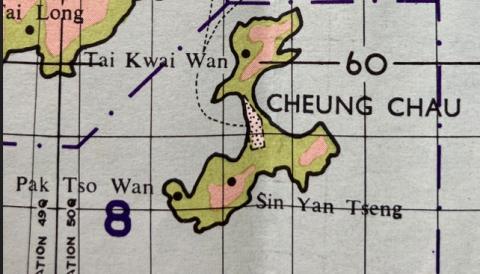
1960 - a simple map of Cheung Chau (prn. Cheung Jau)
|
| 1960 |
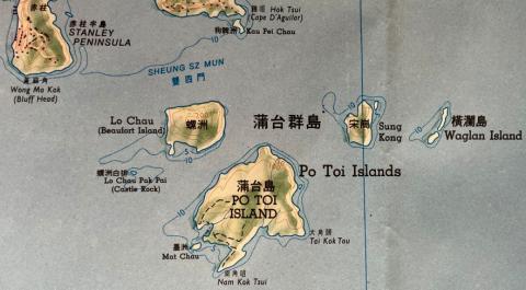
1960 - Po Toi Island Group
|
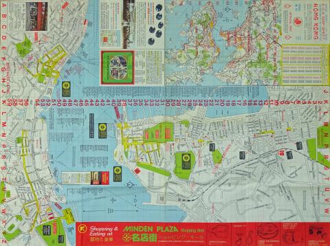
| 1961 |
1961 1:600 Minden Row School

|
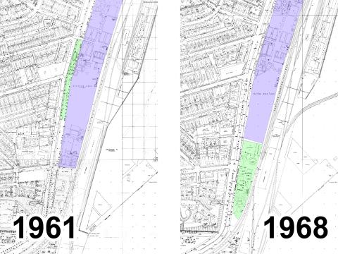
| 1961 |
1961 Map of Buildings between Ice House St and Pedder St
|
| 1962 |
1962 1-600 212-NW-4 showing Blarney Stone
|
| 1962 |
1962 Map of Silvermine Bay
|
| 1962 |
c1962 mui wo lantau island map
|
| 1962 |
Nam Sang Wai map 1962
|
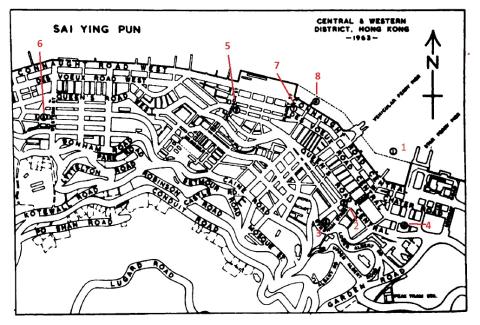
| 1963 |
Map of Seymour & Robinson Roads
|
| 1963 |
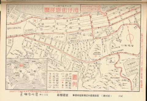
Map of Wan Chai in 1963 (Chinese Version)
|
| 1963 |
1963 map of TST
|
| 1963 |
1963 Map of Tsim Sha Tsui
|
| 1963 |
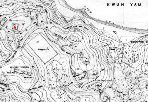
1963.5 HK Maps crop Kwun Yam Wan houses
|
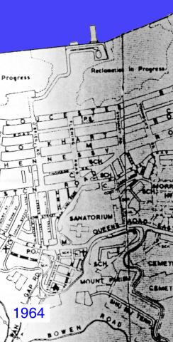
| 1964 |
Wanchai 1964
|
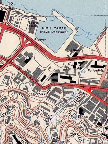
| 1964 |
Admiralty, 1964
|
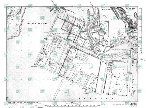
| 1964 |
Lai Chi Kok map 1964
|
| 1965 |
1960s Map of Central
|
| 1965 |
1965 north point map
|
| 1965 |
1965 homan tin new village map
|
| 1965 |
1965 shek kip mei map
|
| 1967 |
Cavendish Heights 1960s
|
| 1967 |
1967 map heavy draw off hydrant 30
|
| 1967 |
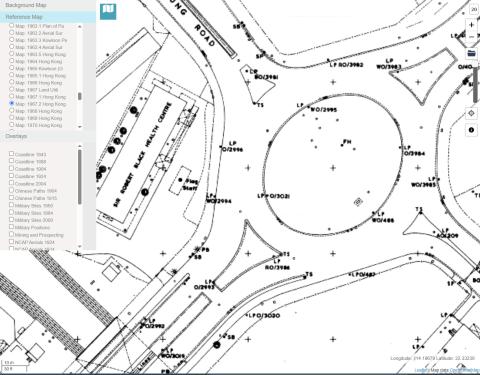
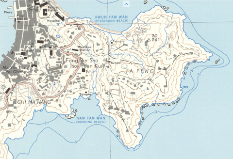
1967 map with contours, zoom in on Fa Peng area
|
| 1968 |
Map showing Southern end of Anderson Road, circa late 1960s
|
| 1969 |
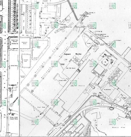
1969 map of Green Island Cement Company
|
| 1960s |
1960s Cinemas in Kowloon
|
| 1960s |
1960s TST Hotel Map
|
| 1960s |
1960s Central District Map
|
| 1960s |
A.R.P. SCHOOL AND HEADQUARTERS
|
| 1960s |
StJoseph'sComplexMap.jpg
|
| 1960s |
1960 map of block bounded by DVRC / Potttinger St / Connaught Rd / Douglas St.jpg
|
| 1960s |
Conspicuous tree
|
| 1960s |
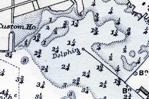
Dolphin
|
| 1960s |
High chimney
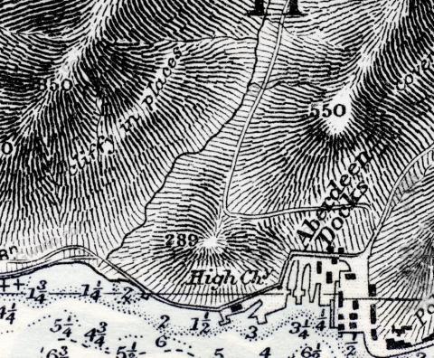
|
| 1960s |
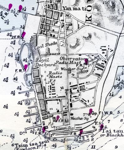
Hydrographic Office
|
| 1960s |
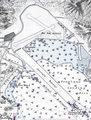
Kai Tak
|
| 1960s |
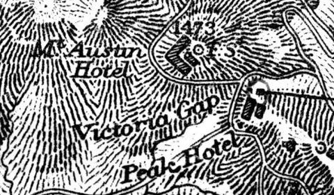
Mount Austin Hotel
|
| 1960s |
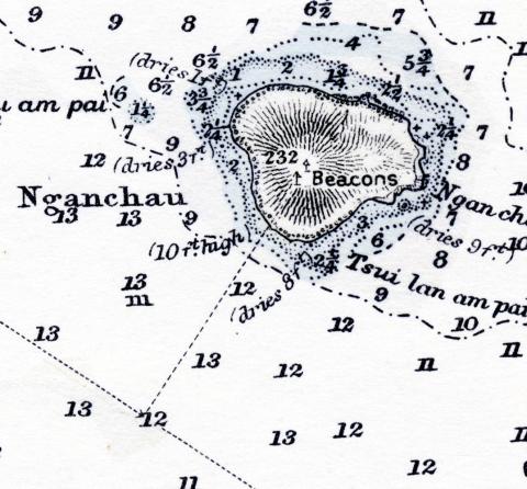
Nganchau
|
| 1960s |
TST lights
|
| 1960s |
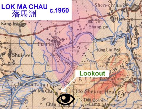
Lok Ma Chau - Map of border region c.1960
|
| 1960s |
1960 tai wan shan map.jpg
|
| 1960s |
Chatham Road playground, 1st & 2nd locations
|
| 1970 |
Hong Kong O\S 1970
|
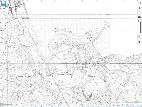
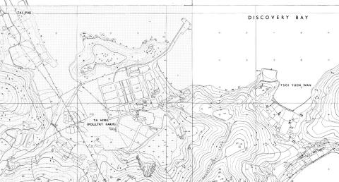
| 1970 |
1970 Ta Hing poultry farm, Lantau
|
| 1970 |
discovery bay ta hing poultry farm 1970
|
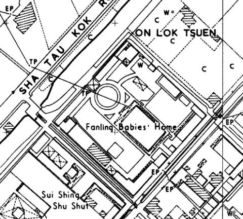
| 1970 |
Fanling Babies Home map (1970)
|
| 1970 |
1a broadwood road 1 1
|
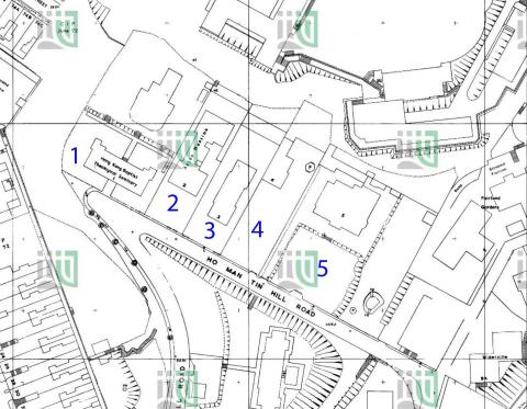
| 1974 |
1974 1:600 Ho Man Tin Hill Road 179-SE-2-(Ed-1974-01)
|
| 1975 |
1975-09 map of the Gutzlaff Street Area
|
| 1975 |
1975-central-map
|
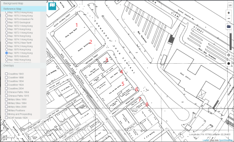
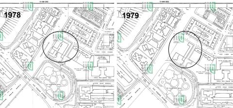
| 1979 |
Hung Hom Police Station 1978_79
|
| 1980 |
Hong Kong Map (1980)(2).jpg
|
| 1980 |
Hong Kong Map (1980)(3).jpg
|
| 1981 |
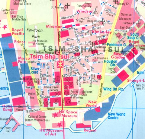
Tsim Sha Tsui.jpg
|
| 1981 |
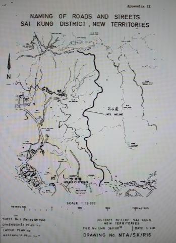
Map of JAT INCLINE
|
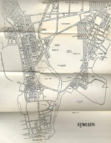
| 1983 |
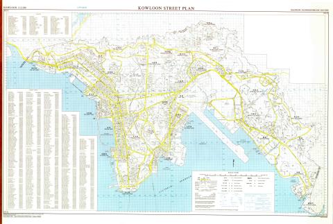
Kowloon street map
|
| 1987 |
1987 map of the Shing Mun / Golden Hill area
|
| 1980s |
1980 Map of Admiralty
|
| 1980s |
Ocean Park Map Headland (1980).jpg
|
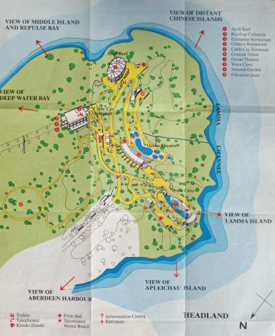
| 1980s |
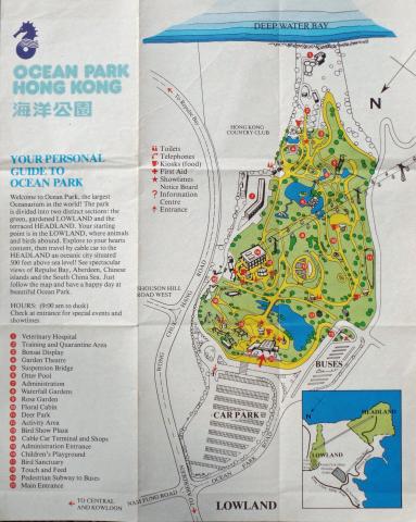
Ocean Park Map Lowland (1980).jpg
|
| 1980s |
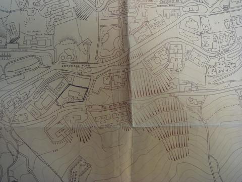
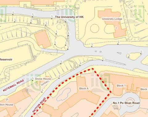
Po Shan Road 1980.JPG
|
| 1980s |
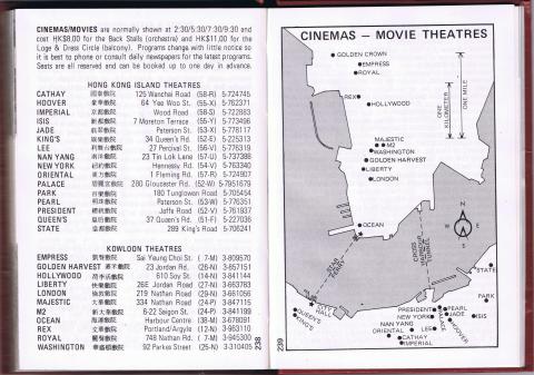
Cinemas/Movie Theatres_1980
|
| 1980s |
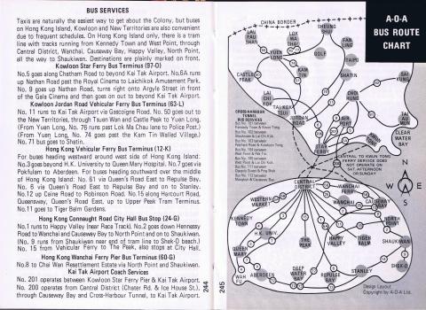
Transport Map 1980
|
| 1980s |
Bus map 1980
|
| 1980s |
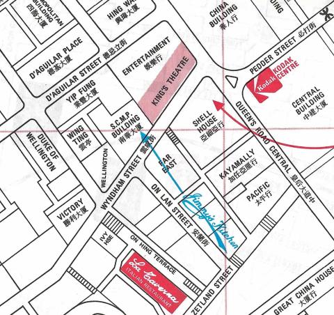
Jimmy's Kitchen on the 1980 map
|
| 1980s |
Jimmy's Kitchen Kowloon on the 1980 map
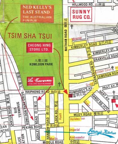
|
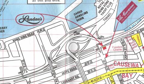
| 1980s |
Landau's Restaurant on the 1980 map
|
| 1980s |
Hung Hom Piers (1980)
|
| 1980s |
Green Jade - Tsing Bik Villa (青碧別墅) [????-1986]
![Green Jade - Tsing Bik Villa (青碧別墅) [????-1986]](/sites/default/files/styles/large/public/thumbnails/image/signal-2022-02-07-111048.jpeg?itok=8WOtWyZ6)
|
| 1990 |
Admiralty, 1990
|
| 1997 |
tsing yi power station map
|
| 1997 |
1997 map of Lai Chi Kok
|
| c.1998 |
Proposal for the Yau Tong Bay reclamation 1998
|
| 1990s |
Wanchai 1990
|
| 1990s |
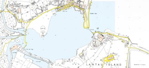
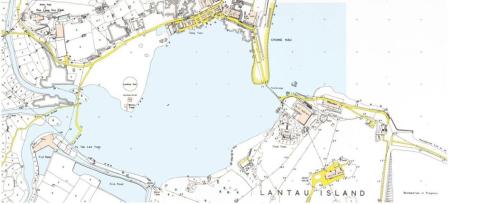
Kai Tak airport area
|
| 1990s |
Map of Hung Hom Bay about 1990
|
| c.2000 |
2000 - Tai O heritage map

|
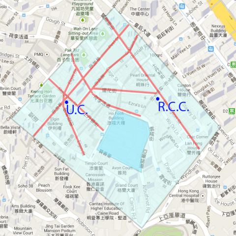
| c.2003 |
Map Central Wanchai c. 2003
|
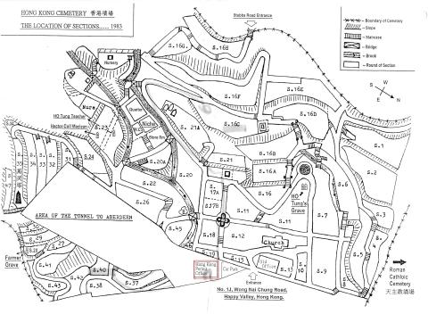
| 2010 |
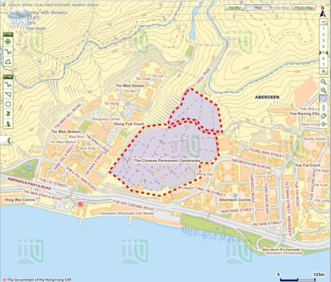
Hong Kong Cemetery Map
|
| 2011 |
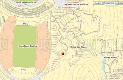
Wesley Village and Race Course Fire Memorial
|
| 2011 |
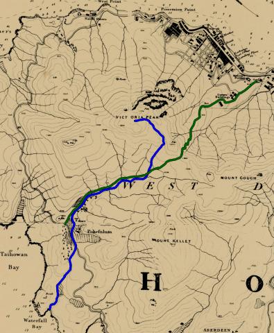
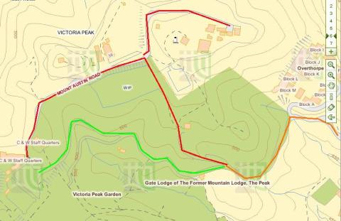
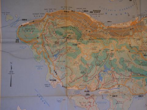
Map of Victoria Peak
|
| 2011 |
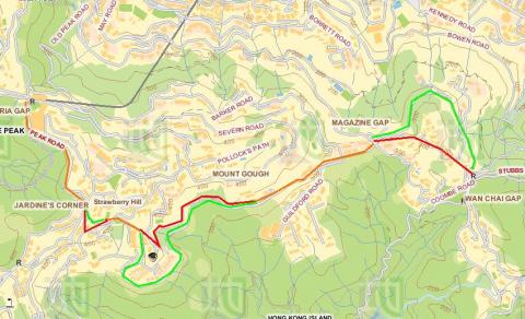
Route from Upper Peak Tram Terminus to Wanchai Gap
|
| 2013 |
2013 map of lower Shing Mun reservoir
|
| 2014 |
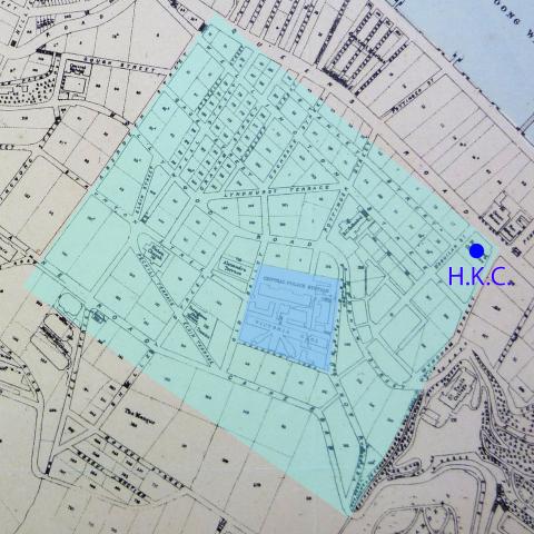
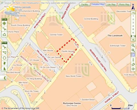
Map of area around Central Police Station
|
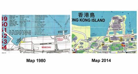
| 2014 |
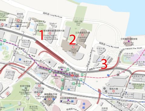
Maps Fenwick Pier 1980_2014
|
| 2015 |
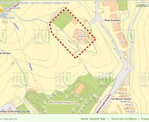
Haystack - RBL 509
|
| 2015 |
AIL 78
|
| 2015 |
A bend on Victoria Road
|
| 2015 |
A bend on Victoria Road and Sai Ning Street Garden
|
| 2015 |
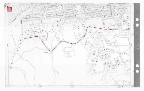
Map
|
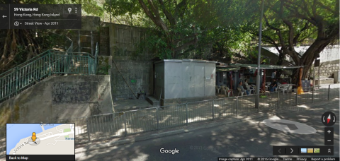
| 2015 |
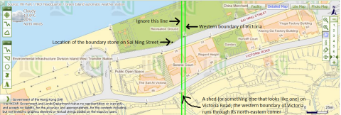
'Shed' which the city boundary of Victoria cuts through on Victoria Road
|
| 2015 |
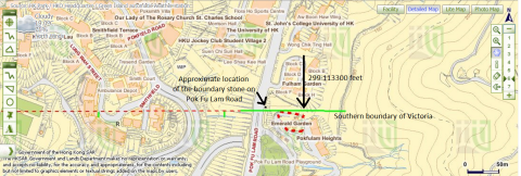
The University of Hong Kong's St John's College and Victoria's southern boundary
|
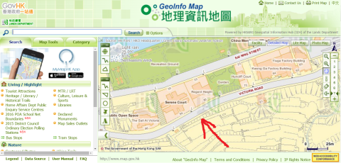
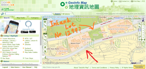
| 2015 |
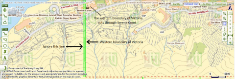
Victoria's western boundary cuts through Serene Court.png
|
| 2015 |
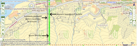
Western boundary of Victoria and previosuly-predicted location of the boundary
|
| 2015 |
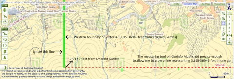
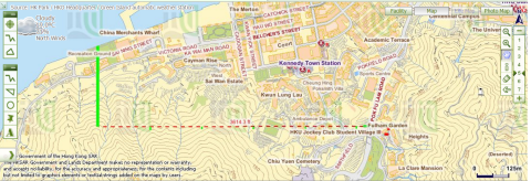
3,615·36946ft from Emerald Garden
|
| 2015 |
City boundary of Victoria intersects Victoria Road and Sai Ning Street
|
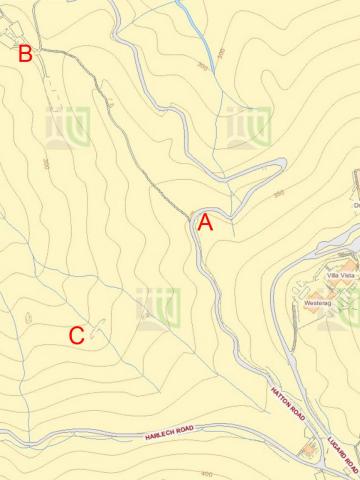
| 2015 |
Lines drawn to deduce the location of Victoria's western boundary
|
| 2015 |
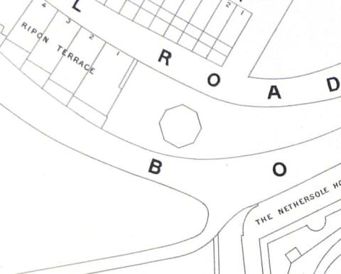
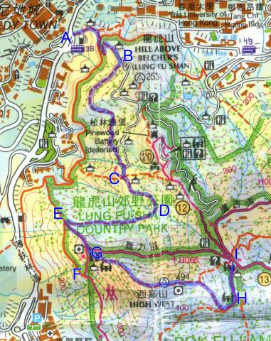
Map of High West
|
| 2015 |
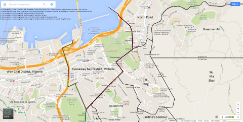
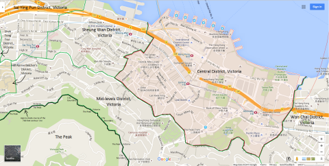
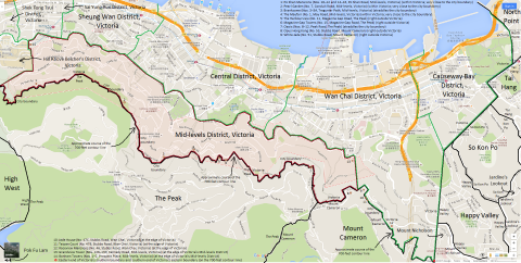
Map of Causeway Bay District, Victoria, Hong Kong
|
| 2015 |
Map of Central District, Victoria, Hong Kong
|
| 2015 |
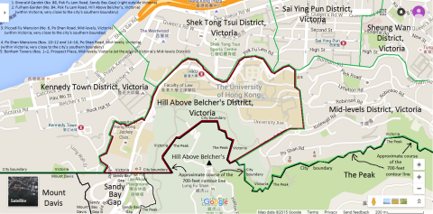
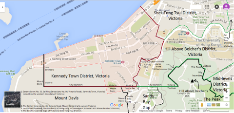
Map of Hill Above Belcher's District, Victoria, Hong Kong
|
| 2015 |
Map of Kennedy Town District, Victoria, Hong Kong
|
| 2015 |
Map of Mid-levels District, Victoria, Hong Kong
|
| 2015 |
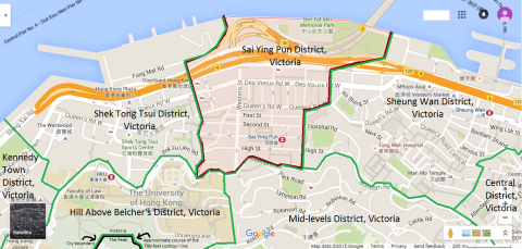
Map of Sai Ying Pun District, Victoria, Hong Kong
|
| 2015 |
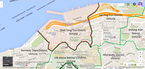
Map of Shek Tong Tsui District, Victoria, Hong Kong
|
| 2015 |
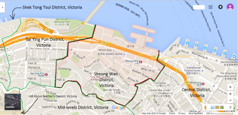
Map of Sheung Wan District, Victoria, Hong Kong
|
| 2015 |
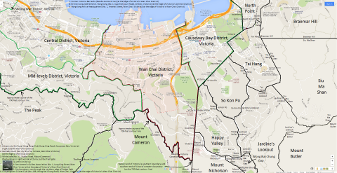
Map of Wan Chai District, Victoria, Hong Kong
|
| 2015 |
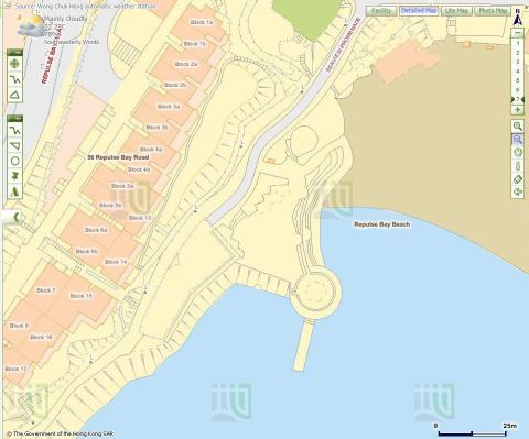
Repulse Bay Map
|
| 2016 |
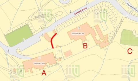
2016 Map Barker Road.jpg
|
| 2016 |
Map of Anti-Aircraft sites at Tai Mo Shan
|
| 2016 |
IL 619 RP
|
| 2016 |
Tunnel above Siu Sai Wan
|
| 2016 |
Map of Sai Wan Hill Battery & Redoubt
|
| 2016 |
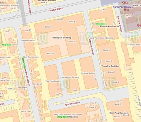
2016 Causeway Bay map
|
| 2017 |
Modern map of HKU area
|
| 2017 |
IL 1874
|
| 2017 |
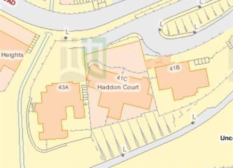
Map of buildings around Haddon Court
|
| 2017 |
2017 Map of Admiralty
|
| 2019 |
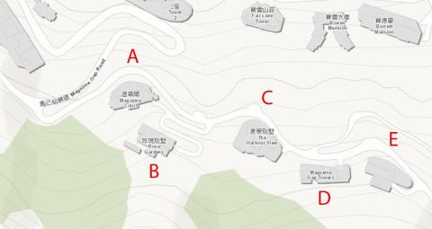
Annotated map of Magazine Gap Rd
|
| 2010s |
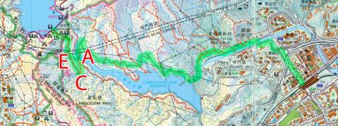
Map of Kowloon Tong walking route
|
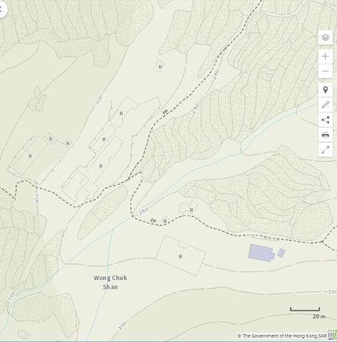
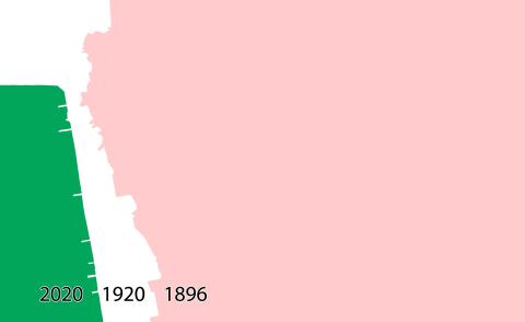
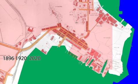
| 2020 |
Wong Chuk Shan map
|
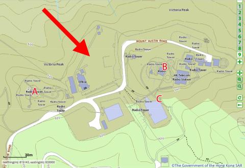
| 2020 |
Map of The Peak
|
| 2020 |
List of Lights Hong Kong
|
| 2021 |
The water tunnel inlet above the lower Shing Mun reservoir
|
| 2021 |
Gwulo-A623-Modern-map-crop.jpg
|
| 2021 |
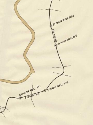
Gwulo-map-of-Pokfulam-siphons.crop_.old+new-conduit.jpg
|
| 2021 |
2021 Ma Tau Chung's lost hills
|
| 2025 |
CCIL 44, 46, 47 on map
|
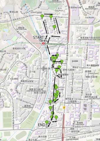
| 2020s |
Map of Wong Chuk Shan boulder trackway
|
| 2020s |
1889-map-overlaid-Pokfulam-conduit.jpg
|
| ???? |
Map of Tai Tam Bay (crop)
|
| ???? |
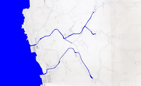
Map
|
| ???? |
8216258376_709022a9b1_o.jpg
|
| ???? |
Tai Tam (War Office Hong Kong Map)
|
| ???? |
David's view.jpg
|
| ???? |
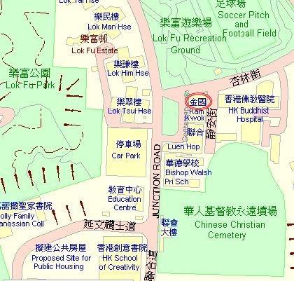
Kam Kwok 金國 map.jpg
|
| ???? |
Location of North Point Bty
|
| ???? |
1952.jpg
|
| ???? |
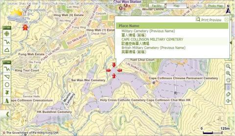
cape_collinson_military_cemetery.jpg
|
| ???? |
Tutorial 01
|
| ???? |
Tutorial 02
|
| ???? |
Tutorial 3
|
| ???? |
Tutorial 04
|
| ???? |
Tutorial 05
|
| ???? |
Zoom 15
|
| ???? |
Reclamation in TST
|
| ???? |
Yau Ma Tei reclamation
|
| ???? |
Ho Mun Tin reclamation
|
| ???? |
Hung Hom reclamation
|
| ???? |
Hill near Market Street / Nathan Road
|
| ???? |
DSCF5012.JPG
|
| ???? |
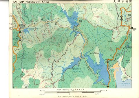
taitamreservoirarea_a.jpg
|
| ???? |
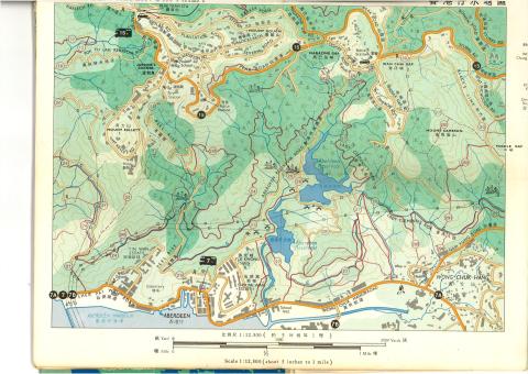
aberdeenreservoirarea_a.jpg
|
| ???? |
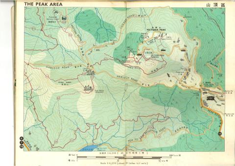
thepeakarea_a.jpg
|
| ???? |
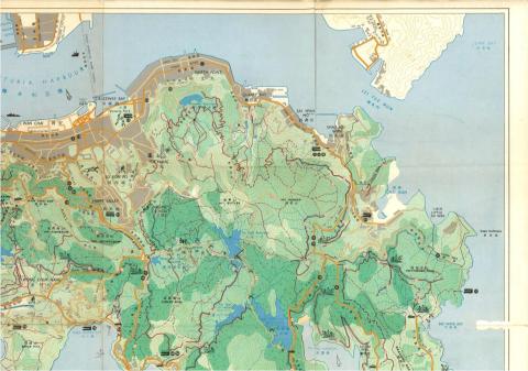
hkislandNE.jpg
|
| ???? |
hkislandNW.jpg
|
| ???? |
hkislandSW.jpg
|
| ???? |
hkislandSE.jpg
|
| ???? |
Hong Kong Tramways 6 of 7.jpeg
|
| ???? |
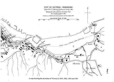
Comparison of maps
|
| ???? |
Hong kong dockyard.png
|
| ???? |
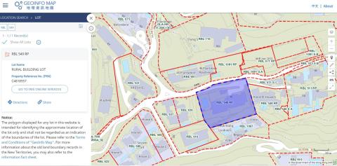
R.B.L. 549
|
| ???? |
DL17 boundary Stone Plan
|
| ???? |
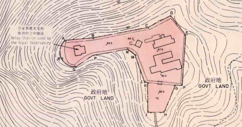
Mount Davis Cemetery Obelisk map
|
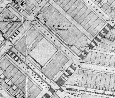
| ???? |
YMCA Bridges Street 1922
|
| ???? |
1978 map of hunghom piers
|
| ???? |
Sam Ka Tsuen
|
| ???? |
Map of past sites of the Harbour Office
|
| ???? |
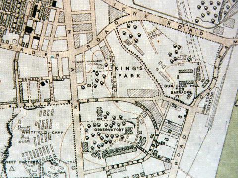
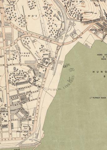
kings park Cottage Resettlement Area map
|
| ???? |
Map Central Wanchai c. 2003 coloured
|
| ???? |
1965 tokawan map
|
| ???? |
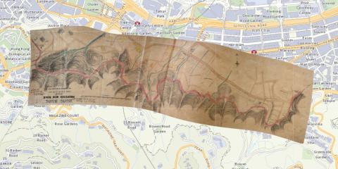
Warped copy of map extract after georeferencing
|
| ???? |
The Manhattan Heights' development in year 2000.
|
| ???? |
tsim sha tsui and kwun chung 1845
|
| ???? |
locating mystery building
|
| ???? |
Map of Hong Kong batteries with arcs of fire
|
| ???? |
1949 Military Map

|
| ???? |
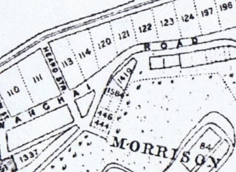
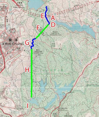
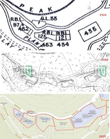
Barker Road maps 1924, 1958 and 2025
|