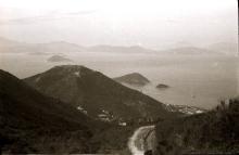
Everything tagged: mount davis

Photos tagged: mount davis

1949
1954
1957

Pages tagged: mount davis

Two Well/Water structures North West of Jockey Club Mt. Davis Youth Hostel

Submitted by MikeB on Tue, 10/26/2021 - 15:13

We discovered a Ribbon Trail leading from Victoria Road at the end of Kennedy Town through the Kung Man Village Resettlement Village

all the way on a ridge to the Jockey Club Mr. Davis Youth Hostel. The recent Typhoon turned it into a machete wielding exercise but the path 

is pretty clear now to use. Approaching the Hostel we came across 2 dilapidated structures in the jungle. They appear to be some kind of water

installation with their well like appearance. 

Does anyone know what they were or when they were built/used? 
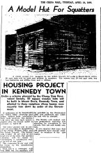
WDBS #6, WDL22 Mount Davis Fort [????- ]

Submitted by Love My Lazy Sundays on Mon, 03/22/2021 - 14:09

War Department Boundary Stone #6, WDL22 Mount Davis Fort 


#6 found base on the Survey Map 195-se-13, 1959 1:600, it is located on a loose soil next to a gully. One third of the base being explored on the slope ,due to the condition of the environment , it may no longer stand after some storm or pouring rain.

This WDBS has a pointed top and engraved with two opposite side. Two side makes in different style, one with the Broad Arrow on top W D. 6  and the other side is W⩚D Nº. 6 .

Reference Map:

wo/5331 Hong Kong  Index Plan#3 ,Sept 1911

WDBS #5, WDL22 Mount Davis Fort [????- ]

Submitted by Love My Lazy Sundays on Mon, 03/22/2021 - 14:00

War Department Boundary Stone #5, WDL22 Mount Davis Fort 


#5 found base on the Survey Map 195-se-13, 1959 1:600, it is found in the woods few meters away from the sideway.

This WDBS has a pointed top and engraved with two opposite side. Two side makes in different style, one with the Broad Arrow on top W D. 5  and the other side is W⩚D Nº. 5 .

Reference Map: wo/5331 Hong Kong  Index Plan#3 ,Sept 1911

Survey Map 195-se-13, 1959 1:600 (#5&6)

WDBS #3, WDL22 Mount Davis Fort [????- ]

Submitted by Love My Lazy Sundays on Mon, 03/22/2021 - 13:54

War Department Boundary Stone #3, WDL22 Mount Davis Fort 

#3 found base on the Survey Map 195-sw-15, 1959 1:600, it is located near the cross section from the Mount Davis Path and the abandoned footpath down to Victoria Road.

This WDBS has a pointed top and engraved with two opposite side. Two side makes in different style, one with the Broad Arrow on top W D. 3  and the other side is W⩚D Nº. 3 .

Map Reference :

wo/5331 Hong Kong  Index Plan#3 ,Sept 1911, 

Survey Map 195-sw-15, 1959 1:600 (#3)

Mount Davis Youth Hostel [1981- ]

Submitted by Klaus on Tue, 02/09/2016 - 00:51

Hong Kong Jockey Club Mount Davis Youth Hostel is located at 123 Mount Davis Path. 

Formerly known as Ma Wui Hall, the hostel was built in 1981 with the Trust’s donation and was opened by the then Club Steward Lamson Kwok, father of Lester C H Kwok.  As demand increased over the years, the Trust funded the Association to expand the hostel’s capacity by constructing an additional wing. Upon completion in 2000, the hostel was renamed as Jockey Club Mt. Davis Youth Hostel (Text copied from David's comment).

Looking for pillbox #72

Submitted by David on Thu, 10/02/2008 - 09:00

Monday's walk was one of those 'it's the journey, not the destination' outings. In theory I was going to find the location of pillbox 72, but in any case it was lovely weather, and a good excuse to scramble over some rocks.

The map we've been using shows pillbox 72 on the coastline, somewhere between Jubilee Battery and Kennedy Town. Last weekend we took a ferry to Lamma, so I used the chance to take some photos of this section of the coastline. It's the view as you pass through Sulphur Channel, between HK Island and Green Island.