Current condition
Demolished / No longer exists
Date completed
(Year is approximate.)
Date closed / demolished
(Year is approximate.)
Photos that show this Place
1954
1958
1959
Comments
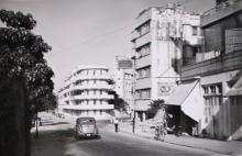
Is it the building on the
Is it the building on the left in the background:
Re: Building
Yes, it is the curved building.
If I remember that building
If I remember that building correctly it once ad a tree growing through it's balcony/verandah.