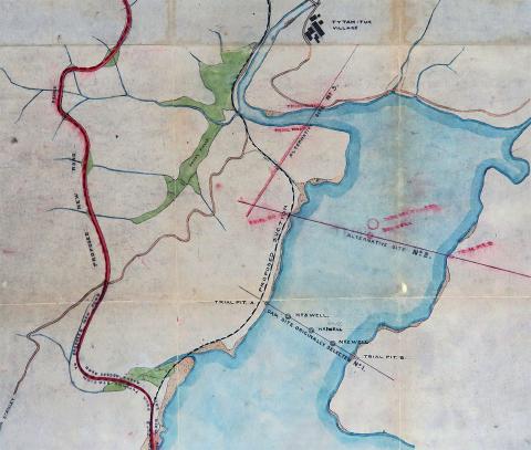
In the recent Birthday Buildings in 2018 article, I posted this map, showing the three initial sites proposed to build the dam for the new Tai Tam Tuk reservoir.
Tymon Mellor has written to say that traces of the two proposed sites in the harbour still remain. Six investigation wells were sunk, to find out what the seabed was like and whether either one was a suitable place to build a dam.
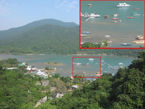
The answer was "no", so the sites were abandoned but the wells were left behind. Four of them are still standing, one on the southern site, and these three on the northern site. If you look at the satellite view of the map above, the three circles of the wells are clear to see.
The photo below shows they are also obvious at ground-level - though I've been around there several times and managed to completely ignore them each time!
For more information about these inspection wells, see the HKIE article: The four brick wells at Tai Tam Harbour


