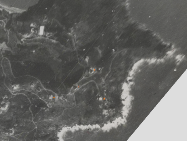
My conclusive analysis of the location, as by line-of-sight, is site C. The houses' view are largely blocked by house D and house A is fairly easy to see. And the rooftop bell tower lookalike seemed to be there in the moddsey photo.
My assumptions are:
Before the construction of the Assembly Hall, the lot already had house #12 with excessive unused area in the south.
The newspaper photo of the Assembly Hall did not capture house#12 because it was rightly hidden from the camera.
My memory of the ruin could be a totally different building elected on the same or other nearby lot.
Comments
The Assembly Hall
Hello hk....
That's very helpful!
My conclusive analysis of the location, as by line-of-sight, is site C. The houses' view are largely blocked by house D and house A is fairly easy to see. And the rooftop bell tower lookalike seemed to be there in the moddsey photo.
My assumptions are:
My memory of the ruin could be a totally different building elected on the same or other nearby lot.
Cheers
Tung