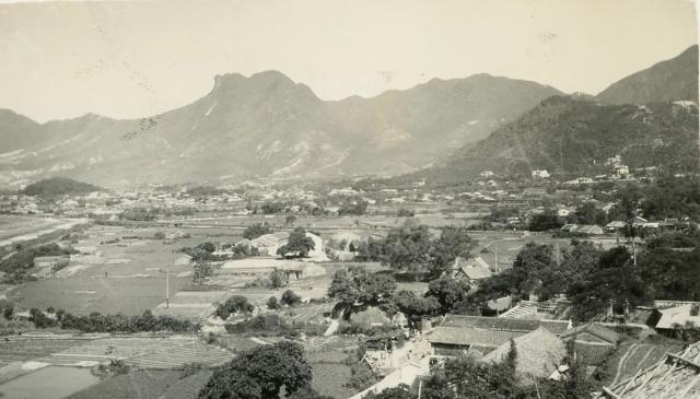
Halfway down the left edge of the photo is a flat piece of ground with fence posts along the boundary, and then a road that runs alongside then turns left. I think that road ran along the edge of the Kai Tak airfield, so the hill on the right would be Diamond Hill. See this area of the 1952 map: https://gwulo.com/map-of-places#15~22.3404~114.2018~Map_by_GovHK-1952_A…
Kowloon City is out of sight to the left so I've changed the title of the photo from "Kowloon City" to just "Kowloon".
Comments
Halfway down the left edge…
Halfway down the left edge of the photo is a flat piece of ground with fence posts along the boundary, and then a road that runs alongside then turns left. I think that road ran along the edge of the Kai Tak airfield, so the hill on the right would be Diamond Hill. See this area of the 1952 map: https://gwulo.com/map-of-places#15~22.3404~114.2018~Map_by_GovHK-1952_A…
Kowloon City is out of sight to the left so I've changed the title of the photo from "Kowloon City" to just "Kowloon".