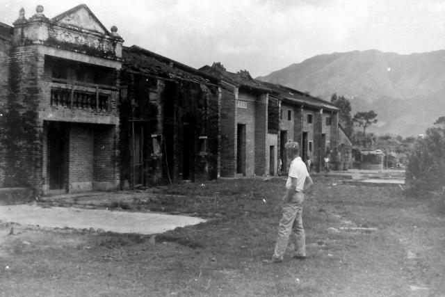
This photograph, taken by an unknown member of the 367 association, shows one of the buildings badly damaged by fire. I suspect that it was somewhere in the New Territories. Any suggestions?
Phil has spotted this row of old buildings in the village of Tsat Sing Kongstill in existence in the village of Tsat Sing Kong. Google Earth street view shows them almost hidden behind a modern building.
Date picture taken
1950s
Gallery
Shows place(s)


Comments
Tai To Yan
Andrew, the ridge in the background is Tai To Yan seen from the west, so I expect this row of houses would be somewhere in the Pat Heung or Kam Tin areas - basically in the vicinity of the other "mystery" images you have been posting.
In fact, I think these may be a cluster of old houses that can still be seen in Tsat Sing Kong. If you look at the older buildings in this link, they are similar to the group of buildings behind the man's head - a shrine/ancestral hall followed by three houses. It looks as though the buildings on the left of the image have already been demolished though - not surprising given their condition back then.
This could also be the rough area where the south-looking image was taken from.
Phil
Phil. You are a star! I…
Phil. You are a star! I have checked the village on Google Earth with its street view and agree that there is a marked similarity between the right hand section of buildings on the black and white photograph and the old ones peeking out from behind the new block on Google Earth. The modern view also seems to show a building that looks remarkably like one or two of the smaller ancestral halls that I once saw in the rural areas. The same building appears on the original photograph.
Many thanks to everyone involved in this research for your diligent and expert detective work. Andrew