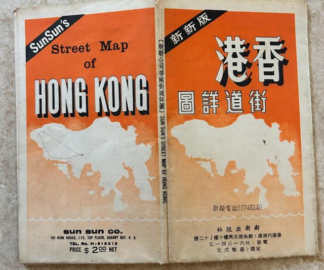
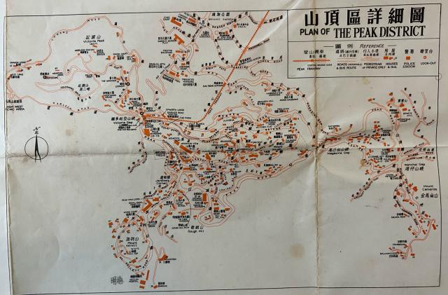
A Hong Kong Island street map recently uploaded by Mr Bellis in Gwulo prompted me to dig into my old old stuff and to my surprise, I found a similar map I have kept for almost 50 years. It is a 1967 edition published by the same company though the name of the company was changed from “Jan Jan” to “Sun Sun”. The format and the setup of these 2 maps are essentially the same with some updated street information and the deletion of contour lines in the 1967 edition.
Since I do not have a big scanner, I can only take photos of different sections of the map and am planning to upload these photos (as HK Island Street Map 1967 Part1 thru. Part 6) to the Gwulo website to share with other Gwulo readers. For some serious researchers, this may be a golden opportunity to compare these 2 maps to find how the HK island road system evolved back in the sixties.
The backside of the map has some public bus line route information which I am going to post in Gwulo also (as HK Island Street Map 1967 Part 7).
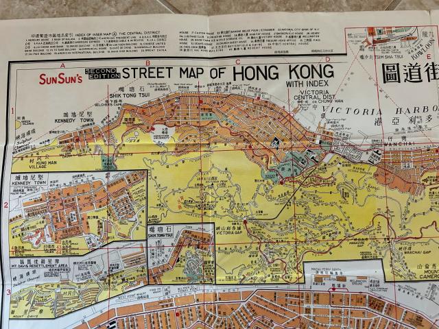
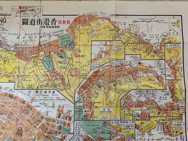
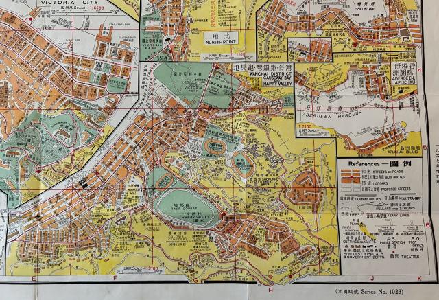
You can click on the images below and use the 'Zoom' feature to view the different sections of the map:

Comments
Thank you for posting this,…
Thank you for posting this, WYIP, I don't remember having seen this map before.
I've pasted in the sections of your map to the notes above, so that the whole map is on one page.