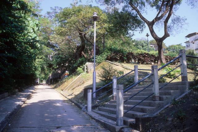
Where is this?
Could be anywhere in Hong Kong in 1998.
The driveway gate posts appear to have ‘restricted access’ signs and on the left a blue & white sign reminiscent of police station signs. The driveway turns sharp right at the top.
The foreground steps lead up to low rise residential housing of 1960s-70s vintage.
In a related image print swinging to the right there are no hi-rises or mountains in view at all.
The location must have meant something to me at the time for me to photograph it!
Date picture taken
1998

Comments
Re: Something to do with RAF?
Hi There,
There seems to be a match.
https://goo.gl/maps/zVnc3c8w4NLqnU4VA
T
Possibly
Possibly-the steps and buildings to the right had me puzzled I don't recall them.
I have other slides of the site showing the RAF buildings or 'The Detectives School' as it was then, but cannot find them at the moment
Path to the RAF Officers' Mess
It is the path that leads up to the former RAF Kai Tak Officers' Mess from Kwun Tong Road. Out of sight on the left is the red-coloured Taoist temple, 三山國王 (Sam Shan Kwok Wong Temple), next to Ping Shek Estate.
2019 Overhead View