The Tuen Mun area has changed a bit since my first visit in 1966 and even in more recent times riding on the top deck of a bus from the HK island to Tuen Mun via the Gold Coast noting development and landscape changes amazes and disorientates me.
My early postings:-
Date picture taken
1980
Shows place(s)
Comments
Re: Chi Lok Fa Yuen
Hi There,
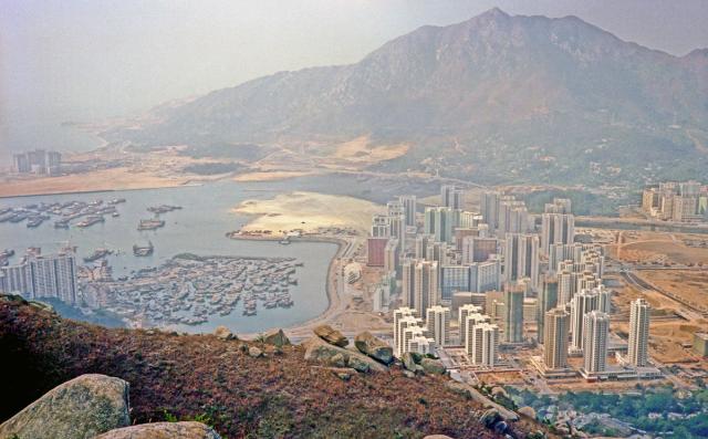
The eight whitish blocks forming a U formation in the foreground is Chi Lok Fa Yuen. It was inaugurated in 1981. The rectangle site in front of it would be the future Yan Oi Market.
On the extreme right, the under-pass of Tuen Mun Highway at Tuen Hung Road could be seen. The empty space beyond would be the present day Tuen Mun City Hall\Public Library\District Court\Bus terminus complex.
Further beyond at the patch of green hill beside Tuen Mun River, there is a plot of bare land at a corner. That is where the Tin Hau Temple still stands. I read the plot of land was muddy then, but had been improved in the recent past. The whole site is now tiled.
T
Tuen Mun Ferry Pier
Just left of centre is the Tuen Mun Ferry Pier.
I believe it was there until at least the latter part of 1986, when the last of the water around Mouse Island vanished.
-kpl.