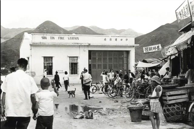
At the junction of first street and the road near shatin sea as shown in this map:
https://gwulo.com/media/43882/zoom
Date picture taken
unknown
At the junction of first street and the road near shatin sea as shown in this map:
https://gwulo.com/media/43882/zoom
Comments
location
on the 1963 aerial images on HKMapviewer, there is a building that corresponds to the firestation located where the main bridge from New Town Plaza crosses the current Shatin Centre Street. I've tentatively created a place for it here, pending confirmation.
exactly location
This aerial map shows the fire station at quite a distance on the right side of the Centre Street. i.e. assuming the old Centre Street is still the same as current Centre Street.
https://gwulo.com/media/40357
It seems difficult to find old maps of Shatin from the 1950s to 1970s with street names.
HKMapviewer
You can use the HKMap viewer website to get a more accurate image of the modern v old street layout. i.e. the old and new Centre streets don't coincide and the old version ran through what is today the bus depot under the plaza.
HKMap viewer
There seems another 2D map showing a building labelled "fire station". The reference map is "Map: 1970 Hong Kong ". It is at the center of the bottom of the map here.