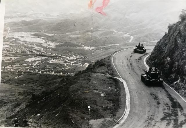
This photo has been sent to me by John Taylor from his father's archive of phtographs taken in Hong Kong in the 1950s. Looks like it may be Shek Kong in the vallley below. Any ideas Moddsey?
Date picture taken
1950s
Gallery
Comments
Sek Kong Plain
Overlooking Sek Kong Plain. On Route TWSK (Twisk). Similar photos here and here for comparison. Follow the Kam Tin Road below.
Tanks on the road
Spot on Moddsey.
Is the top left the sea?
Is the top left the sea, ponds or just lowland?
ponds
maybe the ponds on the north side of the valley.
Re: Land usage
Just a combination of lowland, farmland and ponds. Maps of the area from the 1950s can be seen here
Looks kinda familiar...
That looks to be the last right hander as you head from Tsuen Wan, a bit before the straight section just above Shek Kong where there's a layby in the opposite direction across from the picnic area.
Apex of the right hander: https://maps.app.goo.gl/8AXLHQ2HxoP7snHq8
If correct, then about 100 metres before the apex it's possible to get up the slope that would line up pretty well with what can be seen here.
The next right hander wouldn't line up with the view & the previous right hander where the pavilion is now isn't as sharp as well as not lining up with the view.
-kpl.