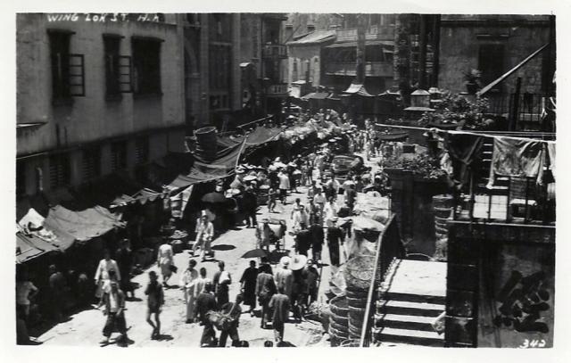
(Text updated in 2025). Looking west. Bonham Strand Public Latrine stands on a triangular junction on the left. Bonham Strand is the street behind the latrine. The entrance to Western Market (South Block) can be seen to the right of the latrine.
Wing Lok Street is in the foreground. In the photo, Bonham Strand and Wing Lok Street converge where the Market is and later radiate to the left and right respectively. In the distance in the centre where the streets diverge is the Tim Nam Teahouse.
Today, the triangular junction has disappeared. Whilst Bonham Strand and Wing Lok Street appear to have merged to form a single street, the left (south) side of the street is deemed as Bonham Strand and the right (north) side is considered as Wing Lok Street. (Verified the road signage on Google Street View. Google Maps provide an incorrect interpretation).
The photographer was at the junction of Wing Lok Street and Morrison Street. On the right is a staircase which may be the one seen here
Source: This image came from Flickr, see https://flickr.com/photo.gne?id=5043345081