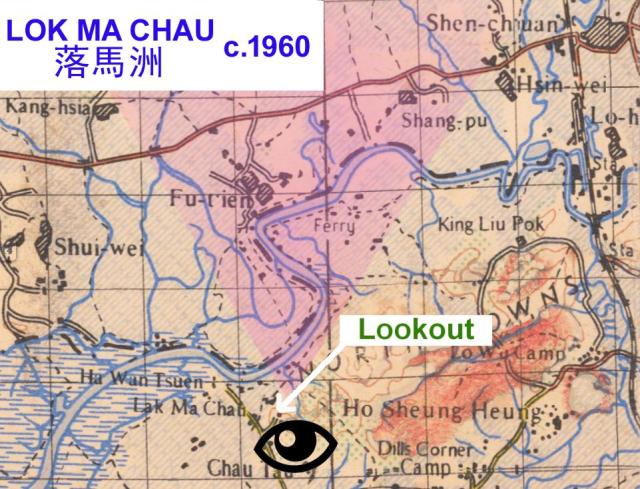
Extract from a late 1950s British military map showing the border region near Lok Ma Chau. The Viewing Point was ( and still is) accessible up a short road leading to the top of a small hill on which Lok Ma Chau police station is located. The viewing point overlooks the border , marked by the Shum Chun River. You can read a description of what met your eyes back in 1966 on this Forum Topic HERE
Date picture taken
1960s
Gallery