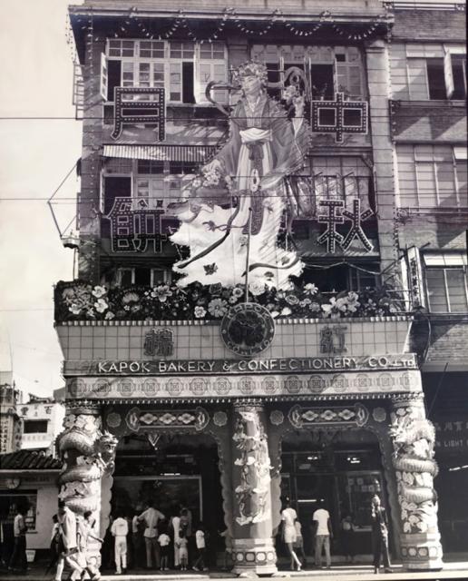
More about Kapok Bakery and Confectionery here To the left of the building is a petrol station (Mobil) as seen on this map In 1941, air raid pen shelters were constructed at the rear of the petrol station as seen here
Source: This image came from Flickr, see https://flickr.com/photo.gne?id=34198680665
Date picture taken
1958
Gallery
Shows place(s)
Comments
flower shop
Behind the petrol station, one can see a flower shop called 百豐花店 at On Lok Lane. Behind it there was the Hong Kong funeral parlour. It moved away in 1967. Now the site is occupied by Lee Cheung building. Therefore the picture was probably taken before 1967. The flower shop would not have lasted long wihout the parlour.
Kapok Bakeries and bomb shelters
There was a bomb shelter right across the street from this Kapok Bakery too.
https://gwulo.com/media/32012
Shelter No.114, Capacity 300 Persons
Hennessy road around kapok
It is how it looked like around Kapok in 1965. Behind the tram was the gap where the petrol station was located. On the right hand side of the gap of course was Kapok. Though one can't see the front of it, the style of the windows looks exactly like the above picture. On the left hand side there was a chinese food store with a sign with red background and white characters. One can go upstairs from there to Wanchai road where the Hong Kong funeral parlour was located on the left. That staircase still exists today (possibly not the same one after the place was converted into a basketball court).
==================================