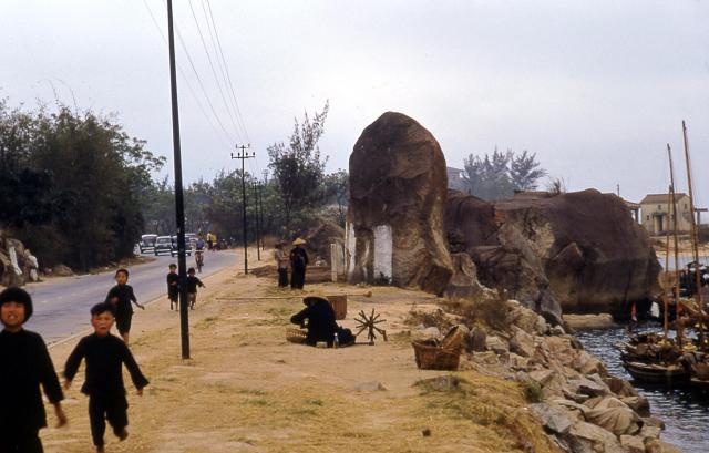
I wonder if this shows the large rock at Sam Shing Hui that is now contained within Ki Lun Kong Public Park in Tuen Mun. The shape is similar and the shoreline in the image matches quite closely with the one on the 1960's aerial images.
I had a look at Googlemaps and really found a picture. The same rock with a text, which declares that the rock marks the original shoreline before reclamation.
It has been left as a reminder for the fishing village.
Comments
Ki Lun Kong?
I wonder if this shows the large rock at Sam Shing Hui that is now contained within Ki Lun Kong Public Park in Tuen Mun. The shape is similar and the shoreline in the image matches quite closely with the one on the 1960's aerial images.
I had a look at Googlemaps…
I had a look at Googlemaps and really found a picture. The same rock with a text, which declares that the rock marks the original shoreline before reclamation.
It has been left as a reminder for the fishing village.
Re: Boulder
Old photos of the boulder appear on Facebook at https://www.facebook.com/tuenmunoldphotos The same boulder at Ki Lun Kong Public Park on a discussion forum at https://www.discuss.com.hk/viewthread.php?tid=11298035