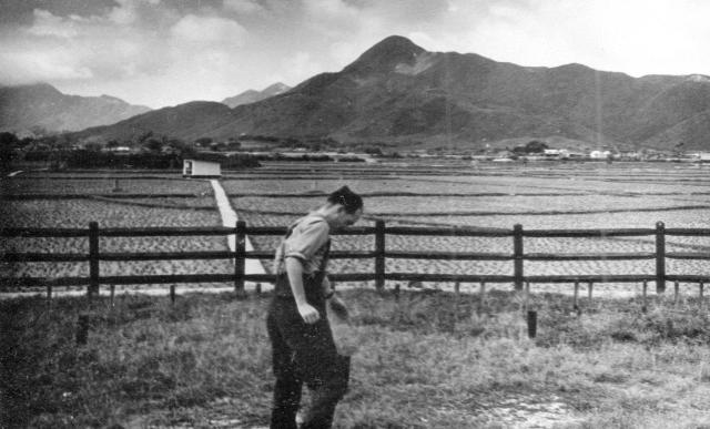
This photograph was taken from within the fence of hut 3 looking to the South West.. The river, which in those days had a very winding course, would have been just beyond the line of trees on the left. (Andrew S)
Date picture taken
1960s
Gallery
Shows place(s)

Comments
Yuen Tau Shan
Hi Andrew
This is the view looking towards the south west. The hill in the background is Yuen Tau Shan. Castle Peak is buried in the clouds at the far left.
Cheers
Phil
Thanks Phil. Rarely do I mix
Thanks Phil. Careless of me to swap my Compass bearings! Now corrected. I think that I placed the pins for the Kong Wei photographs quite accurately on the maps and Google Earth so others can see where things were on Google Earth. It’s hard to believe that all those immaculately kept fields are now buried under tall buildings and roads. Best wishes, Andrew