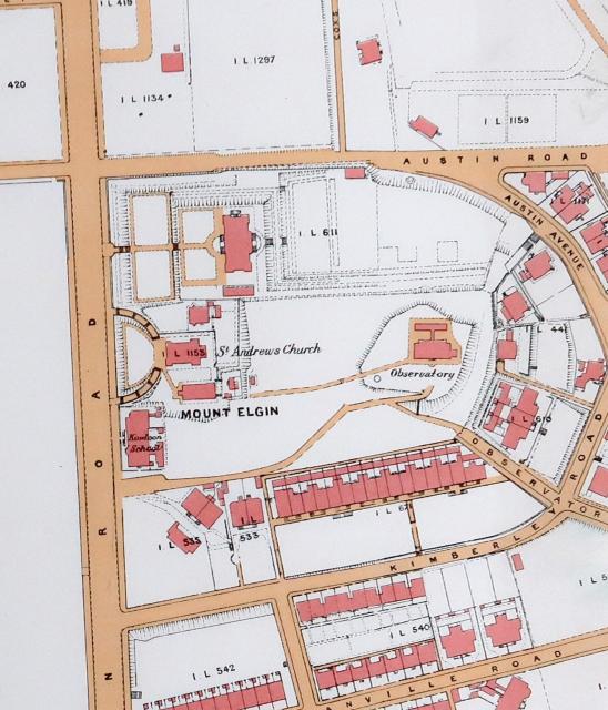
Admin Fri, 03/02/2018 - 01:14 prevnextoldernewer Cropped section of a 1920 map of Kowloon. The original is held at the UK National Archive, their reference: CO 1047/455 Date picture taken 1920s Tags UKNA map Gallery 1920s Hong Kong Log in or register to post comments Comments Armend Building Interesting to note the long building at the junction of Carnarvon and Kimberley Roads from 1920. Surmised to be the Armend Building as noted here Log in or register to post comments
Armend Building Interesting to note the long building at the junction of Carnarvon and Kimberley Roads from 1920. Surmised to be the Armend Building as noted here Log in or register to post comments
Comments
Armend Building
Interesting to note the long building at the junction of Carnarvon and Kimberley Roads from 1920. Surmised to be the Armend Building as noted here