While sorting through some of my late parents’ photos, I came across one of San Wai Camp, so I looked it up on the internet and found Gwulo: Old Hong Kong.
My father was stationed here in 1933. On the back of the photo is written (writer not known) -
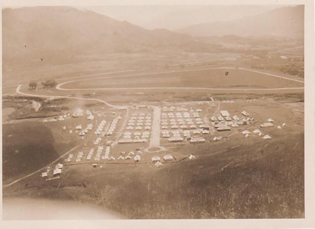
“Sun (sic) Wai Camp and Kwanti Race Course from ‘Cap Badge hill’ (as the troops call it for obvious reasons). The road beyond the race course runs away to Fanling Station about two miles to the right. Officers’ tents at the near left corner.
New Territories December 1933”
I wasn’t quite sure why the reason for naming the hill Cap Badge hill would be obvious, but someone might.
Date picture taken
1 Dec 1933
Gallery
Shows place(s)
Comments
San Wai Camp looking towards Camp Badge Hill
A similar modern view...
...to the 1933 photo can be found on Google Maps here: https://goo.gl/maps/putWByvzQUE2 (although the view is not quite the same on Google, being aerial rather than taken from the hillside above the camp). The 3D function on Google Maps allows you to see the site from a few angles, but it's hard to get exactly the same viewpoint.
Where you can see the racecourse in the 1933 photo is where the Google marker now locates 'San Wai Barracks'. The layout of the camp on the near side of the river is still quite similar to how it was in the old photo, especially if you look at a closer view on Google Maps, here: https://goo.gl/maps/HQKKvKsSKdE2 (where the roundabout at the bottom of the photo is easily recognisable)
Sorry I'm not able to upload better screenshots of these Google Maps for now.
Liz