Have you ever written your address like that? Probably not, but if you live on Hong Kong island there's a good chance your address lies within the 'City of Victoria'. Here's a map showing the approximate route of the city boundary, as laid out in Solomon Bard's book 'In search of the past: A guide to the antiquities of Hong Kong':
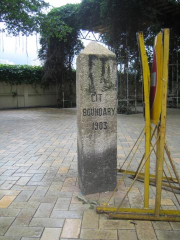
The markers on the map above show where the stone markers can be seen along the boundary line. Here's a picture of the one on Wong Nai Chung Road:
Dr Bard's book says that there were six stones erected, and that all remain today. However I note that a couple of local websites believe that there is a seventh stone on Magazine Gap Road - look at the top right photo here, for example.
Has anyone seen a government record describing when the stones were erected? That would clarify how many there were originally, and how it was decided which points along the boundary needed marker stones. My guess is that a stone was used when the description of the boundary could be misunderstood, eg when there was no other clear landmark to identify the boundary's course.
Here's an example from 25th Jan, 1901, showing how Hong Kong's continuous development made it difficult to give a fixed description of the boundary:
The ATTORNEY -GENERAL said―Just before coming into the Council it was pointed out to me that in the definition of the city of Victoria the eastern boundary is described as― "A straight line from the skew bridge at the south-west corner of Causeway Bay to Wong-nai Chung public school-house, produced southward until it meets the southern boundary." I am informed that the skew bridge here mentioned has been recently done away with. I therefore put myself into communication with the Director of Public Works, and he suggested that instead of the words "skew bridge" we should use the words "centre of the nullah crossing the Shaukiwan Road."
The point "Wong-nai Chung public school-house" is the same as the Wong Nai Chung Rd marker - the rightmost marker on the map. If you follow the boundary from there up and to the right to the next turn of the boundary, that would have been the "skew bridge" mentioned above. The bridge lay on the coastline in 1901, and so marked the end of the boundary. You can see that reclamation means the boundary has had to be extended Northwards several times since then.
Even though we don't hear the term "City of Victoria" used today, the boundary is still legally recognised (though I'm not aware of when it is used - any suggestions?). Here is the latest description I could find, written in 1998:
BOUNDARIES OF THE CITY OF VICTORIA
On the north-The Harbour;
On the west-A line running due north and south drawn through the north-west angle of Inland Lot No. 1299 and extending southwards a distance of 850 feet from the aforesaid angle;
On the south-A line running due east from the southern extremity of the western boundary until it meets a contour in the vicinity of the Hill above Belchers 700 feet above principal datum, that is to say, a level 17.833 feet below the bench-mark known as "Rifleman's Bolt", the highest point of a copper bolt set horizontally in the east wall of the Royal Navy Office and Mess Block Naval Dockyard, and thence following the said contour until it meets the eastern boundary;
On the east-A line following the west side of the Government Pier, Bay View and thence along the west side of Hing Fat Street, then along the north side of Causeway Road to Moreton Terrace. Thence along the west side of Moreton Terrace to the south-east corner of Inland Lot No. 1580 and produced in a straight line for 80 feet, and thence along the north side of Cotton Path and produced until it meets the west side of Wong Nei Chong Road on the east side of Wong Nei Chong Valley and thence to the south-east angle of Inland Lot No. 1364, produced until it meets the southern boundary.
Finally, how many of the boundary stones have you seen?
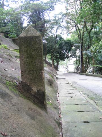
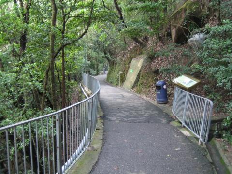
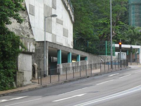
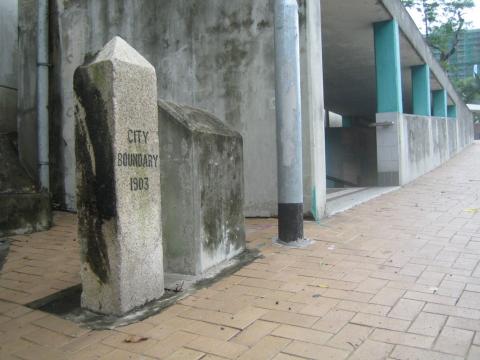
Pictures below, with locations as described on this LCSD page (it also has some more history about the City of Victoria).
Regards, David
Following the boundary in a clockwise direction, the first stone (also shown above) is at the pedestrian road of the car park opposite to St. Paul's Convent School at Wong Nai Chung Road:
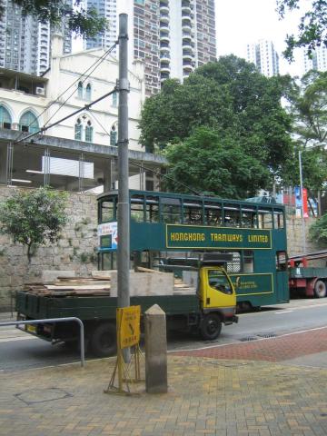
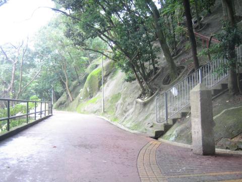
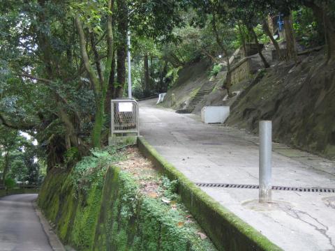
Bowen Road near Stubbs Road:
Old Peak Road near Tregunter Path:
Hatton Road near Po Shan Road:
The south of Pokfulam Road near the pedestrian subway of Mount Davis Road:
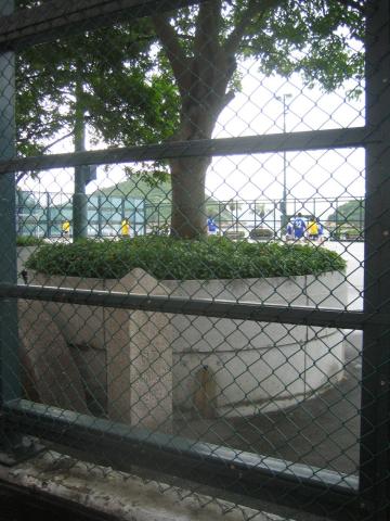
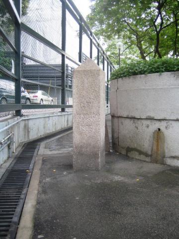
The Kennedy Town Temporary Recreation Ground at Sai Ning Street:
Comments
re: GIS
There's a list of the pages we have for the boundary markers at: https://gwulo.com/taxonomy/term/489/places-list
The older entries' locations are approximate, so will need a visit to get an accurate location (corrections gladly received!). Some of the later entries show their accurate lat/lon values.
It'll be interesting to know more about your project - please could you make a new post in the forum to tell us about it? (https://gwulo.com/node/add/forum/2)
Regards, David
GIS
Hi my33,
I found there's a list of coordinates of the 10 boundary markers in the following YouTube video:
https://youtu.be/H_3V9G2BYKI
It shows up at 3'03" of the video as well as in its description. A link for downloading the route of a hiking app is also provided.
Hope this is helpful to you.
Cheers.
Wan Chai Gap intersection with Holland Path
If most of the boundary stones are found where the boundary line intersects with a main road or hitting a sharp turn before heading off to sea level, would it be logical to say there must be on by the Holland Path where it meets Wan Chai Gap Road? I stumbled upon what looks like the remains of the base structure of a theorised boundary stone location, I wonder if that could be any interesting?
re: Wan Chai Gap intersection with Holland Path
It seems there should be a boundary stone near there. We had a look around that area back in 2006 but didn't find anything (see https://gwulo.com/comment/4023#comment-4023). It'll be great if you've found evidence of it.
Please could you upload a photo of it for us to see? (Here's how to upload a photo: https://gwulo.com/node/2076)
Re: 2006 Posting
Hi David, the embedded map in your posting on 17 October 2006 does not show up on my screen. Not sure if it has to do with the previous upgrade or just my computer? Thanks.
embedded map
moddsey, same problem here, so it probably needs a tweak from admin.
Re: 2006 Posting
Thanks for the heads-up. The old map no longer works, so I've used Google's My Maps to update it.