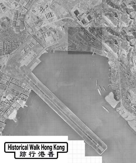
This aerial photograph was published by the Survey and Mapping Office in 1963. It is produced from aerial photographs taken at about 3,900 ft. in January/February of Year 1963 by the Hunting Surveys. (Source: hkmaps.hk, map 1963.2)
Note that To Kwa Wan Island is about to lose its island status due to reclamation.
Comments
Aerial Photograph
This aerial photograph was published by the Survey and Mapping Office in 1963. It is produced from aerial photographs taken at about 3,900 ft. in January/February of Year 1963 by the Hunting Surveys. (Source: hkmaps.hk, map 1963.2)
Note that To Kwa Wan Island is about to lose its island status due to reclamation.
P.S. Please add the tag "aerial photographs"
Kowloon Rock
The tiny spot south of the runway, at about one third of its length, is Kowloon Rock.