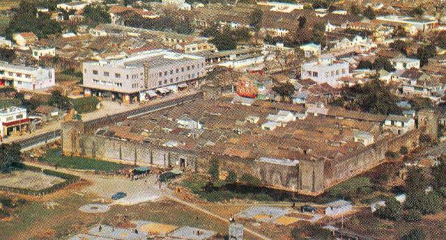
Apologies for the poor quality of this aerial photograph that Brian probably scanned from some publication, but it does show the layout of the central part of Kam Tin, although, because of the development of the land around the walled village, I suspect that this image dates from much later possibly the 1970s. I recall that in the mid 1950s the surrounding area was still paddy(?) fields and photographs that I shall add later in the gallery will confirm this. (Andrew S)
Date picture taken
1970s
Gallery
Shows place(s)
Comments
Re: Kat Hing Wai
Hi Andrew,
This photo clearly showed the moat was still there. It had been filled in the past decades. No use to have a place for breading mosquitos these days.
When I passed throuigh the area in the past few years, I recognized some of the building inside the wall had been rebuilt.
T
Hi T,
Hi T,
Yes, when I first went in 1957/8 the buildings were single storey, as seems to have still been the case here, but by 1981 or thereabouts, extra storeys were being added to some of them. Andrew