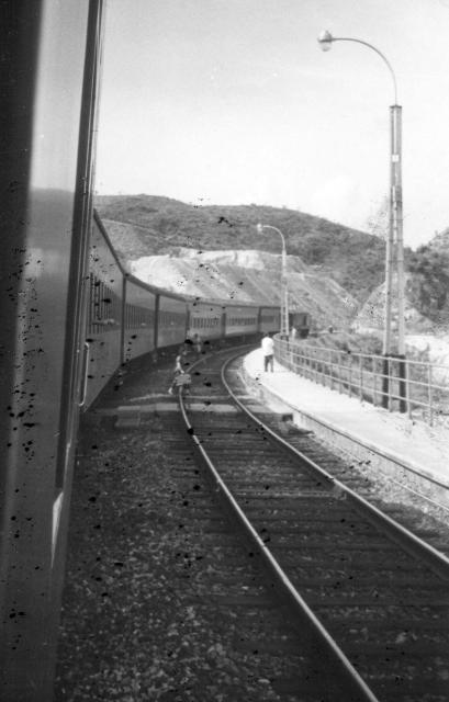
There were not many curves leading into a cutting on the line. This is almost certainly where the train is about to enter the cutting very close to where the Chinese University now is. It looks like a small platform on the right but I cannot see a station there on any of the old maps - but it is right where the University station now is. Any suggestions? (Andrew S)
Date picture taken
1960s
Gallery
Shows place(s)

Comments
Double track
The double track suggests it was one of the passing places for north/south bound trains. Perhaps one of the kcr experts can confirm?
Double Train Track through Open Cut
Greetings. This looks like the spot just east of "Ma Niu Shui" on the 1952 map - https://gwulo.com/jubilee-buildings?a=1#16/22.4157/114.2073/Map_by_ESRI…; . The map shows two small high spots on either side of the tracks, so the camera would be looking north towards the higher hill. The elevated platform would be serving the local residents too far to travel to Shatin or Tai Po. The shaded blue area would then be the reclamation site on this photo. Regards, Peter
Thank you Peter. I see that
Thank you Peter. I see that there is a pin for Ma Liu Shui / University Station on the 1952 map. Do you think that it is close enough to use for Gordon's photograph? Andrew
Ma liu Shui / University Station
Hi Andrew. Ma Liu Shui / University Station is the spot I would use. That marker is on the track and is fairly accurate when I look at the curvature of the track on Gordon's photo. What a wonderful batch of photos you have taking us down memory lane, and track too! Regards, Peter
Thank you Peter. I'm sure
Thank you Peter. I'm sure that the members of the 367 Association who took all these photographs would be pleased to know that they are giving some pleasure to followers of Gwulo. In the next day or so I'll upload quite a few taken byPeter Keeley up on the Peak during one of the Autumn Moon Festivals. Face recognition will be possible on many of them, but it will mainly be of parents and grandparents! Best wishes Andrew