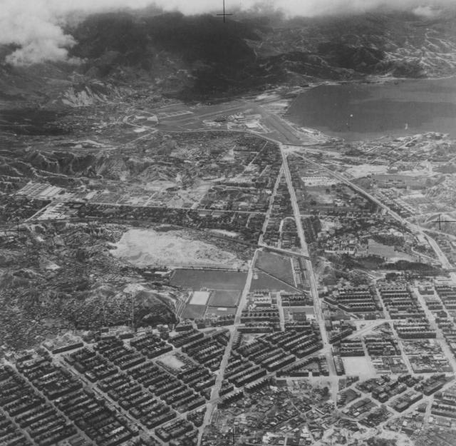
Greetings: The airplane was likely above Stonecutters Island when this aerial photo was taken. The view was looking east to Kai Tak Airport and the hills beyond. On the left we can see Nam Cheong Street and its nullah, and on the far right is Mong Kok Road. Prnce's Theatre [1931-1970] at Nathan and Nullah appears to be there next to the nullah, and it appears Great World Theatre [1952-1972] on Lai Chi Kok Road by Nathan Road was not yet built. The set-ups along the east and west sides of Maple Street Playground were before my childhood years so the photo could be from 1940s. Please correct my estimation. OldTimer. Photo source: uwants.com
Edit, April 12, 2017 EDT - the date has been corrected to 1950s as per reader Moddsey's comments. Much appreciated.

Comments
Date of Photo
Given that the northwest extension of the longer runway 13 is visible and was completed in 1950, I suggest the photo dates from the early 1950s.
Great photo
A clear view of Boundary Street, Prince Edward Street and Argyle Street converging near the airport with Waterloo Road and the railway track intersecting them.