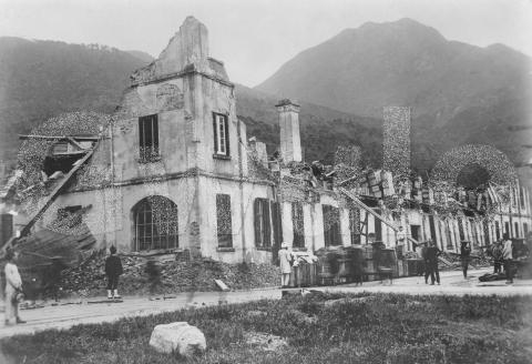
When: This photo was taken shortly after a devastating typhoon hit Hong Kong on the 18th of September, 1906.
Where: The photo was commercially produced, with a caption on the bottom. Unfortunately it was trimmed before it was put in the photo album, but we can still make out some of the words:
??. ?????? & Company's Godown, West Point
Older maps show West Point was a headland in the area between today's Shek Tong Tsui and Sai Ying Poon. Around the time this photo was taken, West Point was used as a more general term for the western area of the city.
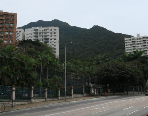
The hill on the right looks like High West, which would put the photographer somewhere in Kennedy Town. To confirm the location, I tried to take a photo from Kennedy Town facing in this direction, but all the modern high-rise buildings blocked the view of the hills. So I went up to Pokfulam Road above Kennedy Town, where this view of High West confirms it's the hill in the 1906 photo.
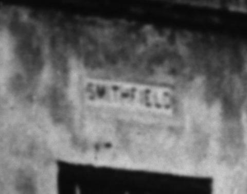
We can also see a Kennedy Town street name above the window nearest to us:
So the godown was on Smithfield, at a crossroads.
The Government's report on the typhoon's damage [1] lists "Godown on Inland Lot 1,296, Kennedy Town" under "Collapses involving the total reconstruction of buildings", so I believe that's the godown we're looking at. Inland Lot 1,296 [2] ran along the east side of Smithfield, between Chater Street (later renamed to Catchick Street) and Belcher Street.
Confirmation comes from a newspaper article the day after the typhoon [3]. In a section titled "BUILDINGS DESTROYED", it says "The godown in Chater Street, now the property of Messrs. Jebsen and Company, formerly the old Feather Factory, was also razed to the ground."
Now we know what it was, look back at the caption and it's possible to make out the name "JEBSEN":
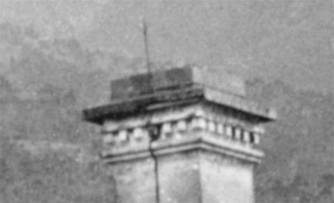
What: One part of the building that is still standing is the chimney with its lightning conductor:
Not that the lightning conductor did much to protect the building in this case!
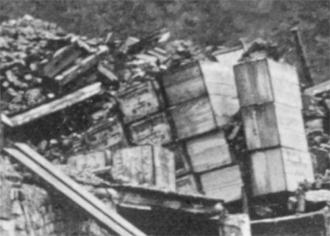
The goods that were in the godown look to be in a sorry state:
Heinrich Jessen, one of the founding partners of Jebsen & Co., thought the same but found things weren't as bad as they first looked:
“When I went to inspect the damage in the afternoon, I saw that [...] our warehouse had been crushed by the force of the storm. There were our stocks to the value of about two million marks exposed to the torrential rain. We began to salvage the goods that evening … It was a terrible sight, and even though the damage later proved to be less than it initially appeared, these days were a great strain on the nerves.” [4]
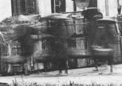
Who: The long exposure means that people in motion just appear as blurs. eg this group of four, carrying loads on their shoulder poles:
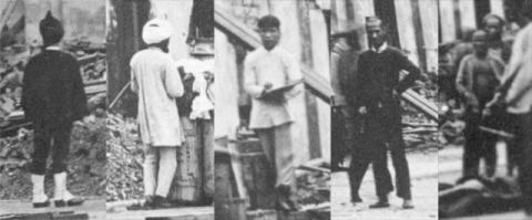
Others are standing still and are clear to see. Some are employees of Jebsen involved in the salvage work. Others appear to be passers-by who've stopped to watch the photographer at work.
Gwulo photo ID: BA093
|
New on Gwulo.com this week:
Readers ask for information (photos, facts, memories, etc.) about:
|
References:
- Typhoon Damage was reported in point 19 of the Annual Report of the Public Works Department.
- IL1296 shown on a 1924 map.
- The article "Typhoon Effects", on page 4 of The Hong Kong Telegraph, 1906-09-19.
- Heinrich Jessen is quoted on page 28 of the e-book, "Three Mackerels.
The Story of the Jebsen and Jessen Family Enterprise."
Comments
Re: Catchick (Chater) Street
Cannot discern the Smithfield road sign from the main photo. If one is looking at Catchick (Chater) Street in the foreground, I guess one would be able to see the tramlines.
Same Photo in "The Calamitous Typhoon at Hongkong"
The photo is the same as the one in the captioned report with subtitle "Full Account of the Disaster with Eighteen Illustrations" published by the Hong Kong Daily Press: https://gwulo.com/atom/27576
There is also another photo of the same Messrs Jebsen & Co's Godown at West Point: https://gwulo.com/atom/27577
CM Shun
West Point etc.
As a former resident in Kennedy Town, near the intersection of Belcher's Street and Catchick Street during 1964-1976, I found the post tickling.
First, the British word of "godown." As fun-loving teneeagers, my friends and I used to make fun of it: Should it be pronounced as God Own or Go Down? Now, after living in the United States for 40 years, I can only use the word "warehouse" to describe the buildings.
Second, I surmise that West Point is the opposite of North Point, which still exists. West Point could be the Chinese equivalent of Sai Wan, which is still widely used.
Third, I believe the hills behind the godown is Mount Davis, and the godown was situated at the southeast corner of the intersection of Smithfield [Road] and Belcher's Street.
Would love to see more info.
Andy
Typhoon Sept 18,1906
Just realized that Sept 18 1906 was my grandfather Tobias Hunter's 29th birthday. He obviously survived, but I never heard mention of the typhoon. He'd have been living in Kowloon at the time and working for Jardine Matheson as a clerk or assistant.
1906 Building destroyed by typhoon
Moddsey,
Smithfield runs along the long side of the building, so the "Smithfield" street name is above the rectangular ground-floor window on the corner nearest us. It is very faint in the main image. I had to adjust the levels of the cropped section to make it visible.
I had the same thought: where are the tramlines or tram cables? It must be just the camera angle that hides them, as if you look on page 28 of the Jebsen ebook, there's a photo of the godown taken from a similar angle that shows a tram on Catchick Street.
CM,
Thanks for the extra photos of this scene.
Andy,
Glad to hear you enjoyed it.
If you check the hill in the old photo, you can see it's the same shape as the modern photo of High West.
Regards, David
Re: 1906 Building Destroyed by Typhoon.
Thanks. Orientation sorted out. The tramlines on Catchick Street can be faintly seen from right to left. The Jebsen godowns (long building on the right) can also be seen below.