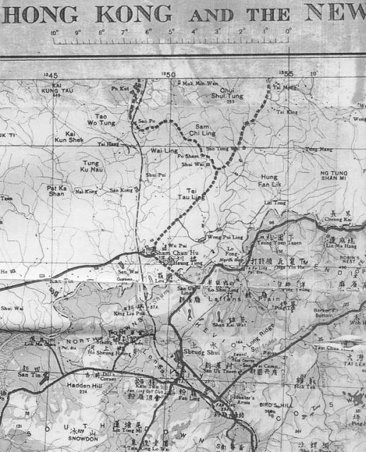
This map shows a number of the places discussed in recent weeks, including the Kwanti Race Course, the Hunter's Arms, various areas named by the Army after English hills ie The South Downs, North Downs, Cheviots, Mendips and also Laffans Plain and Snowdon
Date picture taken
15 Jun 1939
Gallery

Comments
1930's San Wai camp place names map
Great to see the old places names from the San Wai camp area. May I ask the source of this map? Would be great to have a copy if they're still around
Re: 1930s North West New Territories Map
Access to the entire map of Hong Kong is available from the HKPL as shown here
Thanks very much for that!
Thanks very much for that!