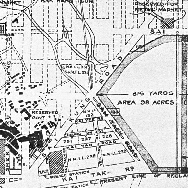
A segment from a Crown Lands Office 1928 map of the Kai Tak area. Over time the layout in the triangle next to the airfield nullah seems to have had streets added.
Date picture taken
15 Jun 1928
Gallery
Shows place(s)
Comments
Crown Lands Office 1928 map
I am interested in the Crown Lands Office 1928 map. May I know how to access the map? Thank you!